
The Rocky Mountains extend from southern New Mexico all the way to northern British Columbia and Alberta. In the middle of that range, there is a chasm, a dividing line of sorts: the Great Divide Basin. That’s where we are on our journey right now. The Great Divide Basin is essentially a place in southern Wyoming where the divide splits, and on a map it looks a bit like the outline of a lemon. To the east of the basin, or on the Atlantic Rim, water flows east. Similarly, rain that falls west of the Pacific Rim flows into the Pacific.
In the middle is essentially a no-mans-land. Water flows neither east or west, instead dropping into some alkaline ponds, or more than likely, never falling at all. It’s the epicenter of the Great American Desert. It’s a dry and harsh place, devoid of life except for antelope, coyotes, mountain lions and thru-hikers.

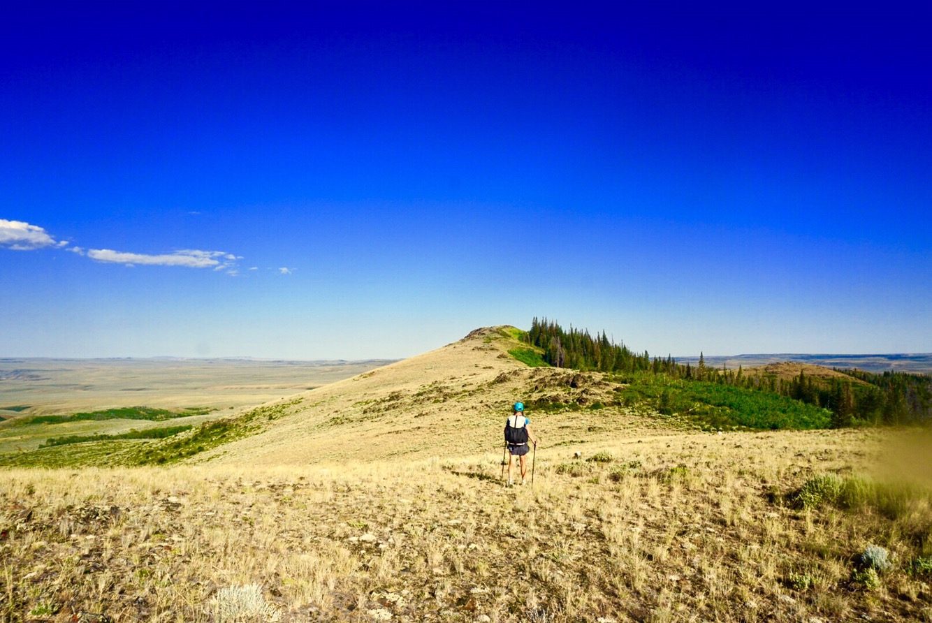
While technically well south of the halfway mark of the Rockies, it’s fair to call the area south of the Great Divide Basin the southern Rockies and the area above the northern Rockies. The ecosystems change dramatically. Ecosystem analysis is beyond the scope of this blog, but on a simple layman’s terms, it’s easy to identify. Two of the main keystone predators, grizzly bears and grey wolves, do not exist in the south. They do in the north, however, staring in the first mountain range we’ll hit in about five day’s time, the Wind Rivers. Our arrival in the northern Rockies is one of the highlights of this trip, but let’s not get ahead of ourselves – we still have the Great Divide Basin to cross.
Folks have been crossing the Basin for centuries. It’s the lowest point in the Rocky Mountain chain, and was the main thoroughfare for the Oregon Trail and a whole host of other emigrant parties. There have been triumphs and disasters, and there is even a game, Oregon Trail, where players can die of such hardships like dysentery and snake bite in the Great Divide Basin.
For a couple of snow and ice-loving nords like Elaine and I the heat is downright intimidating. We love snow and cold and hate heat. I can honestly say we have not met another hiker out here with our preference of snow to heat. Our winter aplomb is damned useful in races like Expedition Amundsen, it helped us in the San Juans and I’m sure it will be valuable in late-September in Glacier. It is not an advantage when crossing the Great Divide Basin in July.
Us going into the heat is like sea level pro sports teams going to Denver. We get psyched out and start doing weird shit – like trying to sleep all day and then hike 40 straight miles at night from 6 pm to 8 am – to avoid the heat. It’s impractical, not overall efficient, but it does lead to good adventures and stories.
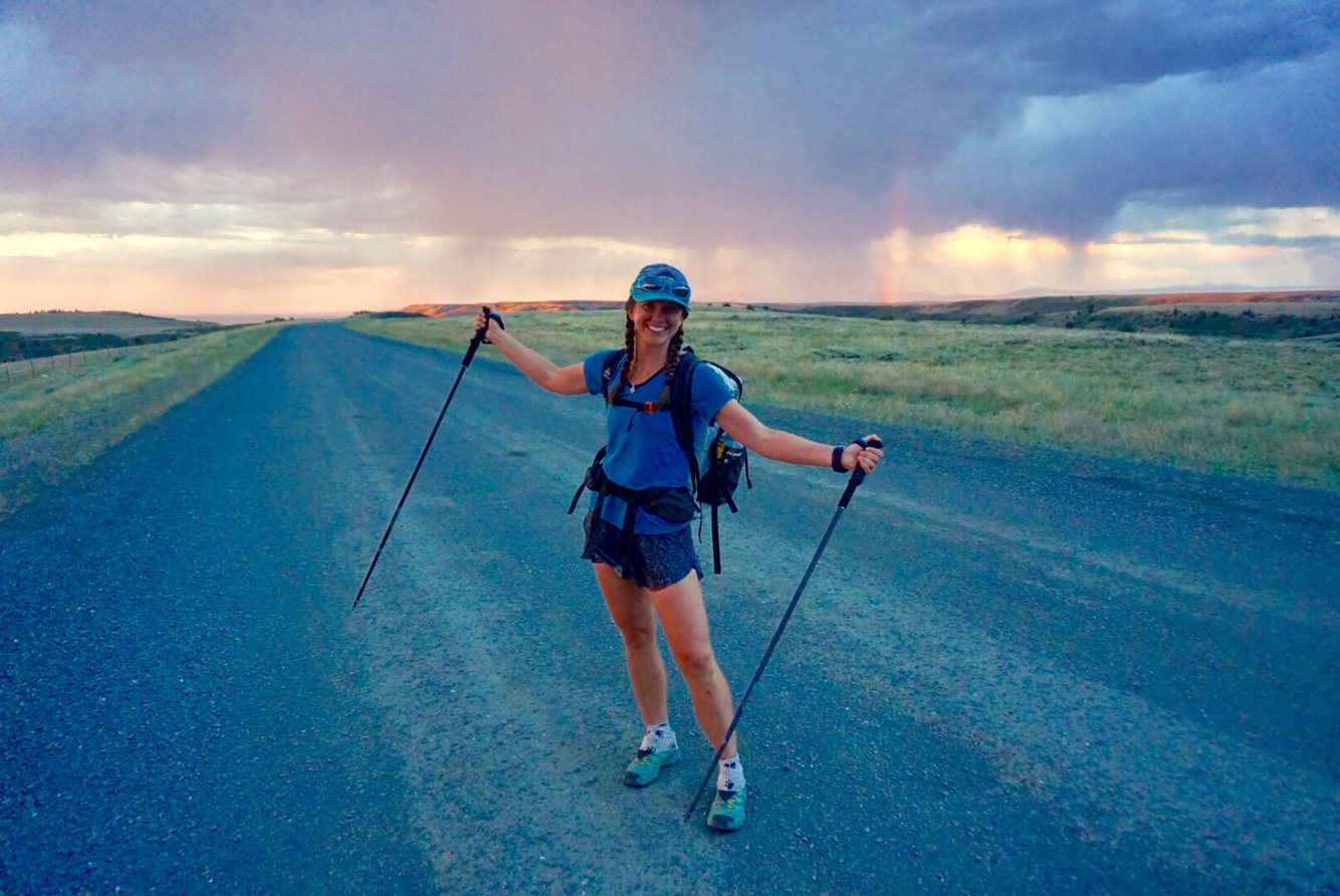
We left the tiny town of Encampment, Wyoming and caught a fairly quick lift up to the pass from a late rising oil well worker who was out for a Sunday cruise. We ran into another hiker on our hitch, a guy by the name of “Roswell,” wearing purple short shorts and a tank top. Roswell is hilarious and we like him instantly. Of course, Roswell loves the heat, is thrilled about crossing the basin and woudn’t be bummed in the least if he didn’t see another speck of snow. Lucky bastard.

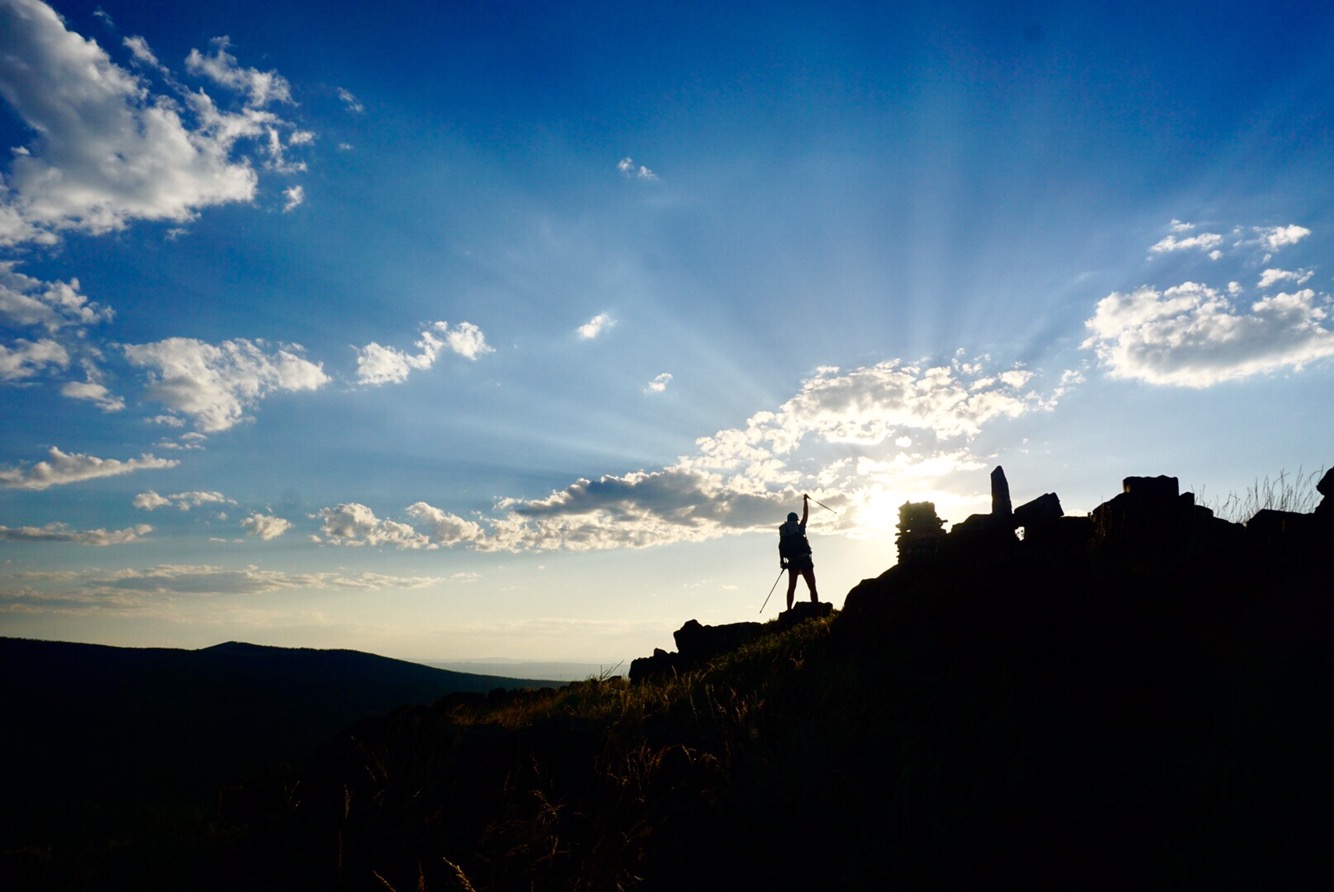
Before dropping into the desert we had to finish up the tail end of the southern Rockies. We climbed Bridger Peak, caught a final distant glance at Longs Peak to the east, and headed on our way. That first day was marked with inefficiency. Breaks too long, ill-timed trail magic and just a frustrating stecatto type day in an area where we wanted to be moving quickly. But we were feeling pretty good and decided we were going to hike all night that first night and see how far we got.

That plan worked well except for two things. First, hellacious deadfall. We’ve been relatively spoiled with clear trails from Highway 50 thru Colorado, but no more. The deadfall was every ten feet, requiring balance moves, high steps and straddles. Elaine ripped her skirt, I tore my shorts, and we were moving at about half a mile an hour for two hours.

Second, the CDT insists on taking the traveler up and down every last little ridge of the actual Continental Divide. See that nice trail half a mile down the valley following the pretty river? Nope. We’re going to keep you on this ridge, off trail, exposed to lightning, the sun, the wind and every undulation of the land, far from water, because this here is the Continental Divide Trail for crissake! I appreciate the purity of the trail, but it can be a bit maddening when trying to cover big miles. The good news: we’re getting really strong for ski season!

We ended up spending the night up on a ridge, as crossing deadfall in the dark seemed less than appealing. It was a beautiful night, a swooping bird dive bombing insects, a rosy sunset and then, the galaxies, the Milky Way, the heavens above.

We set the alarm for 4 am and were off at first light. As a final send-off, we collected water from a clear stream in an aspen grove, as a black bear foraged no more than 100 feet away from us. There was no drama or fear – just a couple mammals watering up for the day.
Onward. More deadfall and undulations, but by 8 am we crossed the very last rise of the southern Rocky Mountains. A cairn and an elk antler marked the lonely spot. Before us, vastness and nothingness. We descended into the void. And immediately, the temperature rose. We stopped for a water break, filled up with five liters each, hiked a few more miles to a resting stop, set up camp and waited for the day to cool. Our stopping locale was a little oasis in some bushes with a tiny stream and a culvert frequented by swallows. The stream had tiny fish and frogs and it was amazing to see, given the smallest of chance, how nature can take hold.
Setting up camp during the heat of the day and waiting for temperatures to drop is good in theory, but we suffered. What’s worse than hiking in extreme heat? Sitting in camp in extreme heat. I’m sure there are ways to keep a camp cool in the heat of the day, but we did a poor job. Despite venting our tent to the maximum, it was like a greenhouse, at times reaching 106 degrees inside. And herein lies the problem with night hiking – we are unable to rest during the day because it’s too hot. It worked for a day and a night, but over five days or more? I think we’d get too exhausted. Sleep is needed for recovery, plain and simple.

Despite about 20 minutes sleep each, we got through the day. We packed up camp and were off by 6:30 pm, the day still warm but much more comfortable. Storm clouds were building and there were more than a few “what now CDT?” glances shared by Elaine and I.

As we were heading out, a serendipitous moment. A VW van pulled up beside us to ask if we were OK. The driver inside looked at us incredulously and said, wait, are you the two hiking the CDT who I picked up on Rabbit Ears Pass? At first we didn’t believe it, and then it set in. This was the same gentleman who had given us a ride to Steamboat, the owner of the little independent ski resort in the Snowy Range. What are the odds? Bob and his wife Cindy have been out camping and mountain biking in Wyoming and just happened to be heading down this dusty, desolate road when we crossed paths again. It was awesome to see them and it started the night off right.

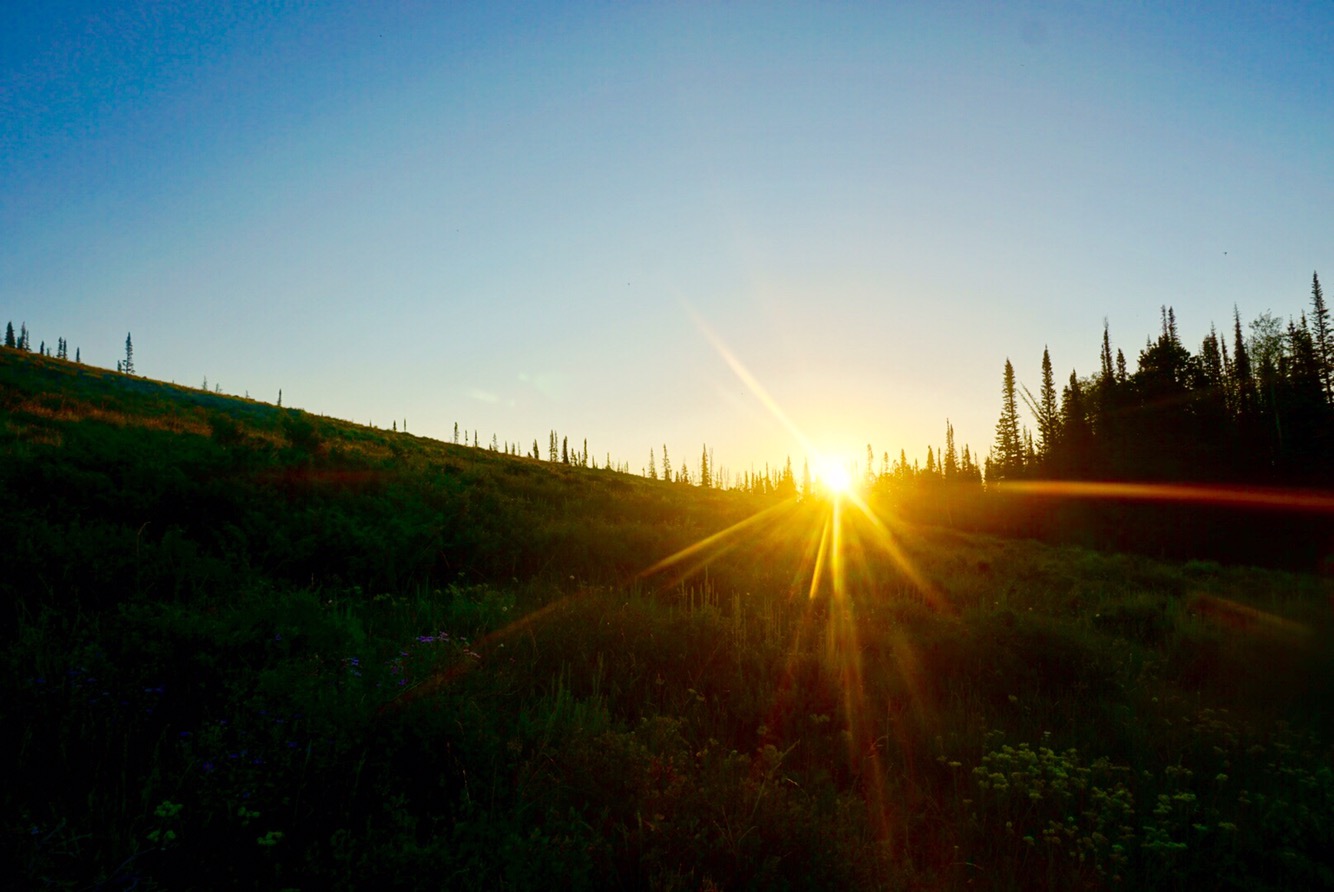
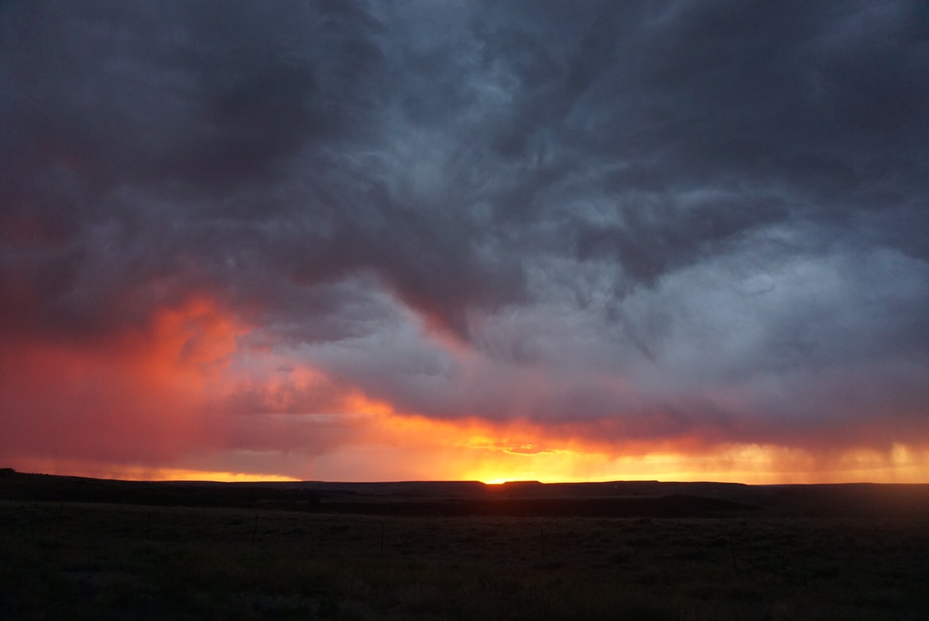
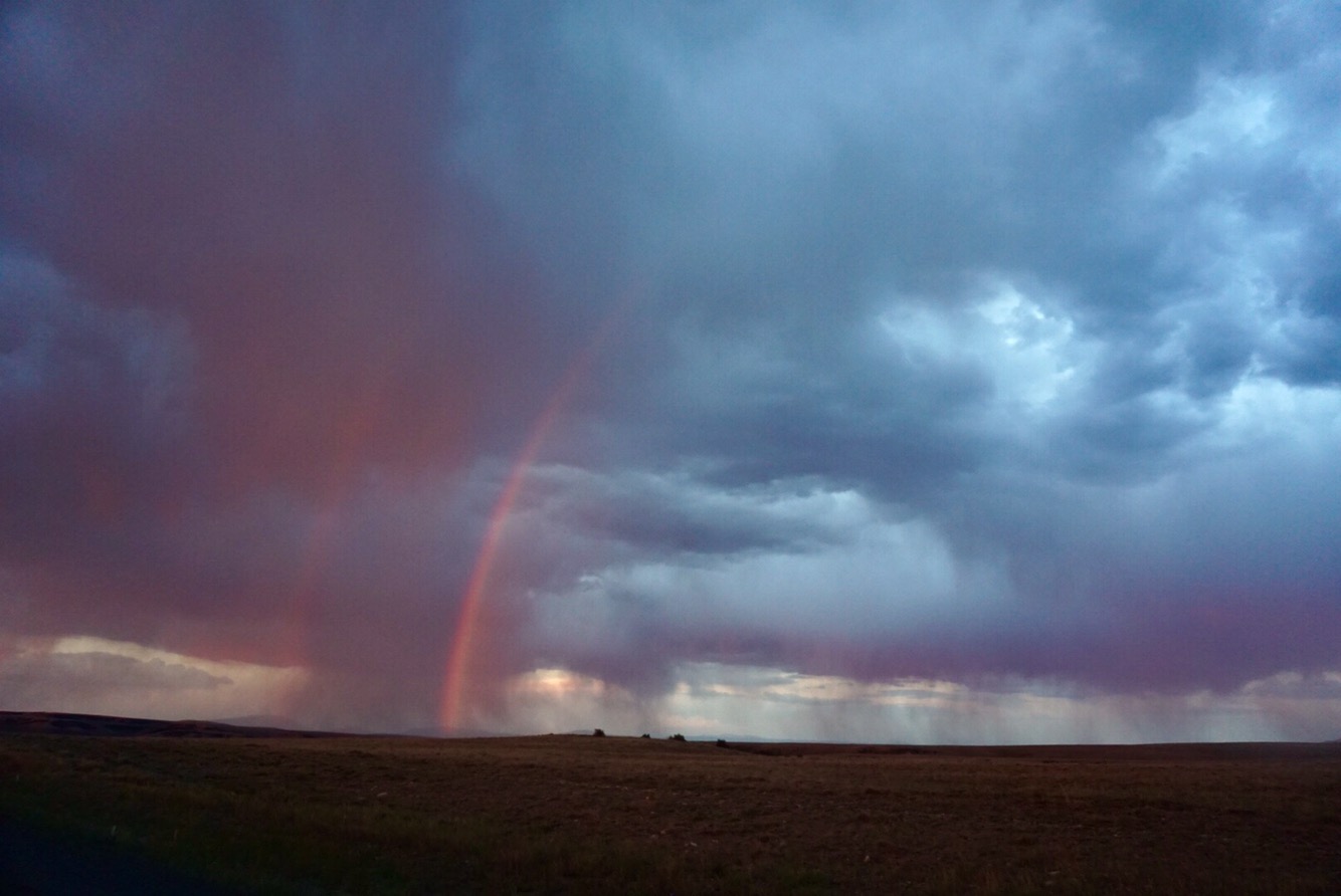
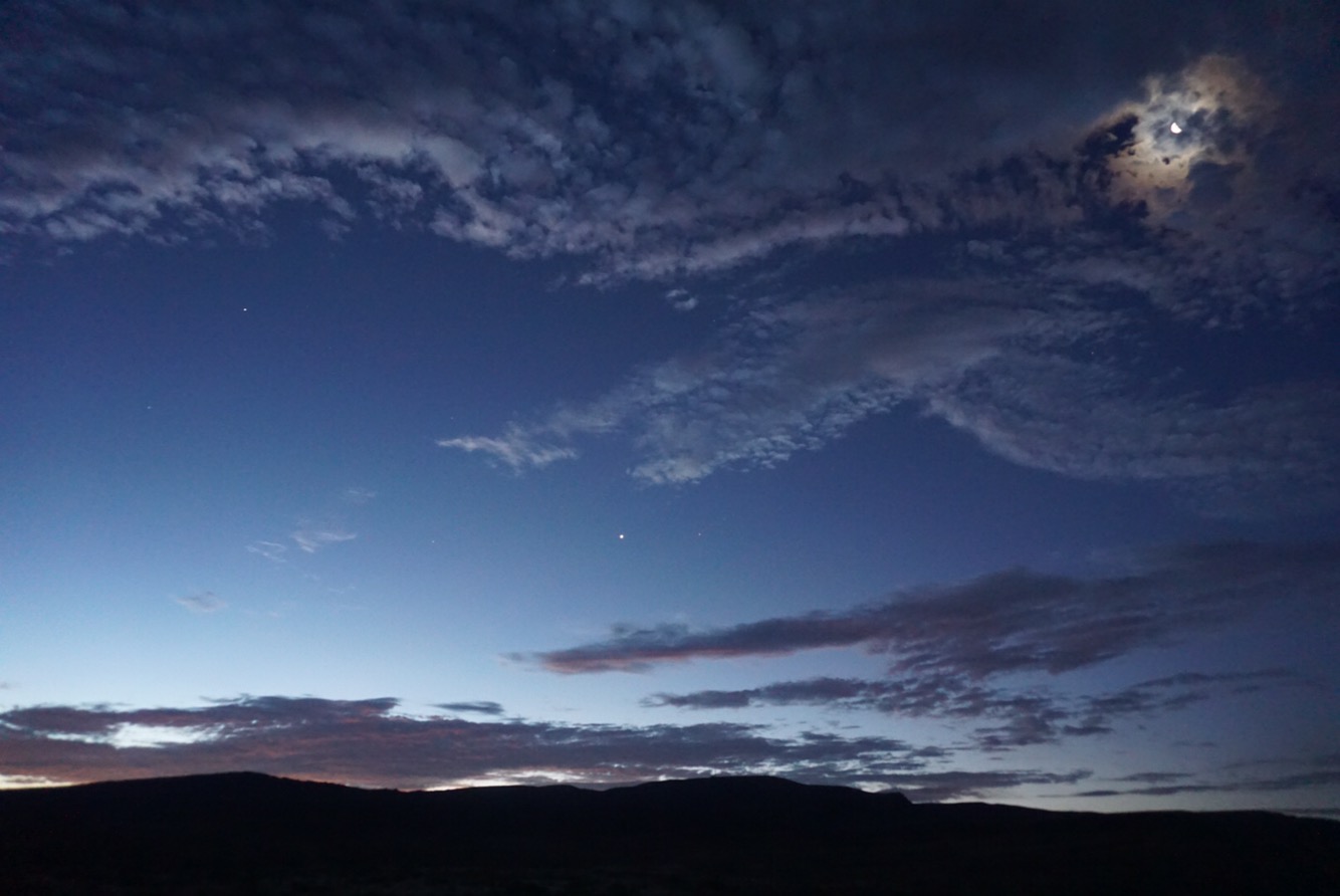
Spirits bolstered, we continued on. And then the light show began. The wind picked up and a light rain fell, and at the same time, the sun began to set. Combine wide open spaces, sunsets, a bit of rain and clouds, and you have a recipe for epic beauty. The sky began to light on fire in the west. Ahead, clouds erupted. To the east, a double rainbow formed. Humbleness, ecstasy, awe and reverence filled us – it was the most beautiful sky I’ve seen in my life, ever.


We continued on. Night came. Miles ticked by, a rhythmic walk along dirt road fueled by music, podcasts and audio books. Stars began emerging. And then the Milky Way, raging, from south to north, across the entire sky. All the while, following Naga, Polaris, the North Star. No other humans. Occasional silhouettes of antelope on ridges. Coyotes howling.

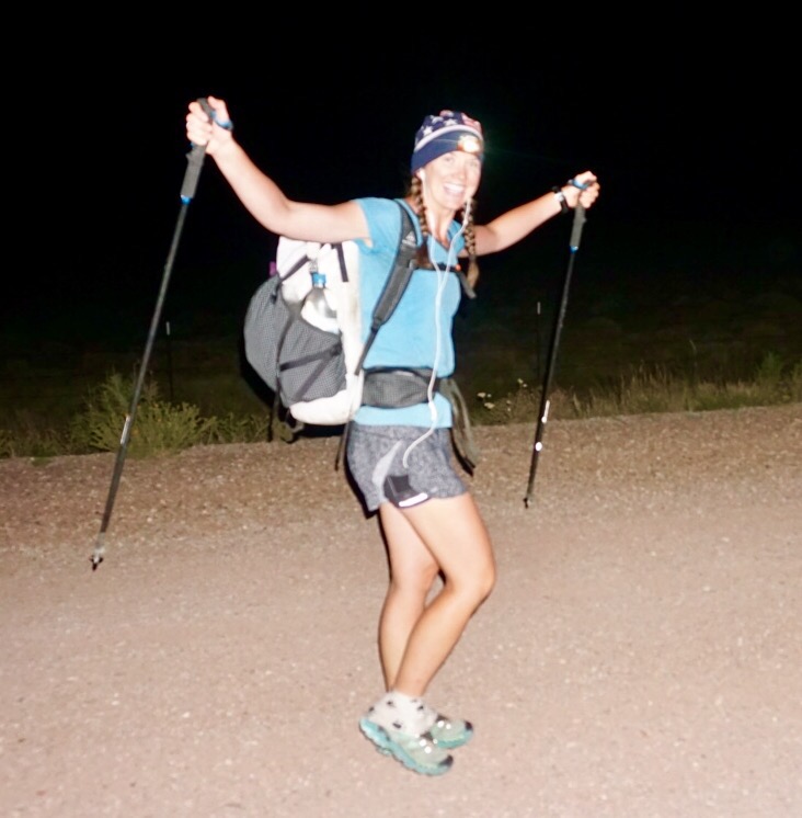
We’d get tired, stop, eat some food, catnap for five minutes, drink some Nuun caffeine drops, and continue on. Hour after hour. Midnight came and went. The stars moved, but ever on we went north, into the void. An occasional county road sign, a stream crossing, but really nothing but us walking across the Basin, the universe raging overhead.

Ten miles. Then 20. By the time the eastern horizon brightened slightly, 30. By the time the sun rose, 35. At this point exhaution set in. The feet hurt. We slept for 20 minutes, woke up feeling worse, and continued on, fearing the sun more than exhaustion. As we strode into the run-down desert oasis of Rawlins, crossed the old Union Pacific line and I-80, we had hiked 45 miles, which combined with the 14 we did in the morning made the tally for the day 59 miles. It was epically hard, epically beautiful, and 100%, absolutely, not sustainable.
We’ve lounged in Rawlins for 36 hours. Slept lots, eaten a bunch of Thai buffet and come up with a strategy for the next five days required to get to South Pass. We’re going to hike in the day and try to manage the heat. Up early, lots of water, a good break from noon to 3 pm, and be smart. We bought a couple umbrellas at the dollar store for shade. We’re going to try and embrace it, relish it. If those 1800’s pioneers could do it, so can we.
I think we’ll be offline for ten days or so. South Pass City is just a visitors center, and then we enter the Wind River Range. We’ll come out in Pinedale, the halfway point of the Winds, for a shower, night in town, good dinner and a little blogging. We’re entering the heart of it now. If the San Juans were the crux, this is the second crux of the journey. Physically strong, mentally stronger in the days ahead.
—
On a side note, through much prodding from friends and family, I’ve finally added a “Care Packages and Donations” button on the menu on top of this blog. I’ve always resisted it because I think it’s a bit tacky and if you are able bodied enough to go on a hike you are perfectly capable of working. That said, I suppose these words and photos have some value and five months is a long time to be away from work. We’ll add gear reviews to these tales as well. We want to offer some value to any donations through these words and images – it goes against the fabric of who we are to take something for nothing in return. So if you so desire, the “Care Packages and Donations” button is there.
Enough said on that. Happy trails and thanks for reading!

Well???? Don’t stop with that as a cliff hanger. Just remember – can’t repeat this enough, “never take no cutoffs and hurry along as fast as you can.” Wolves and grizzlies? OMG.
LikeLike
I empathize a lot with your and Elaine’s approach to the Great Divide Basin. In my mind it’s possibly the most intimidating part of the CDT, second only to the San Juans in the early season.
The Basin is close to my heart, though. I have an ancestor who crossed with the Willie Handcart Company in 1856. The pioneers used East Coast wood to build their handcart wheels, and the axles cracked and broke in the arid west. This led to long delays and a forced crossing of the Sweetwater River in a late October blizzard. Several people in the company died. My great-great-etc-grandfather survived and went on to procreate, for which I’m grateful. This story is a great source of pride, and was even more meaningfu when I crossed the Basin myself on a bike (with a broken freewheel, no less!) I hope to one day cross on foot, as you guys are doing. Maybe not in July. 😉
LikeLiked by 1 person
This is such an inspiring story, Jill! I knew you had ancestors who crossed the Basin, but that story – that’s the stuff of epic tales. And yes, July in the Basin scared me! I think it could be really cool as an early spring crossing though
LikeLike