August 27, 2016 – Odda to Nibbetjørn – 20 miles, 8,517 feet of climbing

It’s amazing what a night of sleep can do to take care of physical ailments. Be it a bad headache or feeling car sick from an 8-hour bus ride, a solid night’s sleep, even if it’s in a rainy pyramid tarp in a muddy field with Norwegian teens ripping up and down the road all night on motorcycles, will do wonders for the spirit and the body.
As the first light glowed off low clouds, we rose. There was a lot of work to be done – expressly walking a long way across Norway – and daylight was wasting. We quickly got ready, pulled down camp and filled up our water bottles before anybody else in the campground even stirred. A quick “before” photo at the campground and we were soon walking through the early morning dampness towards the fjord and Odda.

The click-click of our trekking poles tapped on the pavement and echoed off homes, schools and yet-to-be-opened stores. The first steps of a thru-hike, no matter how long, are always a “feel it out” situation. How does the body feel? Labored or smooth? What about the pack…too heavy or just right? That was a pleasant surprise. For the previous month we’d both been hiking up the hill behind our house three days a week with packs loaded with 50-pound bags of beans. Walking down those early morning Odda streets, I knew this pack was lighter. That boded well.

We didn’t pack quite enough food for this trip, planning to supplement some of our dinners with snacks from the huts and towns we’d pass thru. In our rush to get out of Oslo, we’d failed to pick up one of the main staples of a thru-hike: cheese. When you are tired, cold, bonking and starved for protein, cheese is hard to beat. We decided to wait 30 minutes for the grocery store to open, enjoying the morning quiet and the views to the north. This would be the lowest elevation of our entire hike – sea level on the edge of the Atlantic Ocean.

The market opened, so we picked up two very large cheese blocks (probably the heaviest single item we had for the whole trip), a little pastry and fruit for breakfast, and a bag of Cheez Ballz for later consumption on the trail. There is nothing like cheese and salt to quench the cravings of thru-hikers. Those chips would come in handy later on.
As we walked down the street, we got smiles from people driving through town, even more so than when we walk down the streets in Norway with skis. We obviously looked the part of hikers, tights with shorts over them, wool tops, ski caps, backpacks and trekking poles. I think in Norway, while skiing is celebrated, the simple act of walking is revered. It seems everybody walks. Most, old and young alike, like climbing to the top of mountains. Walking is part of life in Norway, and there is no better thing to do than go for a walk in nature, in the mountains. I think this is why people smiled at us.
Across the river, onto the other side, and up through a subdivision right to trailhead. I’d looked at this squiggle on the map months before from home in Colorado. There was no other information other than the contours of the map and the way the trail worked its way up them. It was surreal to see those symbols on the map transformed into real life.
The trail went up. Almost comically so right from the start. This was no manicured Colorado switchback route. This was a near vertical wall, hiking on your toes with no way to drop the heel, legs driving, lungs bursting type of climb. We were fortunate though – we were at sea level and our packs were lighter than what we’d trained with. It was doable, and it was even at times satisfying. Hard work and preparation yields results.
We entered into a pine forest and stumbled upon bushes and bushes of wild raspberries and wild blueberries. Memories from my youth of picking berries in the woods outside Oslo and in Vermont came flooding back. It was early, but we ate nonetheless. Berries are one of nature’s best treats, and a little vitamin C after days of immune system depleting travel is something to take advantage of.
The trail went up and up steeply. One-thousand feet of climbing turned to 2,000, turned to 3,000 in a remarkably short amount of distance, maybe a couple miles. We chuckled a nervous laugh from time to time…it appeared Norway was not messing around. Eventually the trail broke out of the woods and into a green lush wonderland with a small barn in the middle. The fjord dropped away behind us, and we simply stared at the mountain on the other side of the valley with an ice cap glacier on it. The western fjords were delivering a punch of beauty and challenge right off the bat.

As we climbed further, we were met by a constant companion for the next nine-days, sheep. Just like the U.S. uses public lands to graze cattle, Norway uses the land to graze sheep. The sheep are used for wool and meat, and are the top livestock animal in the country. I can’t complain, as I have a couple Norwegian wool sweaters that are unbelievably comfortable and warm! For all the synthetic fabrics used to make clothes, wool can’t be beat for warmth, lack of odor and functionality in wet and variable conditions.

The trail kept climbing though not as steep as before, leaving the sheep country behind and entering into a rocky tundra landscape. From this vantage, we could see the massive ice cap to the west.

After 72 straight hours of travel, this high vantage point, combined with the big climb and a night of sleeping on the ground, far from airports, hotels and cities, reminded me why we travelled all this way to hike. As the wind picked up and landscape unfolded, we were once again adventurers, and this made us happy.

Norwegian trails have a different marking system from American trails. Often, there is no trail, as routes will take you across rock, river and snow, surfaces non-conducive to trail treads. This is not to say there are not trails in Norway, because there are, but in the region we travelled there was probably an absence of trail tread 80-90% of the time. While there is not tread in many places, there are large cairns spaced every 50 to 100 feet. The cairns are marked with a large red “T” representing the last letter of DNT. Volunteers come out and repaint them every year. Intersections are also very well marked, with posts propped up in rock piles, giving clear direction where things are.
In this regard, backpacking in Norway falls in a weird middle ground. The tread is much rougher than the Colorado Trail or that found on popular 14ers in Colorado. It’s also rougher than the Indian Peaks. More often than not, there is no trail. It’s more like Alaska in that way…use rock, river beds and ridges to get around. But, on the other hand, the entire “route” network is exceptionally well marked. There are these massive cairns with giant red “T”s on them at close range (a necessity in a country with such wild weather, fog, snow and white-out conditions). Intersections have signs that would rival road signs in the U.S. There are huts every 15 miles or so. You can choose to sleep and eat in them or not use them at all. They are not luxury but they are not shacks by any stretch.
For Elaine and I, autumn backpacking trips are used in part to build a base for ski season. The nature of the Norwegian trails allows us to hike steadily without having to check navigation every two minutes, but also provides extremely varied and challenging terrain. We can push our bodies, but also enjoy a wilderness experience. That’s what makes hiking in Norway so unique and that’s why we came here.

We passed an older couple heading quickly down from the mountain we were heading up. They were much more bundled up than us, head-to-toe in Gore-Tex. They shouted something in Norwegian through the wind, to which we responded a common response, “Beklager jeg snakker ikke norsk så got (sorry, I don’t speak Norwegian so well.)”No problem, the entire country speaks fluent English and they can switch between the two languages easily (this makes it very hard to learn Norwegian). They told us we were heading to Møyfallsnuten at 1,450 meters and that we could stamp our book at the top. I wasn’t sure what they meant, but I could tell they were happy and having the time of their lives. It seems Norwegians rather like hiking on the tundra in windy conditions. I have to agree – it’s much more enjoyable and satisfying that 85° days with perfect sun and no wind. The harsh weather keeps you alert and alive.
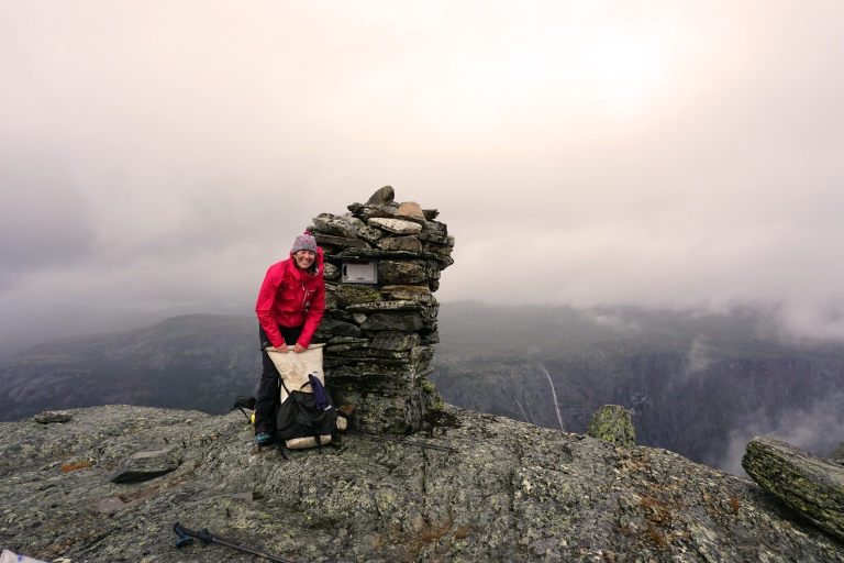
We made our way to the top of Møyfallsnuten and its accompanying cold, gale force wind. We stamped our journals and signed our name in the book (tucked into a little cubby built in the rock), and by the time we were done our hands were starting to not work so well from the cold. It was time to move on. To the west, we saw clouds moving towards us quickly. We descended into a little ravine in the rock and put on more layers, including long pants. They would not come off for the entire rest of the trip. We continued across snow fields, into a fierce wind. Licks of rain touched our skin, but it never reached downpour state that morning. While it didn’t rain right on top of us, it rained hard all around us. As the sun broke through sucker holes, the water was illuminated and rainbows shot up on all sides. This was a typical pattern – there was only one day on the entire trip where we did not see at least one rainbow, and that was because on that day we were in a pouring rain fog from first light to last. If Norway changed its name to “Rainbowland” it would not be an inaccurate description of the country.

There was an incredible amount of snow on the ground for late-August. The ice age was not that long ago up here. Traveling on snow was no problem, and usually a respite from tougher terrain. It’s smoother and softer than talus, and a snow-confident traveller can make good time across fully supportive snow fields.

We navigated through the snow and rock covered plateau to its edge, and then began a steep descent down to a valley with a small cabin and a raging river. It was back into the land of green and berries, and after 5,000 plus feet of climbing and lots of calories burned, we were happy to supplement our walnuts, dried fruit, cheese and chocolate with fresh berries. Next up, our first experience with a swinging suspension bridge. Basically, you climb a ladder to get onto the bridge, walk across as it swings precariously, and then go down a ladder on the other side. They were great fun and a nice little shot of adrenaline on endorphin filled days.

After the river, the trail climbed steeply again to a rocky and snowy valley. A light rain picked up, forcing me to tuck my camera in my jacket. Because of the wet weather, this remote, talus filled valley felt exceptionally wild. By accident, we ended up taking a little detour to the top of the 1,446 meter mountain Einseten. It was a good detour, as the climb was very fun and top offered an exceptional view of the surrounding rock, snow, mountains, waterfalls, glaciers and fjords.

After Einseten we backtracked to the valley and continued east, past a small lake with grey mountains rising into the clouds around us. We shouted at the walls, and were answered once, twice, three and four times with echoes, bouncing from one wall to the next, wildly and indiscriminately. Happy and alive feelings overwhelmed the senses.

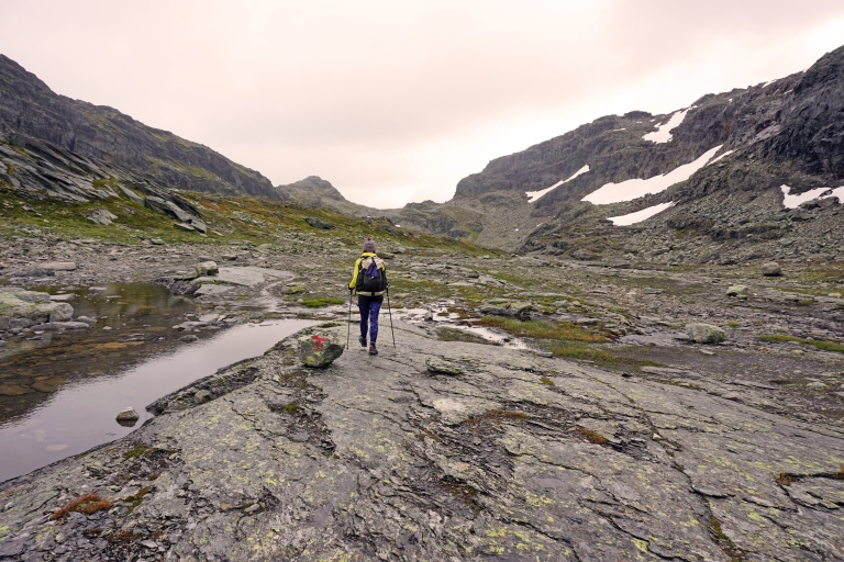
We continued through the wild valley, past an alpine lake and then up the other side to a high pass. The fog and drizzle moved back and the light started dancing through the clouds. Fog ripped past the peaks, being blown at a pace similar to an airplane.

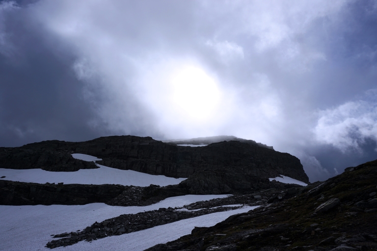
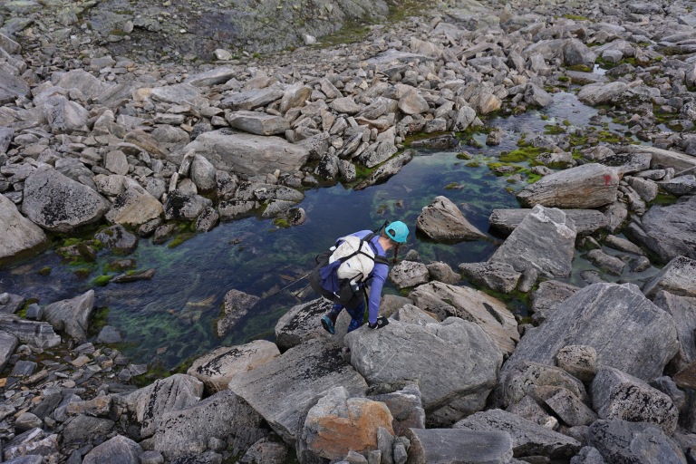
We continued on over undulating, rocky and wet terrain, carefully stepping to avoid twisting an ankle or worse. We filled our water bottles and drank directly from streams, sans filtering. There were many stream crossings, but we’d given up on dry feet long ago.

There was no trail surface to speak of, but there were massive cairns guiding the way. It was some of the most spectacular terrain I’ve ever hiked in my life, like something out of the imagination. The mind dreams there are places like this on earth, but this was the first time I ever had proof. I was coming to the realization that this might indeed be my favorite day of hiking ever.

We rounded a bend and came across a huge waterfall, dropping off an ice cap from the plateau above. The cascade echoed off the rocks and mountains, creating an overwhelmingly beautiful scene as the wind howled from the north.

The day was progressing on, and we were beginning to think about setting up camp. It had been a hard day with more than 7,000 feet of climbing over very difficult terrain. But, wilderness doesn’t care so much about the concerns of humans. If anything, as we got more tired the terrain got more difficult. We did a number of map checks to find potential campsites and make sure we stayed on course.

We worked our way along the northern shore of Langavatnet and came across a discovery – a tiny emergency cabin tucked under a rock mound with a sod moss roof. The door was no more than three feet tall, but the inside was cozy.


In addition to the regular DNT huts, there are also a number of emergency cabins tucked in the hills. If conditions get bad enough, these could keep you alive and even comfortable. Most are privately owned, but there is an ethics in this country that wilderness cabins should remain unlocked. Similarly, there is an ethic among the people of Norway not to abuse this. The entire system is built on trust. Almost all the cabins are stocked with some food, wood for a fire and mattresses for sleeping.

While certainly fatigued from a long day of travel, we were not in an emergency by any stretch. Besides, one goal for this trip was to sleep outside as much as possible. We would move forward, but not before taking a nice little snack break on the stone built picnic table and bench right outside the sod roof rock hut.

The route headed north. We entered an area that is used heavily for hydroelectric power. Norway has an enormous amount of water and a lot of steep vertical slopes that can harness that water and create an energy source that is much less environmentally impactful than fossil fuels and even wind farms. The western fjord region is ideal for this type of power, and we crossed a couple dams that are used for this very function. Elaine is a tremendous outdoor woman, but like all of us has a few fears. Her biggest fear is dams and potential for them simply breaking. Perhaps not rational, but who among us doesn’t have some fears that are not overly rational? As such, we moved quickly over the dams!

The day was seriously getting late now and the terrain was not letting up one bit. We identified on the map an area with small lakes and what appeared to be flat terrain called Nibbetjørn and made that our target for the day. It was a harsh landscape, attested to by the reindeer skull we found near our destination. I can only imagine how wet, windy and brutal winters are in this place. Such conditions yield a harsh toll.
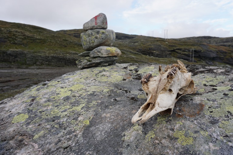
We found a flat spot near some tiny alpine lakes and decided to camp. It was less than ideal terrain, as the ground was so soggy it would barely hold a tent stake. We gathered as many large rocks as we could and tied our shelter to them in hopes that if a big wind came over night, they would hold. Soon the shelter was up, and warming up quickly as we cooked pasta and tea before spending our first night out in the Norwegian wilderness. Despite a stiff wind and the sound of rain on our shelter we quickly fell into a deep sleep after one of the single best hiking days ever.

Wonderful. Made me feel as if I were there. Wish I were. Except for the suspension bridge, maybe. Dams don’t bother me. But string bridges seems crazy dangerous. The emergency hytte, both inside and out, looks like a small version of the houses the Norwegians, and their livestock, lived in during the middle ages. Love this. Look forward to more.
LikeLike
Love to read about your adventures.Take care and happy trails!
LikeLiked by 1 person
I am so excited I finally get a chance to read about your travels. As one who is never going to go on these sorts of trips, I so appreciate being taken on a journey through your words. So evocative, and also specific. I have a wonderful sense of the terrain, the beauty, the challenge, and the reward of the journey. The photos are unbelievable and a stunning visual accompaniment to the journal. I so admire your being so clearly at home in such a wild place.
LikeLike
Reblogged this on Nature-Watching in Europe and commented:
I can’t possibly see all of Europe for myself, so I’ll be keeping a look-out for blog posts from others who have enjoyed hikes and nature experiences here.
Note – I’m not sure yet what happens when I reblog someone else’s post, so this may be edited, or deleted as appropriate.
LikeLiked by 1 person
As I said, I didn’t know what happens when I reblog something – now I do – and it doesn’t hurt! So I may reblog some more.
Glad you enjoyed your hike across Norway.
LikeLike