

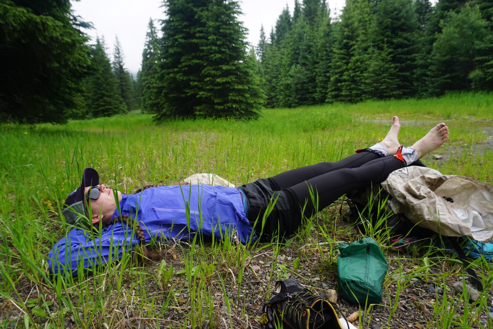
It’s a bit of a miracle we started this trail at all. On June 5th, we had resigned ourselves to spending a summer working in Boulder, commuting the canyon in its nightmarish construction state, and making the most of our days off – already planning a bunch of long backpacking trips we could take directly from the house, weird and convoluted routes to avoid people as much as possible.
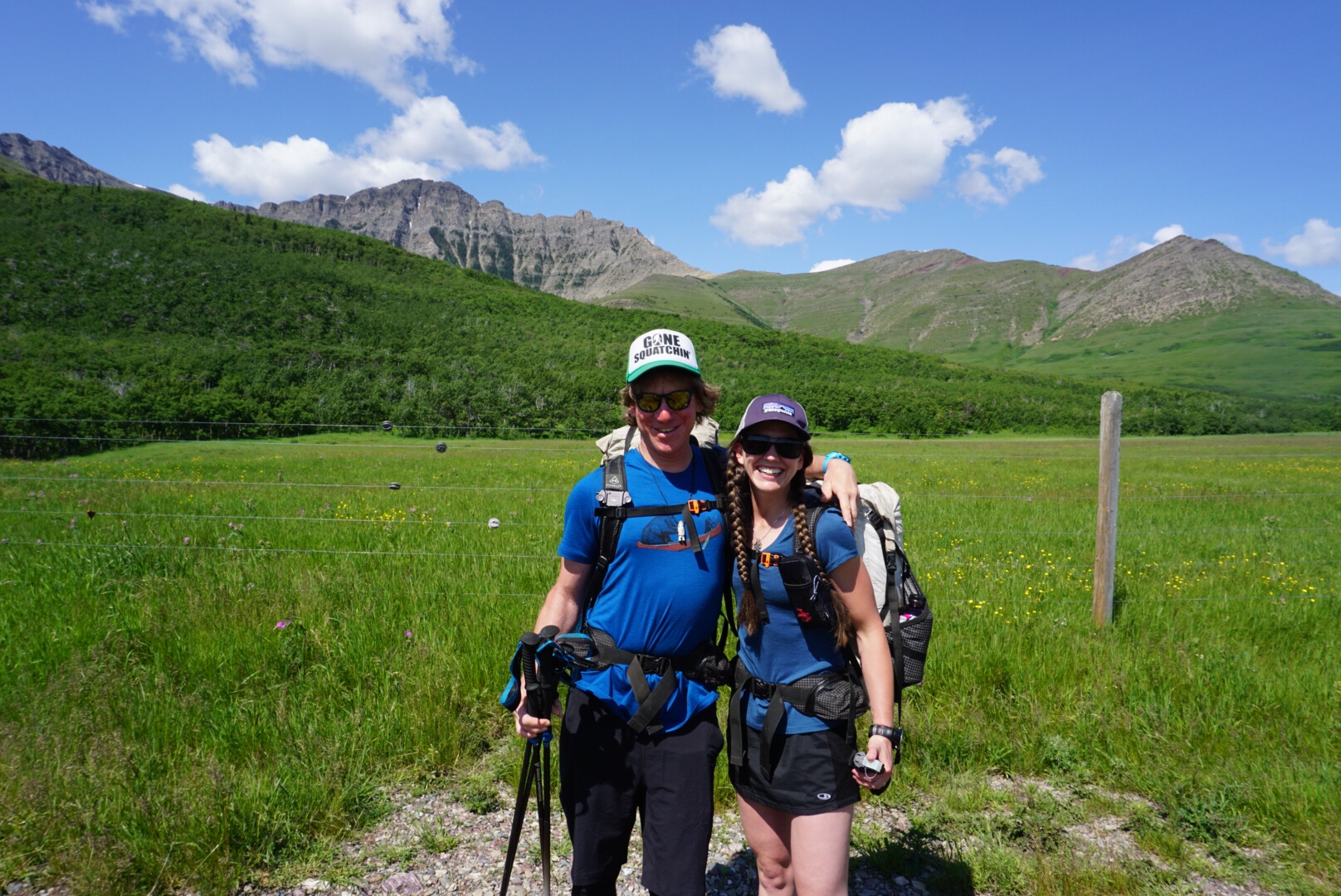
But July 3rd found us barreling down a dirt road in Alberta in Keith and Leslie’s minivan to the “start” of the Great Divide Trail. On this trail, one of my goals is to go with the flow a bit more, to accept that I haven’t planned much at all, and to let go of some of the control I’m used to having. True to the nature of long trails and their desire to test you thoroughly, I was given the opportunity to practice this new, less control-centric philosophy from the get go. When Dan and I were finishing our thru hike of the Continental Divide Trail in 2017, it was highly impacted by fires, forcing odd re-routes, extensive road walking, and even ending in a different location from the “official” finish. Ironically, this same fire is impacting our Great Divide Trail hike. Most of Waterton National Park is closed due to this same fire, so our starting location was along Yarrow Creek – outside Waterton, and somewhere I’d never heard of.
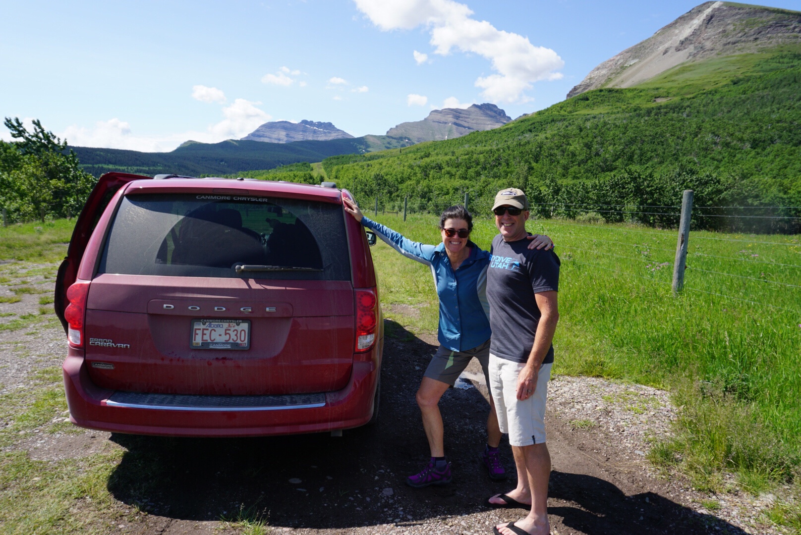
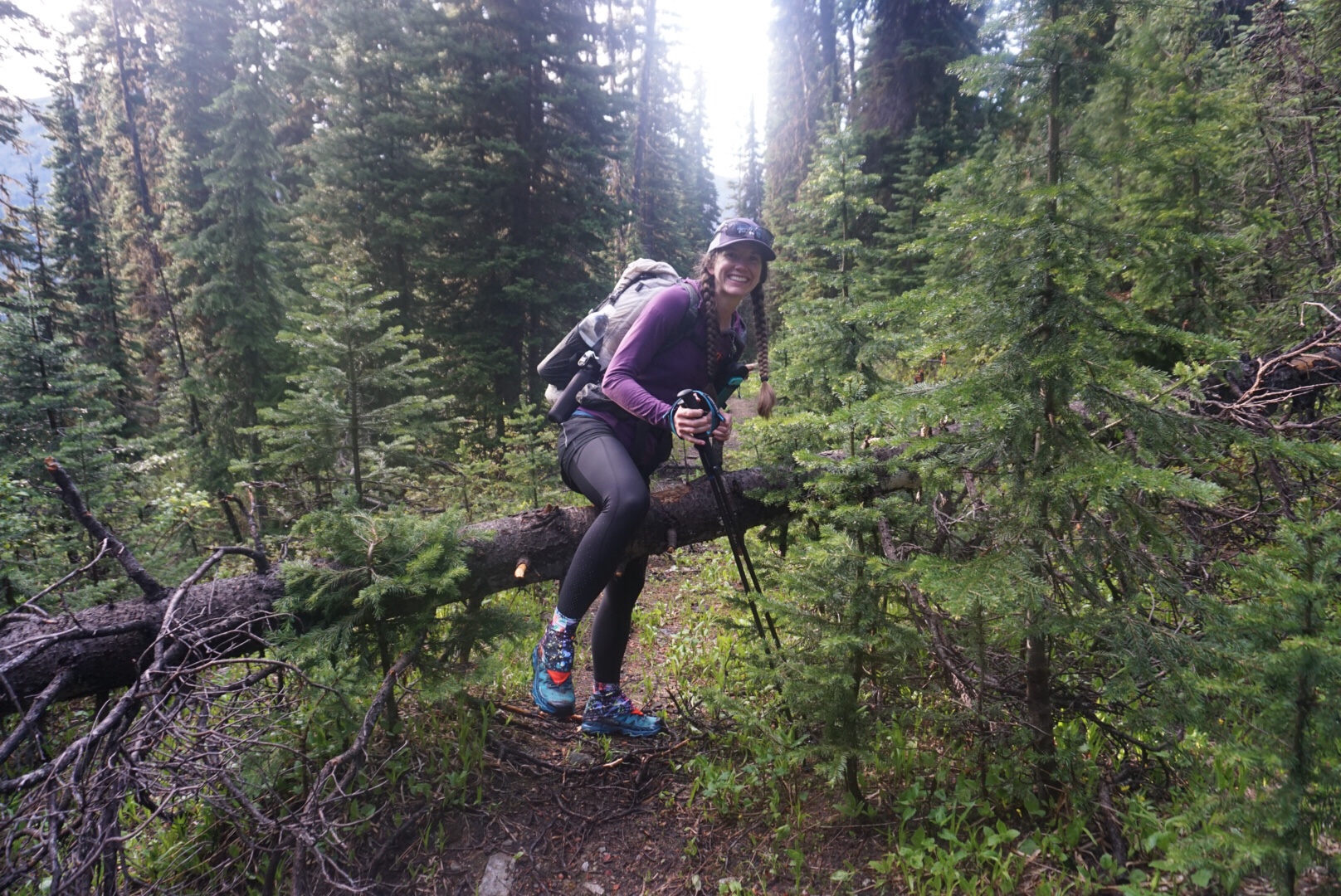
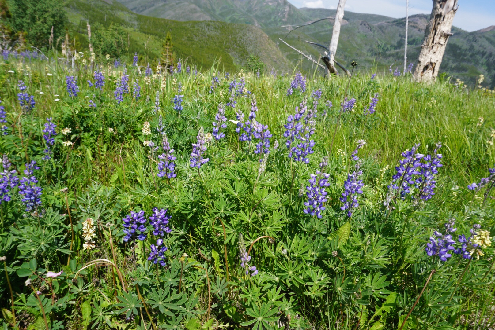
Keith and Leslie drove us to the end of the dirt road, and after hugs all around, we started off, bear bells jingling. After passing some sort of power plant (oil or coal was my guess, complete with eternal torch thrust towards the sky), this alternate varied between dirt road and cross country travel across cattle grazing lands, but soon we were emptied out onto beautiful trail, wildflowers ablaze all around, and huge piles of fresh bear scat every few yards along the trail.
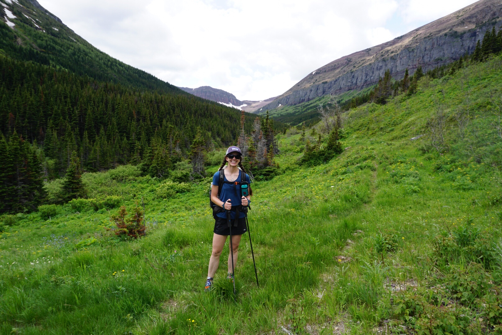
Up and up we climbed, taking our first snack break at a beautiful alpine lake surrounded by towering mountains, red and green bands streaking through them, and lingering snowfields glittering on their flanks.
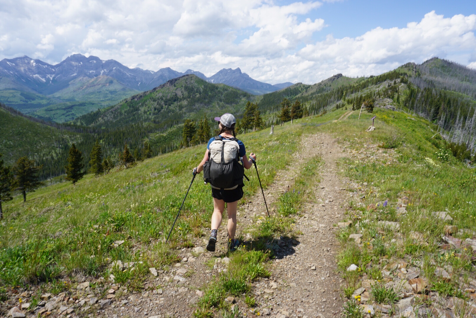
Up, up, up we climbed, passing by another couple who were also starting the trail. Monique and a man I didn’t catch the name of had tried to start in East Glacier in Glacier National Park in the US and had run into a lot of trouble because of all the trail closures in Waterton. Already our Banff friends were proving to be a great help to us on this endeavor with their local knowledge. As we crested our first pass, a stunning view expanded out before us.
Towering mountains extended as far as the eye could see and I found myself choking up a bit. A month ago I had been crying for days on end, devastated by what I felt was an unfair situation. Now, the vast expanses of the Canadian Rockies stretched all around me, enveloping me in their rocky embrace – mine to explore for two whole months.
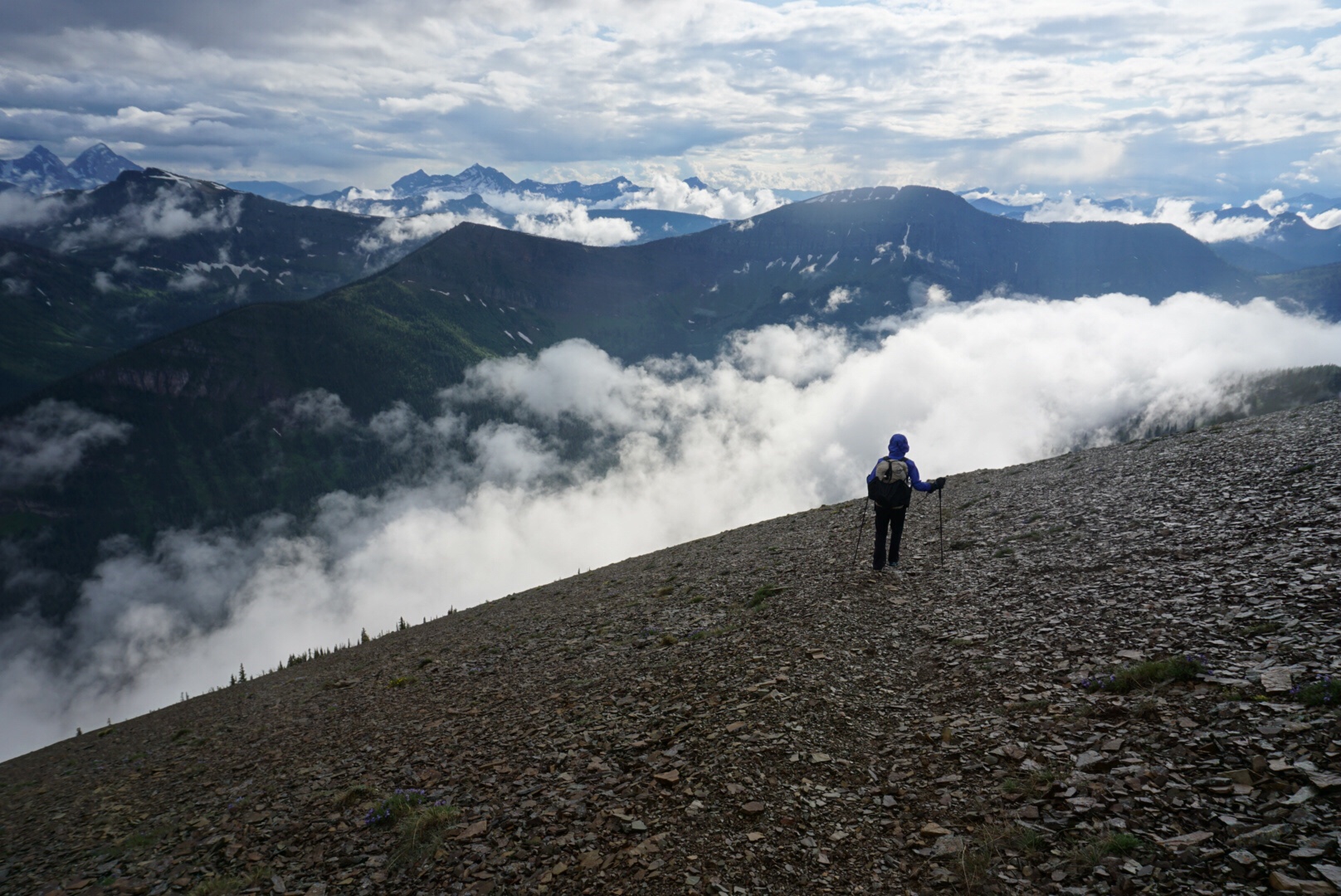
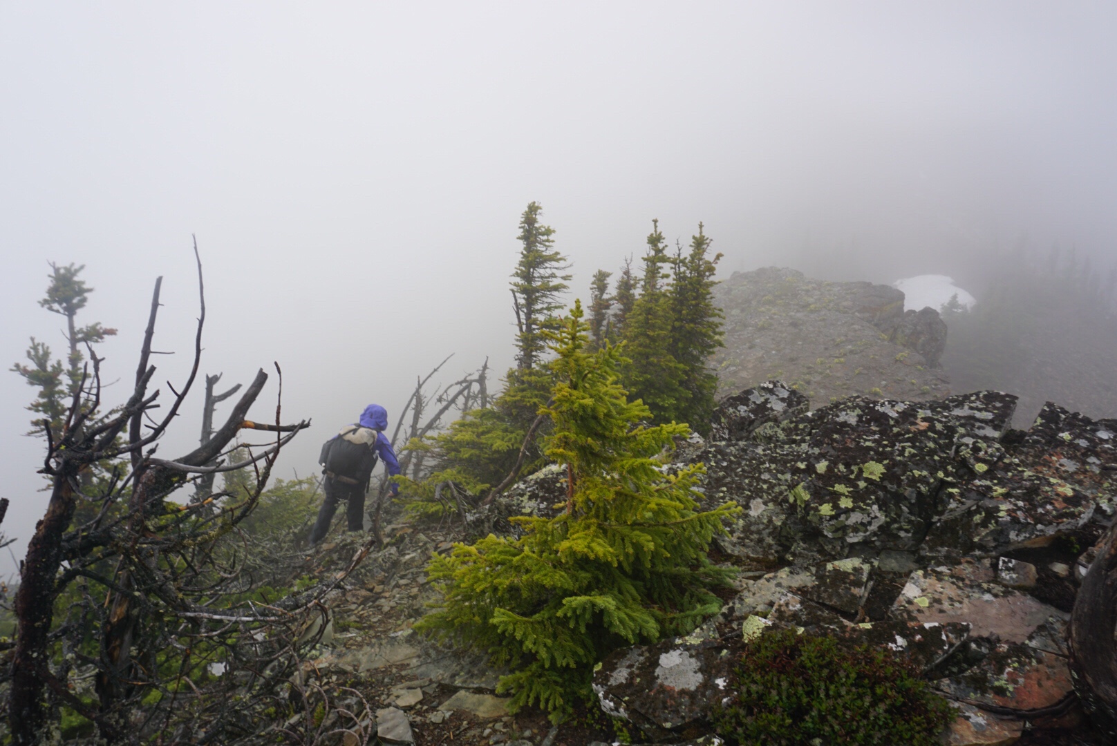
We traversed along Avion Ridge, a gigantic flank littered with scree. Footing was tricky along this side hill, and we continued to climb along the ridge as thunder boomed and cracked in the distance. As the spaces between lightning flashes and thunder crashes grew closer and closer and the trail climbed still higher, we finally dove off the side, scrambling down the ridge towards tree line, where we hastily erected our shelter none too soon. Lighting flashed across the sky, thunder cracked over head, ringing in the ears, and a wet mess of hail and rain pounded down.
We pulled out the stove and cooked an early dinner while the skies exploded all around us. Part of our bear management plan for this trip is to cook dinner, eat, and then continue on down the trail, leaving the tasty dinner smells behind. Just as we were finishing dinner, the storm rolled by, so we packed up and left.
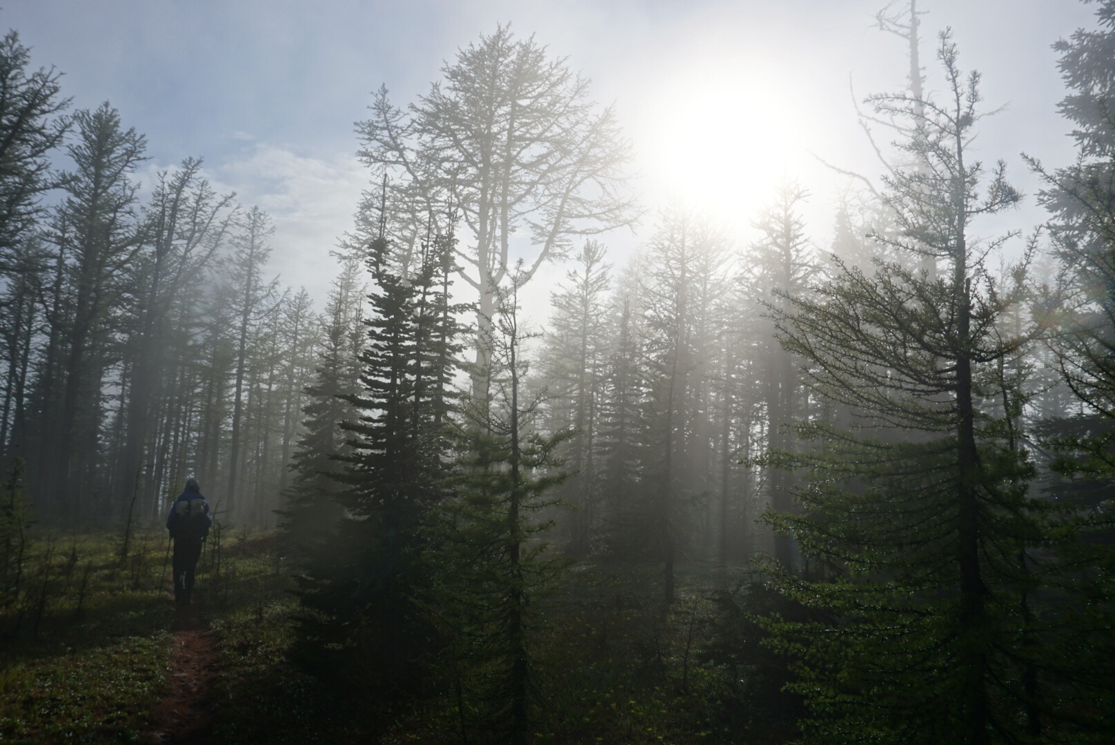
The ridge continued to climb for a while longer, and then dropped down into a larch forest. I was surprised when a branch struck me across the face and it was soft – I’m used to pine trees where getting those needles to the face is a very unpleasant experience, but larch drop their needles in the fall, and these new needles were velvety soft.

Down a steep trail and just as I was stepping over yet another downed tree, I looked up to see the most classic black bear I’ve ever seen: deep black, with a brown muzzle. Dan and I raised our arms and trekking poles, talking to him, until he trundled off up the hill.
 As the evening wore on, we passed a tent set up next to a creek, although we saw no humans, and we started looking for our own place to set up. The extremely dense underbrush made it difficult, as well as looking for a tree that would make for a good bear hang, but we found one and were soon tucking in for the night.
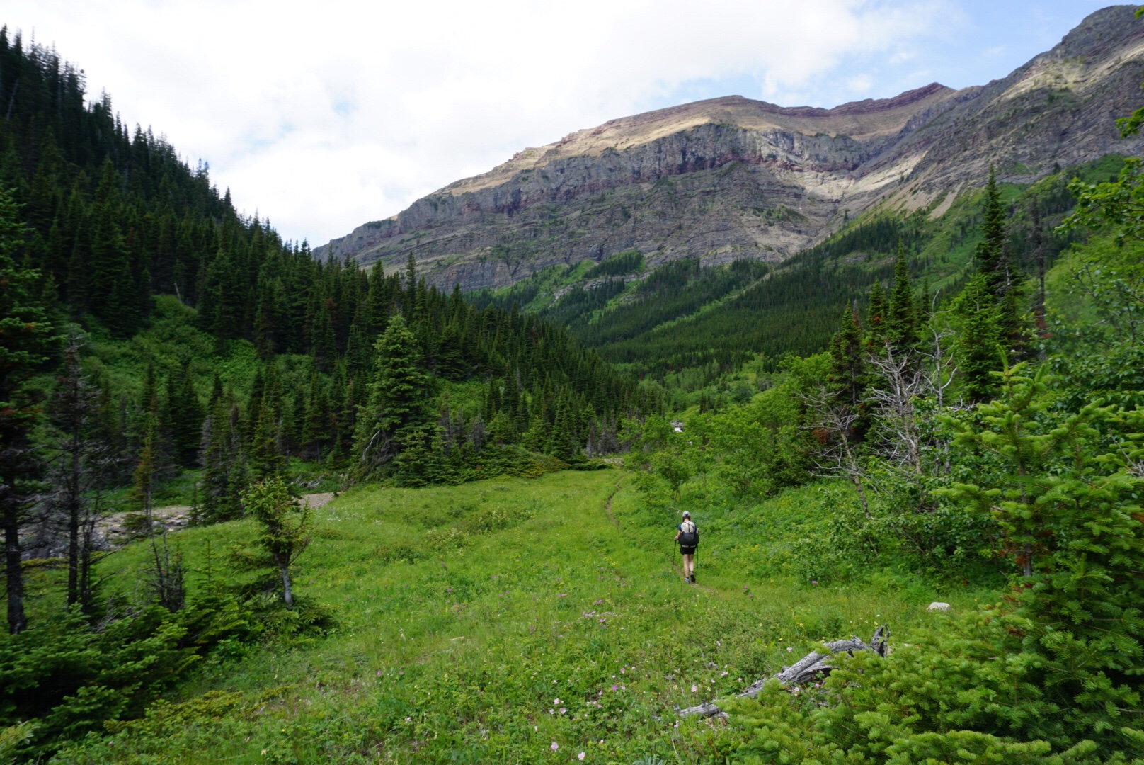
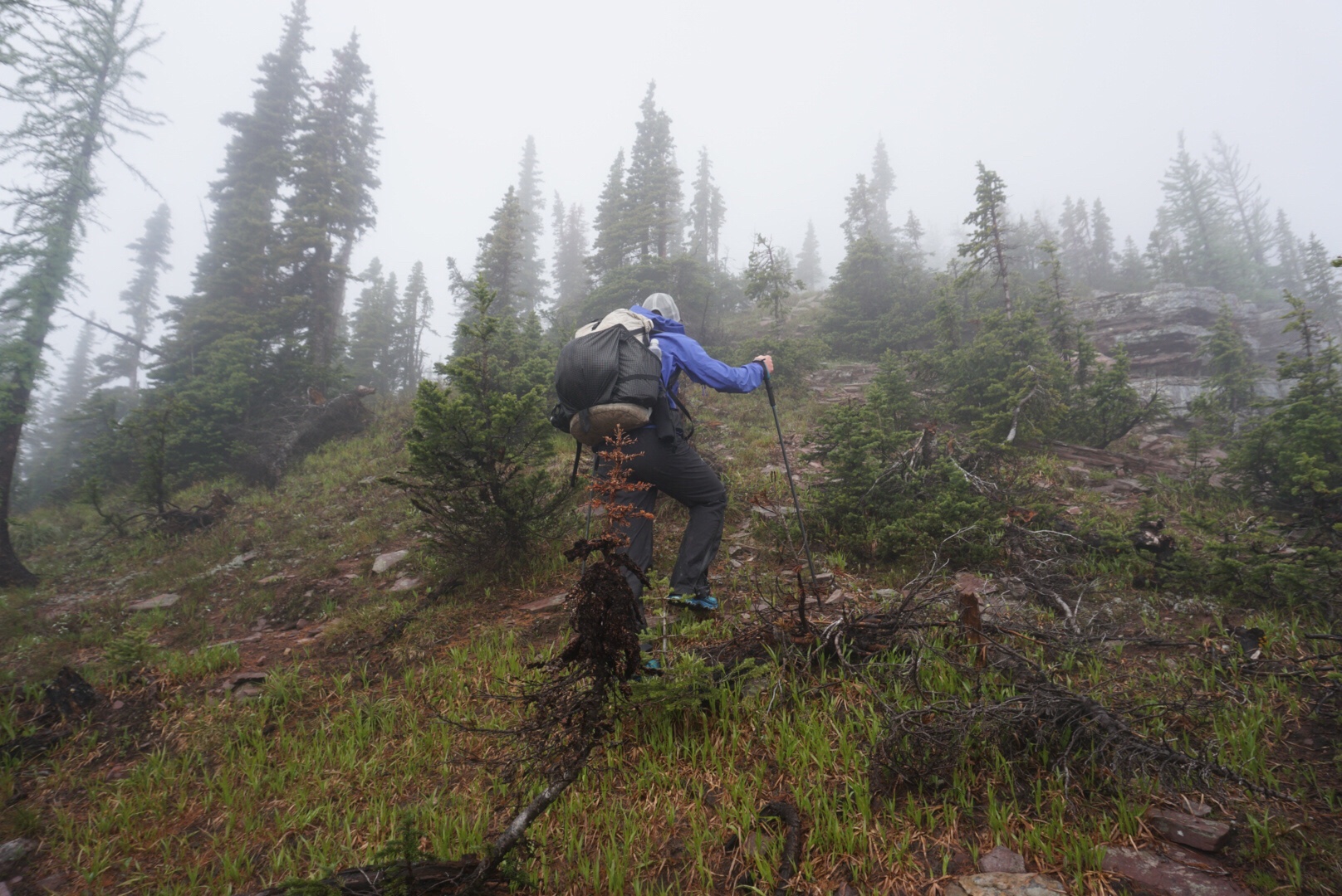
The next morning dawned cold and wet, and as Dan and I were layering on our rain gear, a couple passed us, different from the couple we had met the night before, and we assumed they must be from the tent the night before. We were following what seemed to be a very old logging road, quite overgrown in places, decent in others, that sloped gently downwards, getting the proper car wash experience as the dense brush on either side of the trail offloaded their rain-drenched leaves on us as we passed.
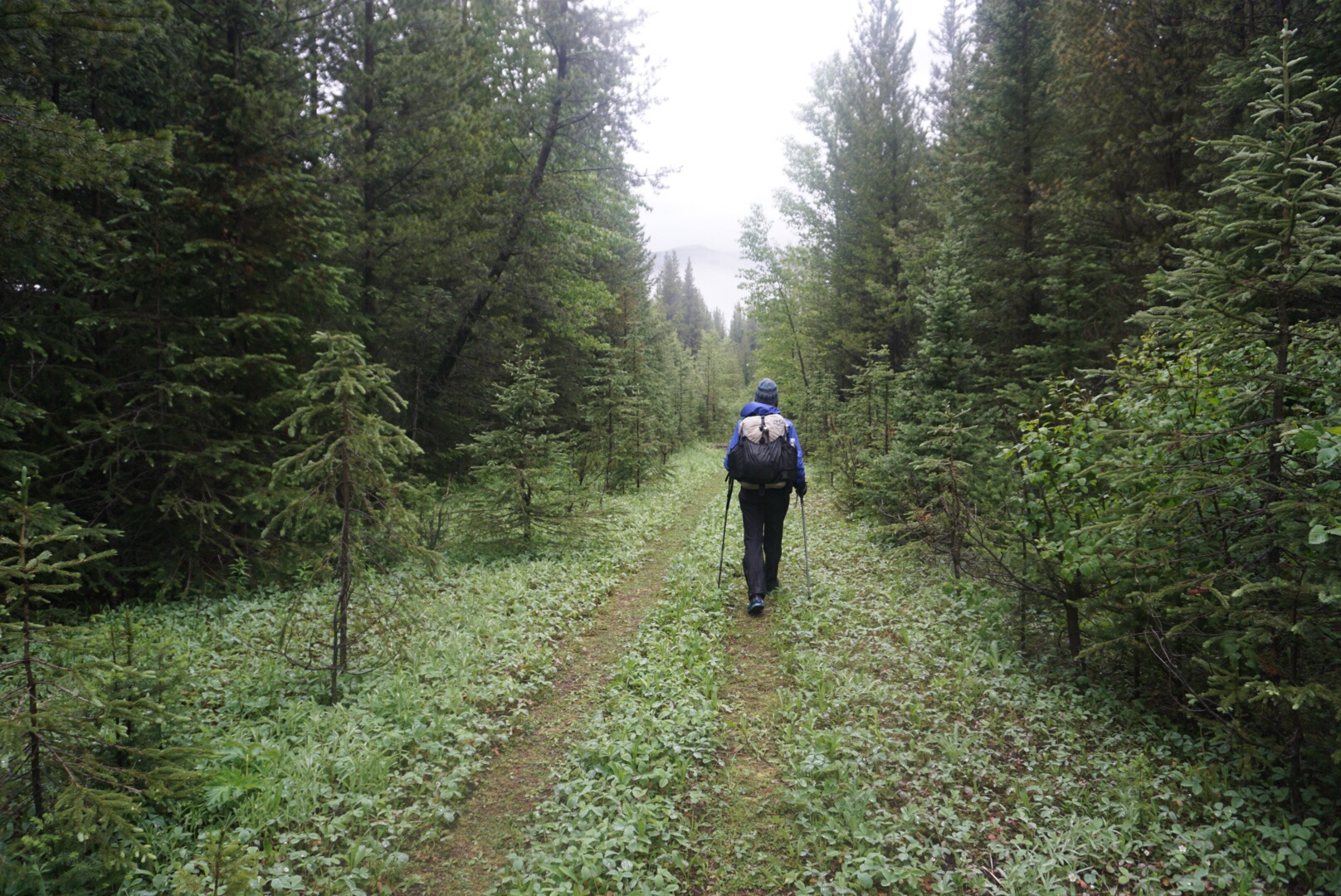
We played leap-frog with the other couple as we each took snack breaks, eventually joining the official GDT and climbing up to a creek that was the last water source before a 14 km stretch of challenging, slow ridge walking – the hiker notes say it often takes hikers 8 hours to do the upcoming stretch. The other couple stopped to camp there, but as it was only 2 pm, I didn’t think Dan and I could manage not hiking for that long. We loaded up on water and started climbing.
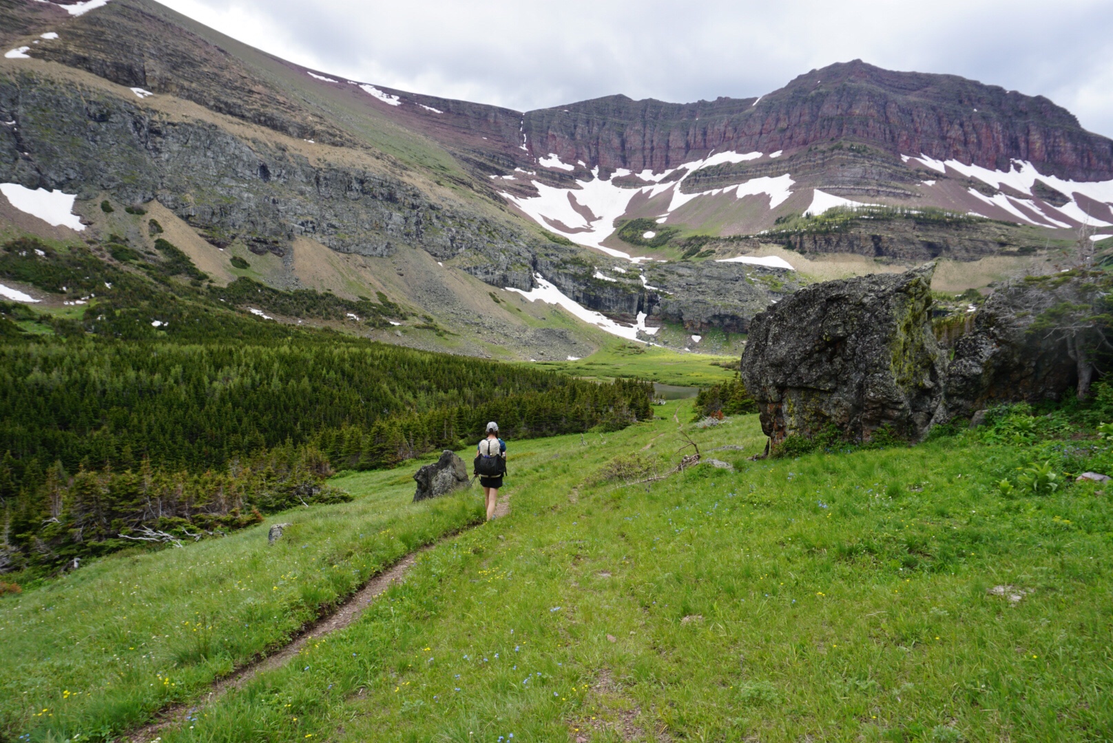
And up it was! Soon the trail disappeared and we were left to clamber up an almost vertical wall of slippery plants and mud, gaining 490 meters in less than 4 km. The view was richly rewarding.
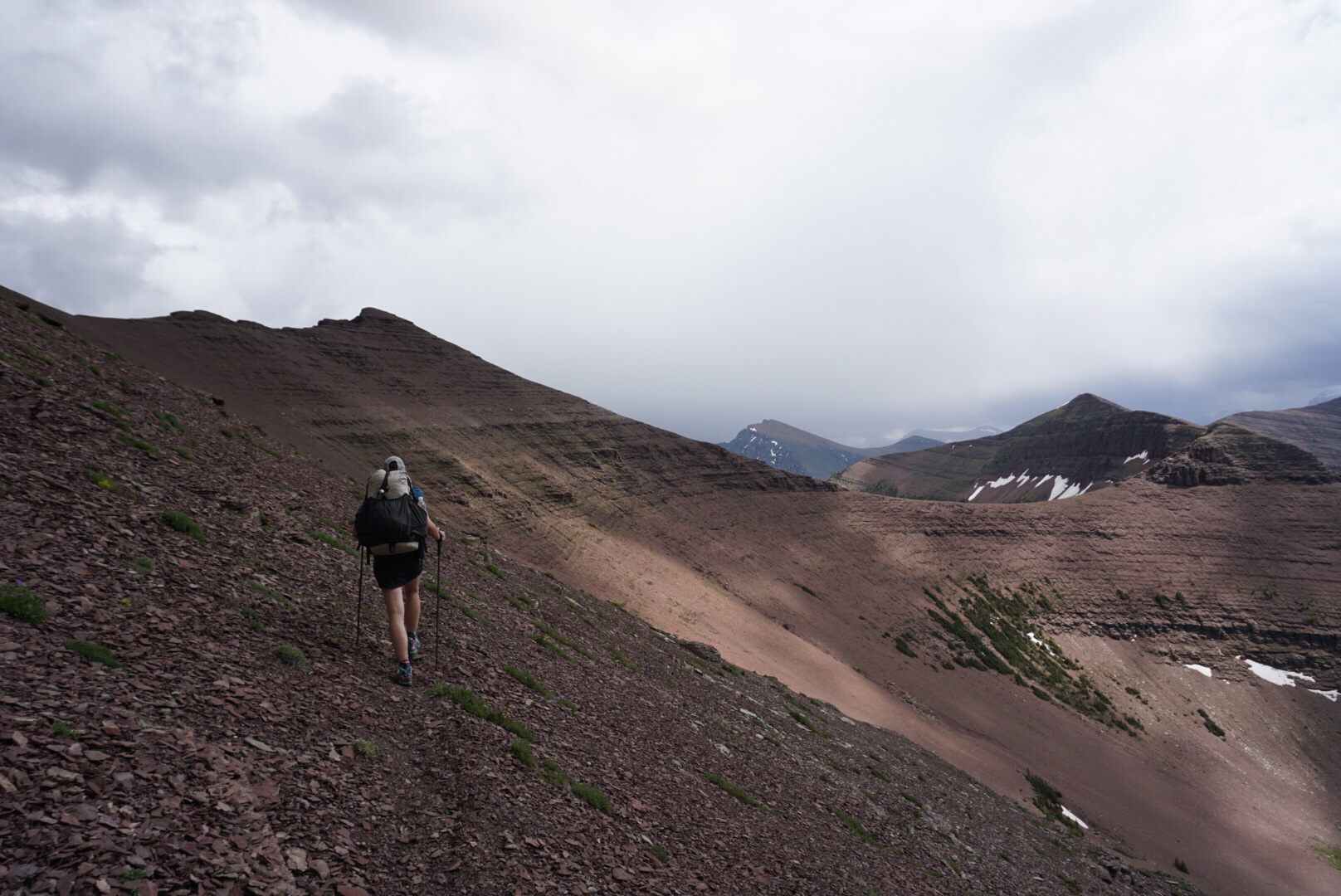
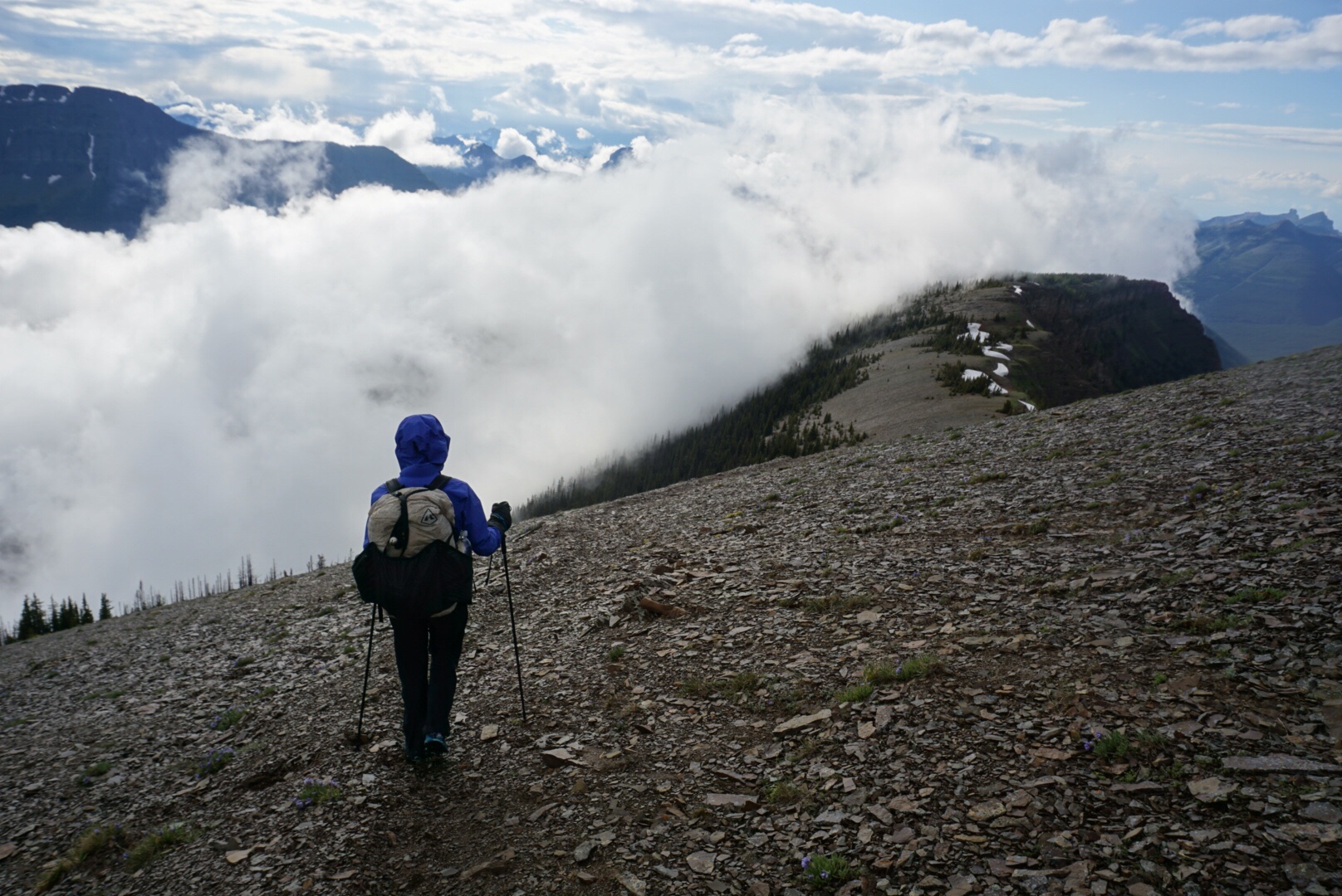
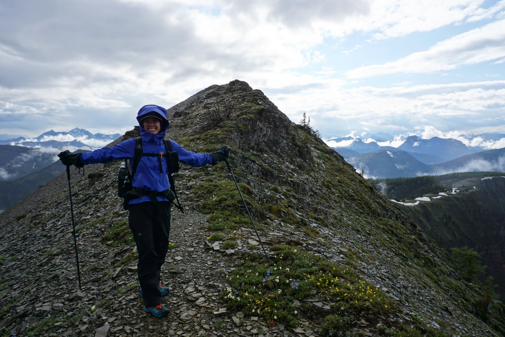
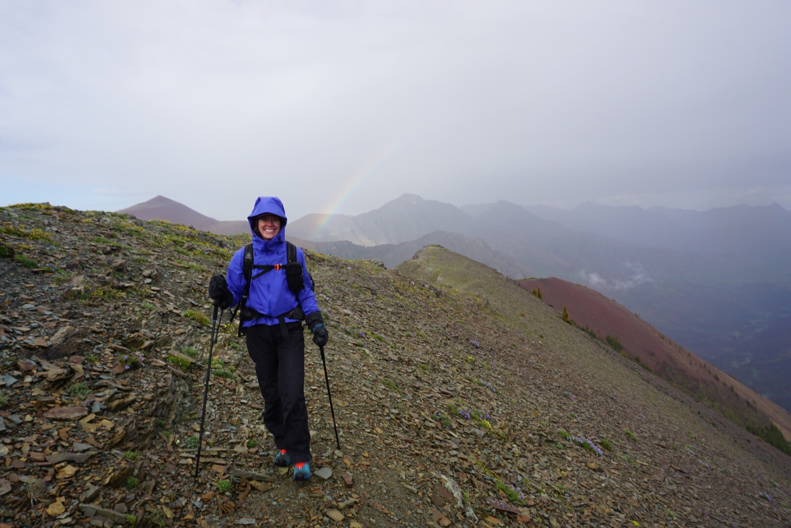
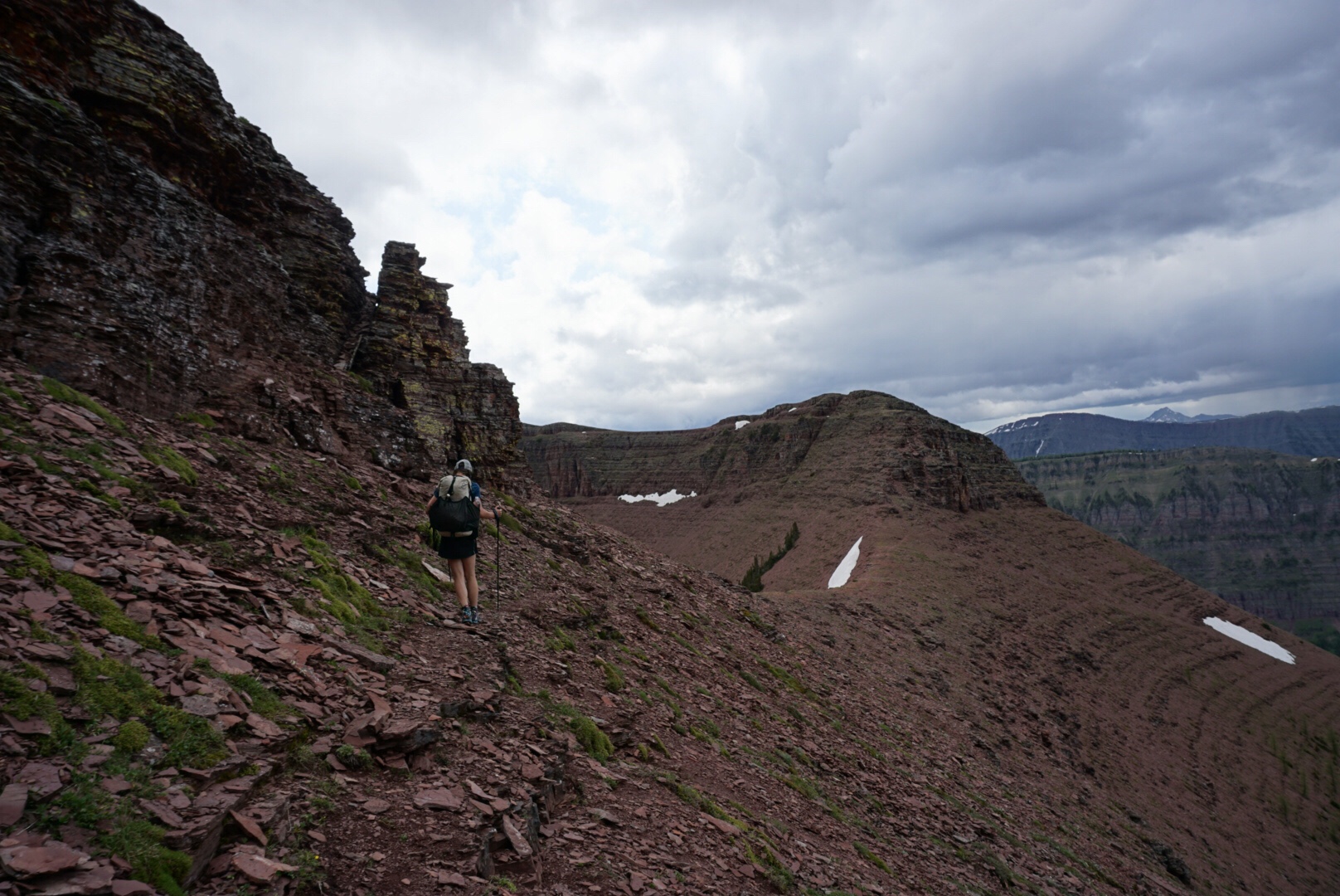
La Coulotte Ridge was a jagged knife-edge, requiring a bit of scrambling and a bit of navigating to avoid a descent over cliff faces, made a bit more challenging by the rolling clouds that were wafting by, sometimes so dense we could hardly see what was directly in front of us, sometimes lifting up so that we could see the spectacular ridge line stretching away from us.
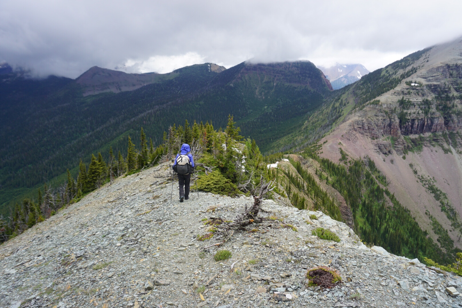
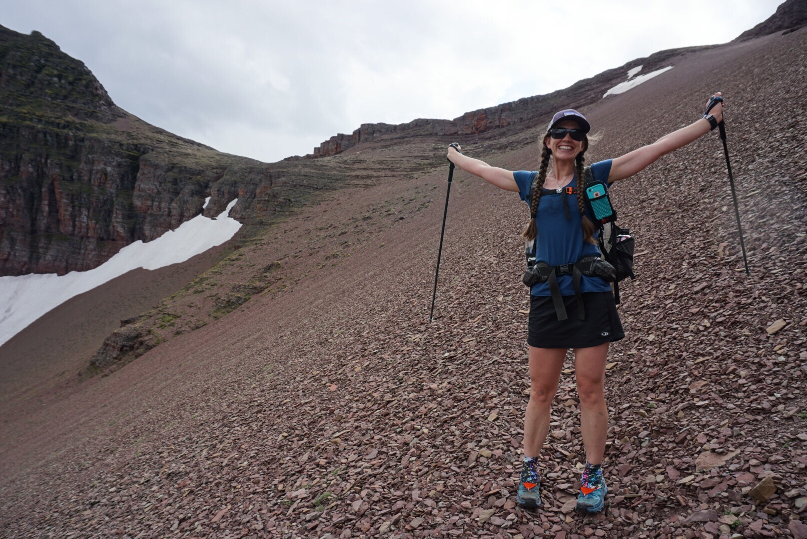
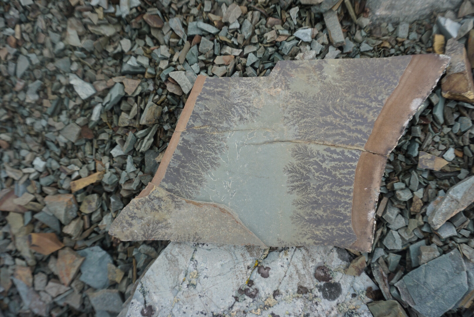
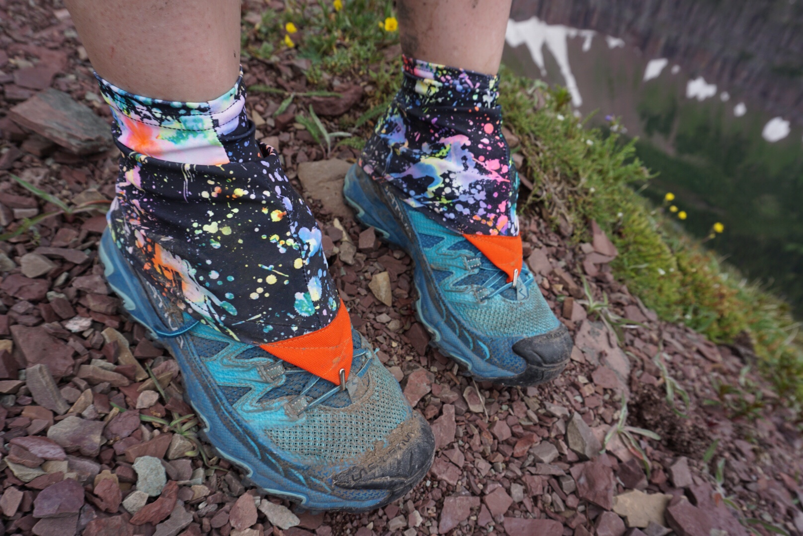
The climb to La Coulotte Ridge was followed by a just-as-steep descent down, and then up La Coulotte Peak, a peak standing at 2360 meters, and a total mess of scree. Our feet punched through the scree as though it were rotten snow, and I found myself very glad we had decided to bring two pairs of La Sportiva Raptor shoes for this hike – this was going to tear through shoes pretty quick. On the way up, Dan found what I’m pretty sure is a fossil. We may be wrong, but it was pretty cool.
The Barnaby alternate takes off from the top of La Coulotte, but we decided to stick to the main trail – Barnaby Ridge is Class III/IV terrain, extremely dry and exposed, and our luck with the weather had been tenuous at best so far.

We descended about a kilometer off the peak, found a tiny but suitable flat spot and set up camp for the night, watching more weather move in. To our east, dense fog billowed up and up, reaching tendrils through the little dips of the ridge, and to our west, British Columbia basked in the glory of the setting sun, the Continental Divide acting as the barrier between.
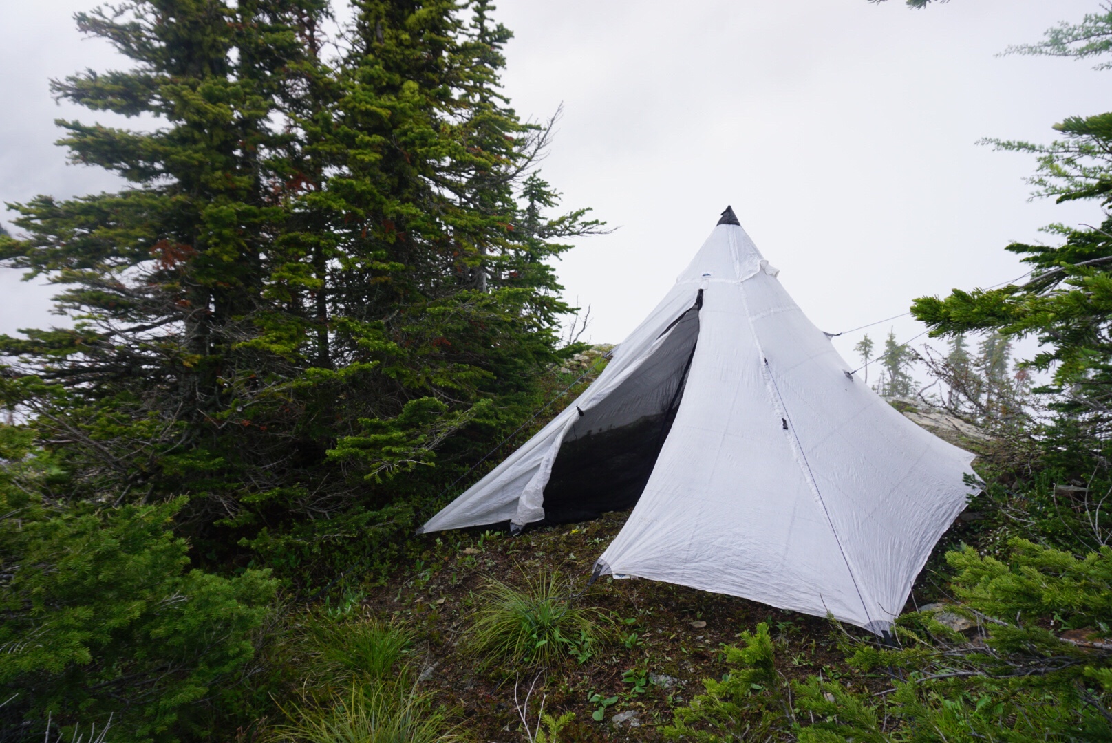

Heavy rain came and went throughout the night and a cold wind blew underneath the shelter to kiss our faces with brisk fierceness, making sleep a fitful thing, and we arose to dense fog. I also awoke to an uncharged phone. I had plugged it in to my charger the night before, but it seemed to have mostly charged it, and then stopped.
“Perhaps it was just trying to conserve battery power,” Dan suggested as I lectured my battery.
“It’s not your job to think,” I told my battery sternly, “It’s your job to charge!”
I was actually quite cross at it, but when Dan started laughing, I couldn’t help but join in, it sounded so much like a line for a ski film, and that became the theme for the rest of the day.
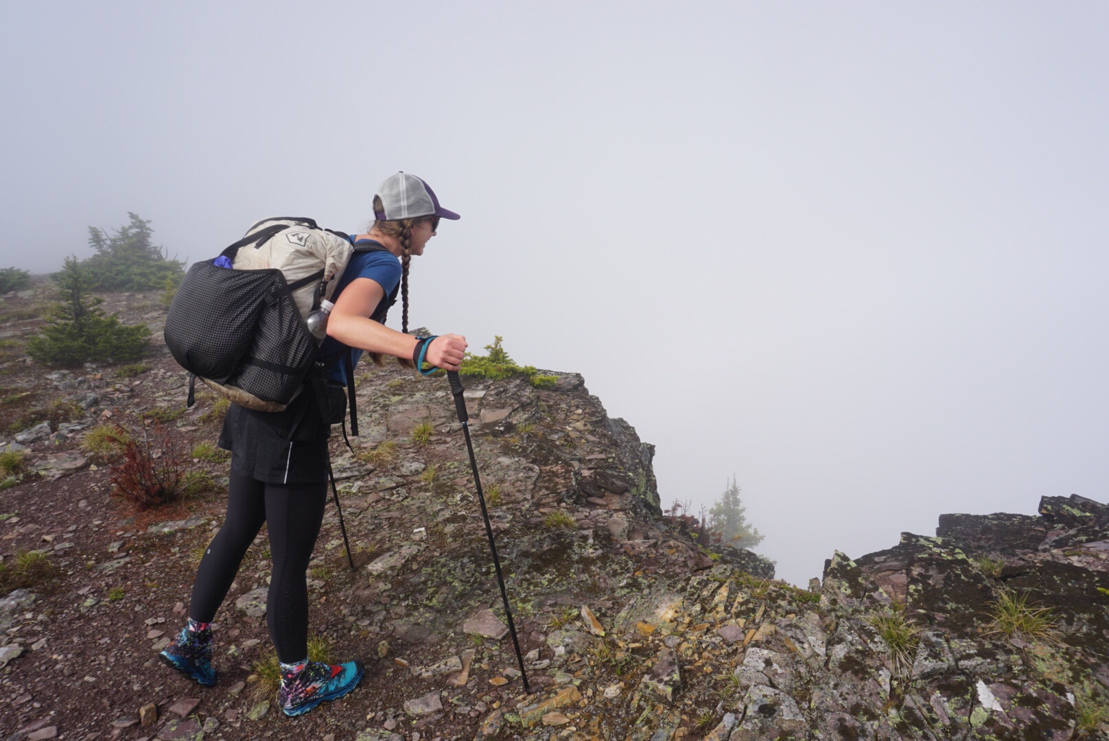
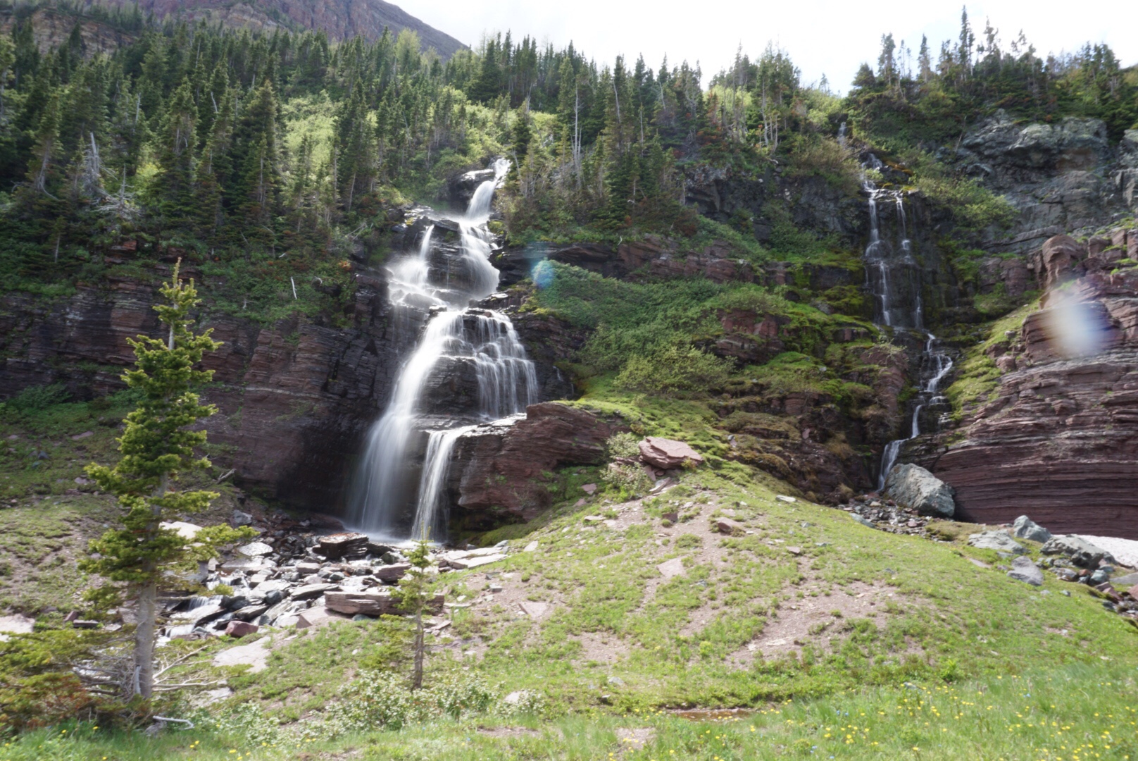
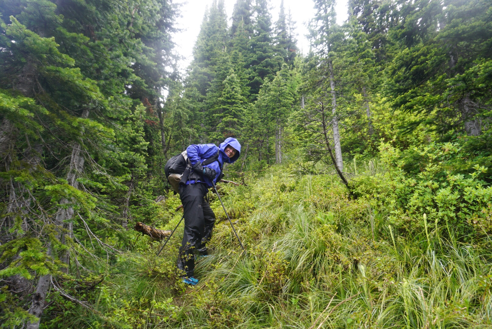
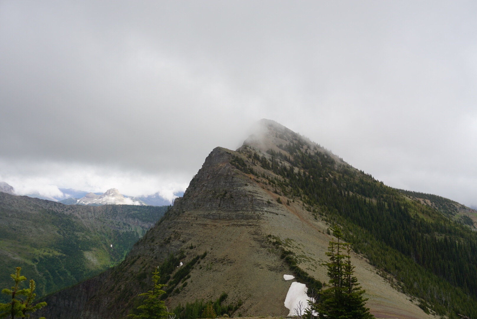
It was another wet start, decked out in our rain gear as we navigated our way carefully through a cliff band that wrapped the flanks of La Coulotte Peak down to a saddle, and then up yet another steep ridge. Visibility was almost nil, and it was slightly vertigo-inducing to climb up, rocks beneath your feet, nothing but fog to the sides, not knowing how steep – or how far – the drop off was. The white out caused me to navigate down a bit too far to the west, but we corrected and soon had summited the next and last peak of the ridge and began our long, long descent into a valley, and then – lo and behold! What appeared to be an old mining road appeared out of nowhere and travel pace picked up a bit.

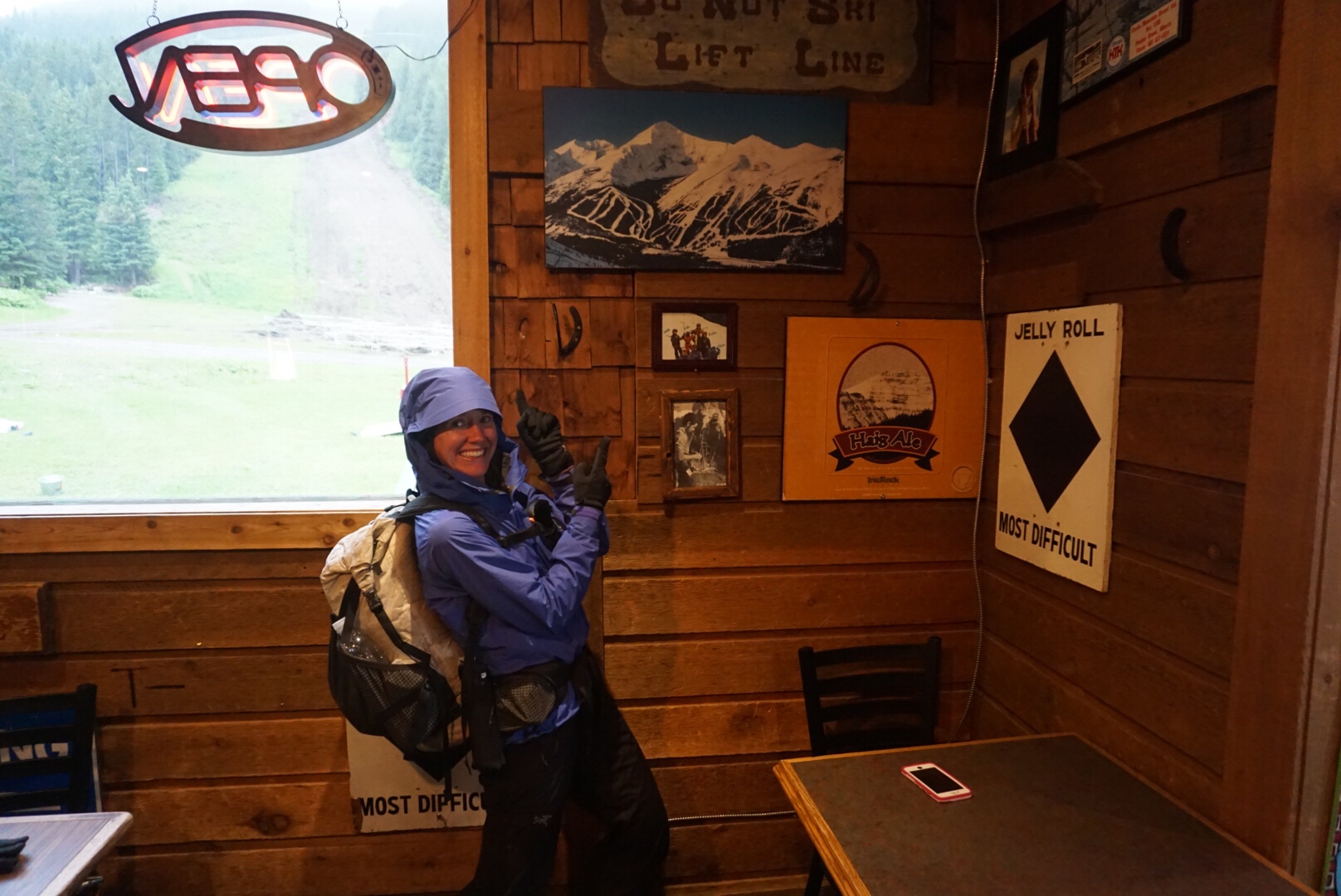
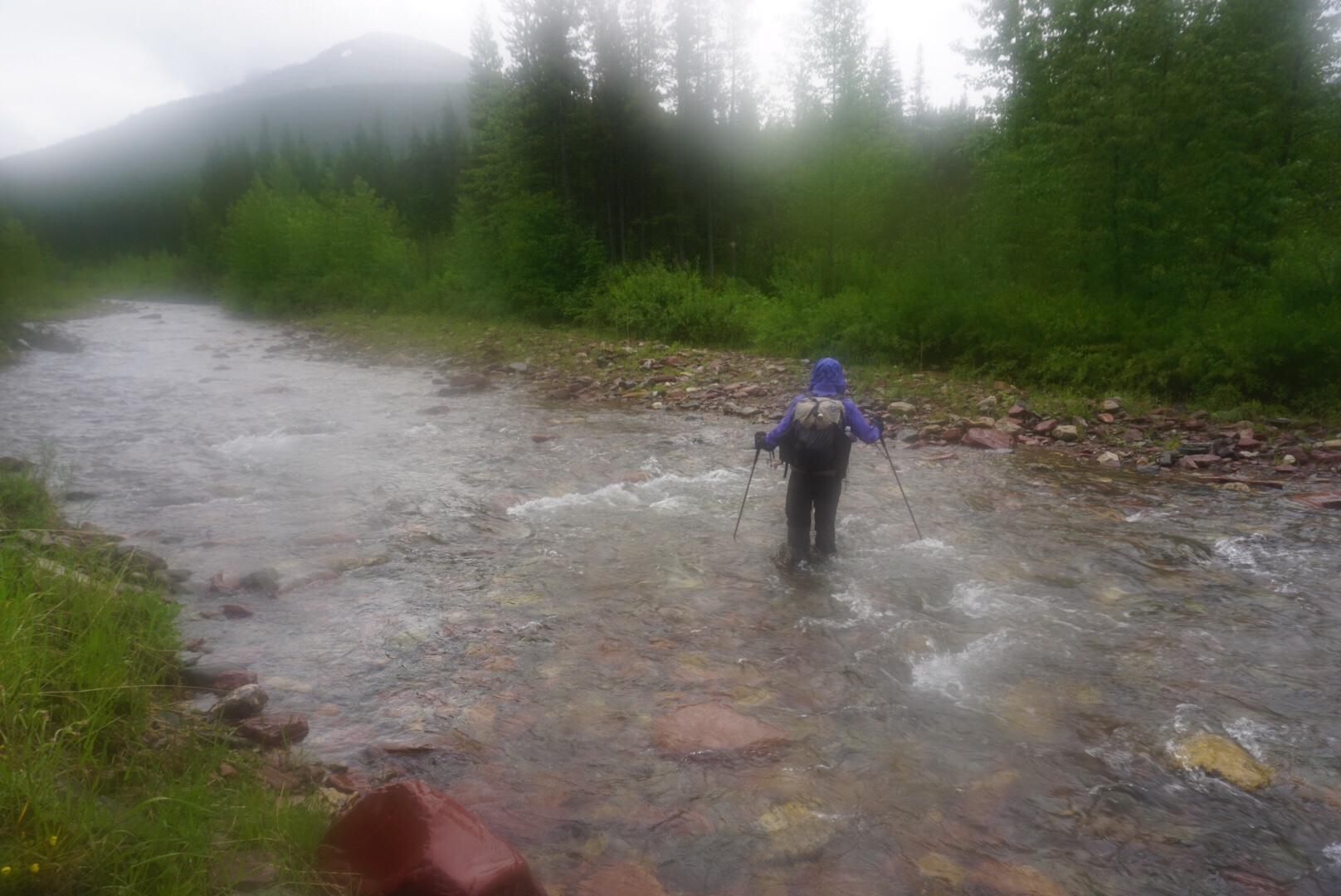
The rain continued as we dropped lower and lower, crossing several rushing rivers until suddenly we were on a dirt road and hit Castle Mountain Ski Resort. Now, I still haven’t seen the place properly, given the cloud cover and rain, but from looking at pictures while we sat in the small pub, demolishing pizza and nachos, I think we might just have to come back. After searching for a trail map (there were none, it is summer after all, I suppose) for a friend who collects trail maps from around the world, it was back out into the dreary evening for a few more miles.
We were dumped unceremoniously onto a highway that we walked for all of a hot second before the Great Divide Trail took us off to walk through a knee deep river for a way before spitting us back out on to the highway, then veered off onto an old dirt track. We followed this for a while, observing the damage from a flood in ’13, wondering if it might have been the same storm that caused our own floods back home in ’13.
As we climbed gently up, passing through the dense brush, I suddenly stopped, looking off to the left where I saw a tiny little erosion gully coming down.
“That can’t be anything,” Dan said.
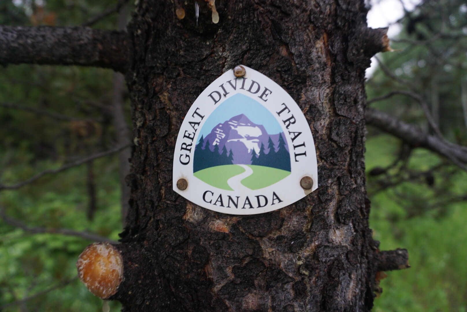
But after checked the maps and notes – “rest assured, this is the correct route” – yes, yes it was the GDT. So we stepped off the old dirt track and climbed vertically through yet more rain drenched bushes, becoming properly soaked now, and talking loudly in the hopes of scaring off any bears around, as we could see no further than the branches in front of our faces. Quite abruptly, after 400 meters of vertical climbing, we were spat out onto yet another two track and witnessed our first GDT marker of the trail!
We set up camp just off the trail while thunder began and lightning flashed over us, counting the seconds between flash and boom, like some count sheep to fall asleep.
Rain poured down that night, and I had dreams of floating away, but we awoke to a weak sun filtering through the thick clouds, slowly burning them away, and we were both so thrilled, we soon shed our rain gear, only to be swarmed by mosquitoes, intent on our fresh, sweet blood. They were so bad, we actually busted out the bug spray for the first time.

It was mostly two track that morning, passing through muggy, swampy areas. As we stopped at one junction to consult our maps on which way to go, I looked up and saw a cow moose trotting off, long legs making easy work of the swampy land. As we located where we were and read the notes, we laughed aloud:
“Watch for moose, on my hike in 2013 I saw a beautiful cow”
Much of what we’ve been hiking through is what I would consider moose terrain, but this was our first moose, and here was a note about it. I couldn’t help but laugh.
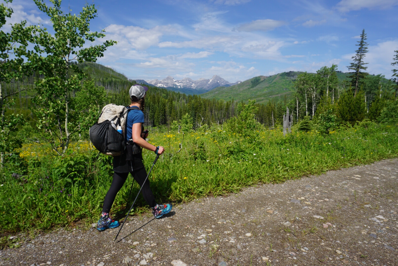
All too soon, we joined a gravel road, where miles became easy, but the sun soon became baking hot and we were stripping to shorts and t-shirts in no time.
We stopped for lunch along Lynx Creek, to fuel and camel up on water before ascending to Willoughby Ridge, another long ridge walk with no water. One butterfly took a liking to Dan’s head, and wouldn’t stop circling as we ate. As we sat, shoes off, feet baking in the sun, a couple stopped along the road and came down to us.
“We’re looking for the waterfall,” the guy said by way of greeting, full of friendly Canadian cheer as he waved his coffee enthusiastically through the air and his pup chased butterflies through the grass.
“I’m sorry, we don’t know where it is,” Dan responded, and was in the process of saying we could probably find it on our maps, but they were past us and in the creek before the words came out. Several minutes later, they came back, the guy dripping.
“I’ve traveled from coast to coast in Canada,” he declared, a huge grin on his face, “and I like to baptize myself in every body of water I find!” With that, they got back in their truck and were gone, and it was time for us to move on as well.
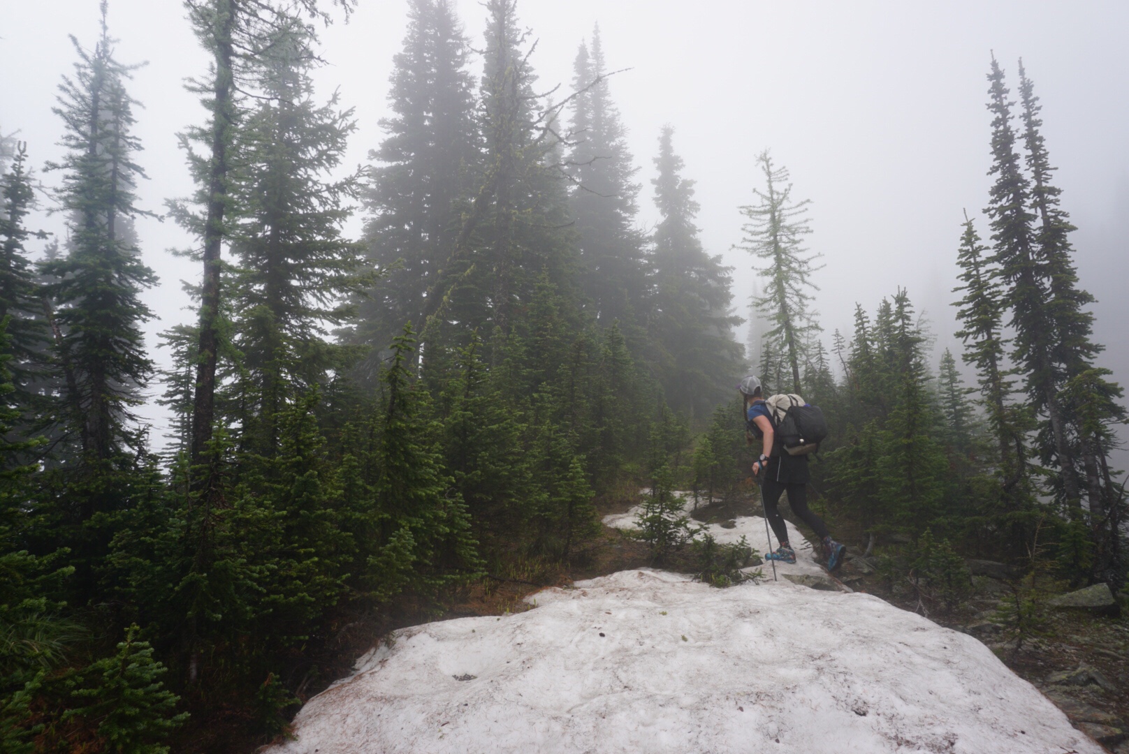
The climb up to Willoughby Ridge was a very steep two track, and with the sun beating down, and the high humidity from all the recent rain, both of us were soon drenched in sweat, even little rivulets making their way down my legs. My foot also began to give me a bit of grief as we climbed up – I’d felt it on some of the steep descents the day before, and it was getting angrier. It felt like a tendon behind my big toe was angry at me. Probably rightfully so. Not knowing that we were going to be doing a thru hike this summer, we hadn’t prepared very well, taking a full month off in April and only resort skiing, and in May doing a ton of backcountry skiing as pow day after pow day hit us. None of which does any good whatsoever for toughening feet up for the trail!
As we reached Willoughby Ridge, a vast view of the Continental Divide opened up to our west, stark and gnarly. It was no wonder the trail was not located there through this section – it would take a skilled rock climber to navigate those peaks. But from our vantage point along the ridge, it made for spectacular viewing.

Descending from the ridge, we ran into the tail end of a local endurance race, the Sinister 7, a hundred mile ultra race that climbs some 21,000 feet. This was the last of them, and many were not hitting the time limit. It was a little depressing to watch someone’s summer goal ending, to be honest. We ate dinner, watching them go by, trying to be encouraging, while they staggered past. One woman stopped, staring at Dan.
“Is that? Do you have a poodle with you?” She asked in disbelief.
“I – what?” Dan asked, taken aback.
“I, you, I’m sorry, I must be seeing things, I thought you had a poodle on your shoulder,” she stumbled off, staring back at us. Fortunately, there was an aid station just beyond the bend, so we didn’t feel obligated to make sure she was ok.
It did make us reminisce about some of the odd hallucinations we had on the Greenland icecap. At one point, we saw a pack of wolves in the distance, and at night, we always saw lights a ways behind us, as though there were a group a day behind us. It is crazy what the brain will come up with.
As we climbed up another ridge, our weather luck broke, and thunder heads gathered with alarming speed overhead. Just as we reached the top, lightning struck way too close for comfort, and at the same second a crash of thunder so loud it left our ears ringing boomed through the sky, and we both dropped to the ground, arms over our heads out of pure instinct. The next second, we were up and running, pell-mell, trekking poles clattering on rocks, slipping in the mud and hail that was now thundering from the sky, hair frizzing and hearts leaping in our throats.
Running down and then dropping into the trees, my foot began to scream at me, and I shouted at Dan that I couldn’t run, and continued on at a fast hike as the rain and hail pounded into the mud, the saturated ground unable to hold any more moisture, instantly turning the trail into a river.
I limped into camp at York Creek, now well below tree line, foot severely aggravated, but nobody struck by lightning. It was with trembling fingers that we tied out our guy lines. So far, I haven’t figured out the weather patterns. Thunder and lightning roll through at any time of day or night. Cold and wet again, we fell asleep, glad that at least it was an easy walk into town.
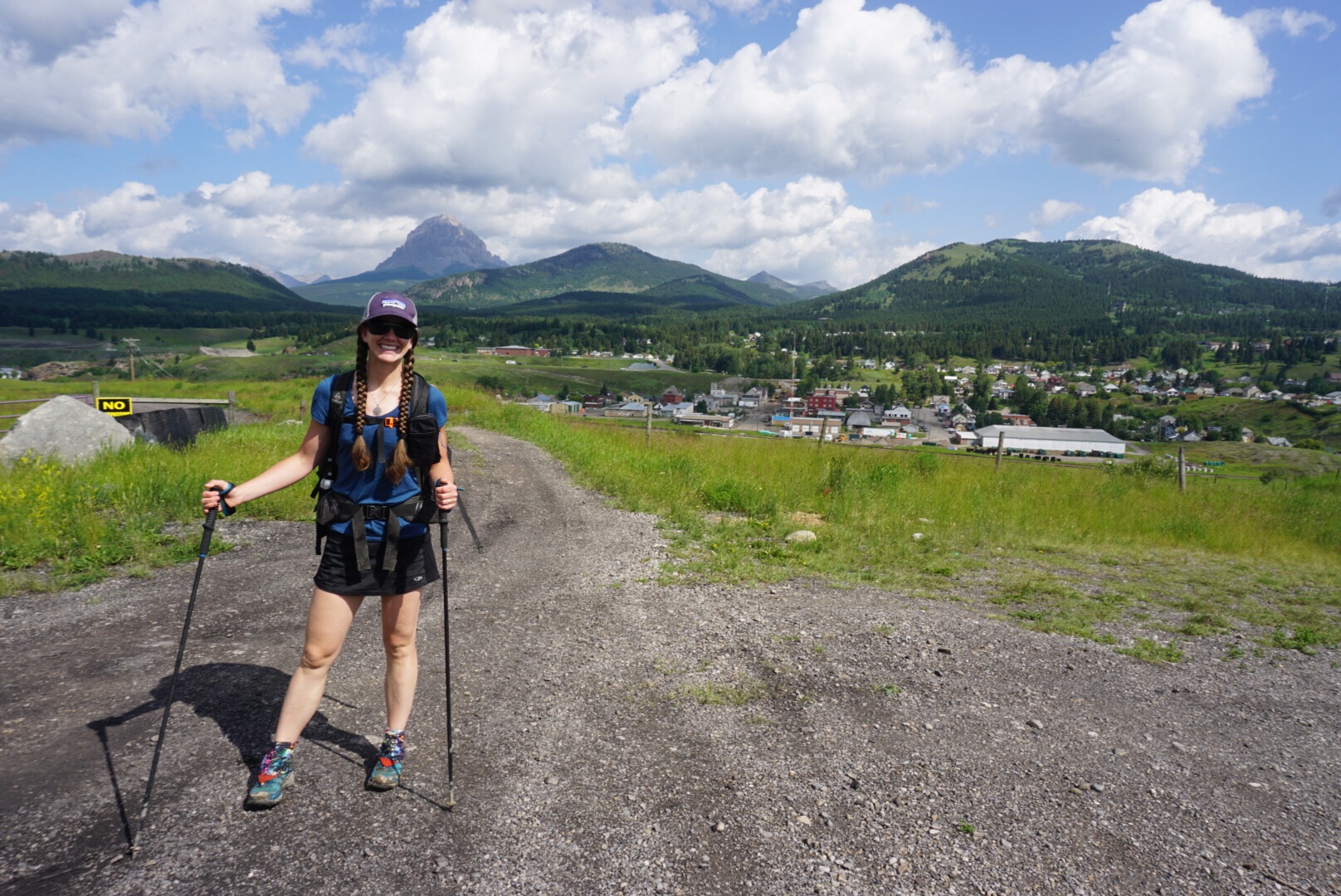
Indeed, it was a very easy walk into Coleman, at first on a two track, then a wide gravel road, then finally a few kilometers on pavement. My foot was still quite angry from the night before, and greatly favored going uphill instead of down, but this was mostly down, and what do you do besides walk?
As we stepped into Coleman, the most delicious smell of cinnamon washed over us, and as it was only 11 in the morning, we headed into the Cinnamon Bear Bakery, where we purchased cinnamon rolls and cookies, and sat down outside, where we were joined by Paul.
This is where the magic of the trail comes out – we came into town a bit hurt, a bit put out about being wet and cold for the last few days, and the very first person we run into in town is the most friendly, warm, encouraging person imaginable. It turned out Paul had guided in the Kakwa Lake area in the ’90s. Kakwa Lake is one of the ending points along this trail, though many end in Jasper National Park, or at Mt. Robson, as Kakwa Lake is quite a long, remote section, and requires an 80 km road walk out of. In fact, I have yet to meet someone in person who has actually been there. Paul’s eyes lit up when he heard that we were trying to get there, and we spent an hour listening to his tales of the area.
Our stoke for our adventure re-kindled, we checked into the Paddock Inn Motel, where the landlady is the kindest, most helpful human, and took a long warm shower each.
Trail life – it’s where your lows are very low, but your highs are even higher for it, and it’s all of that that makes this life so very, very special.
 Thanks for the marvelous beginning, Canada!
And perhaps, truly, there’s a nugget of truth in what I told my charger: It’s not your job to think, it’s your job to charge.

Leave a comment