We continue on with our 2019 Great Divide Trail journey from the U.S./Canadian border to Kakwa Lake. Saskatchewan Crossing to Jasper is the 6th segment of the journey, or Section E. Here we begin to enter the far north including the wild regions of Jasper National Park. This land is home to wolves, caribou, deep bogs and endless above timberline routes. Enjoy! – DV
July 31, 2019 – 19 Miles, 3,700 feet climbing
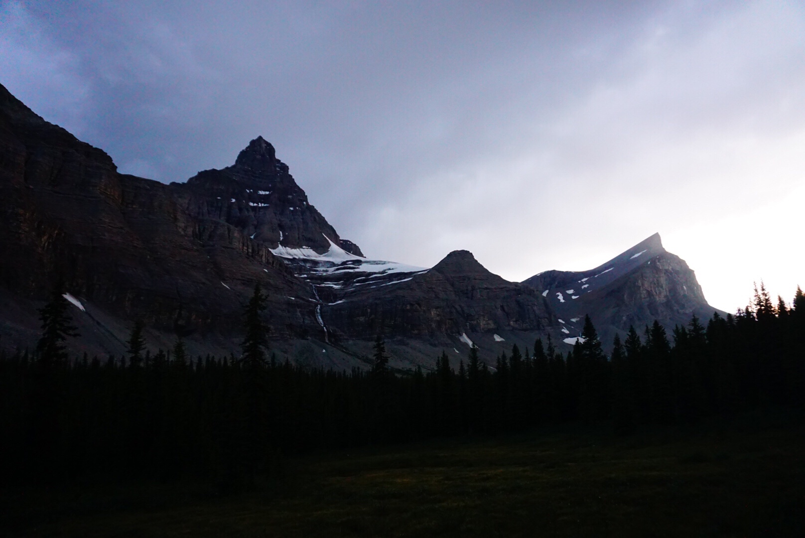
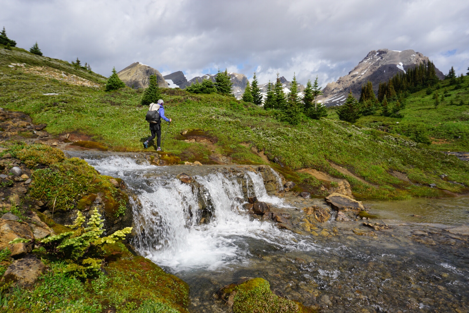
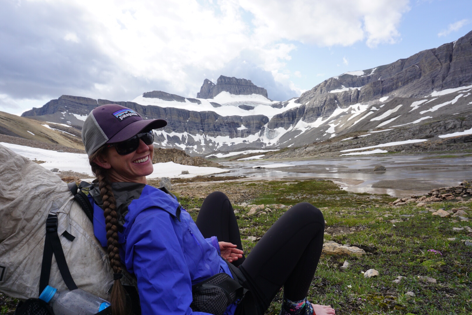
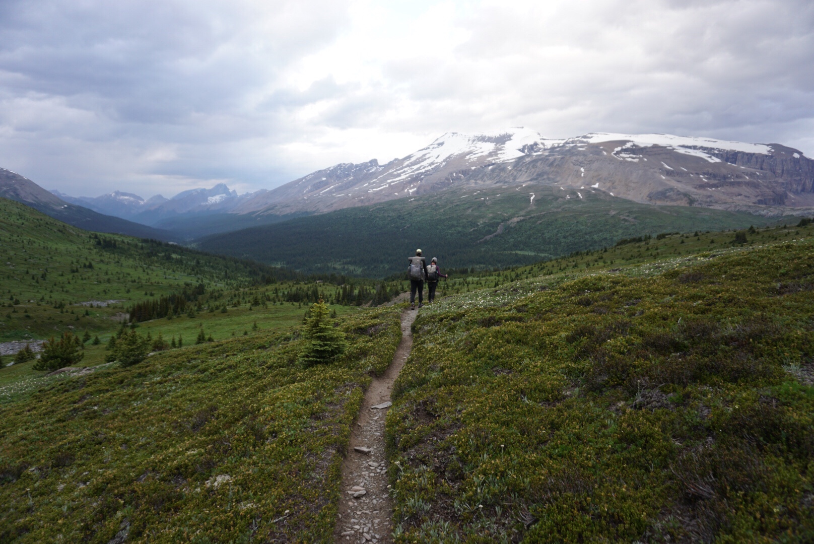
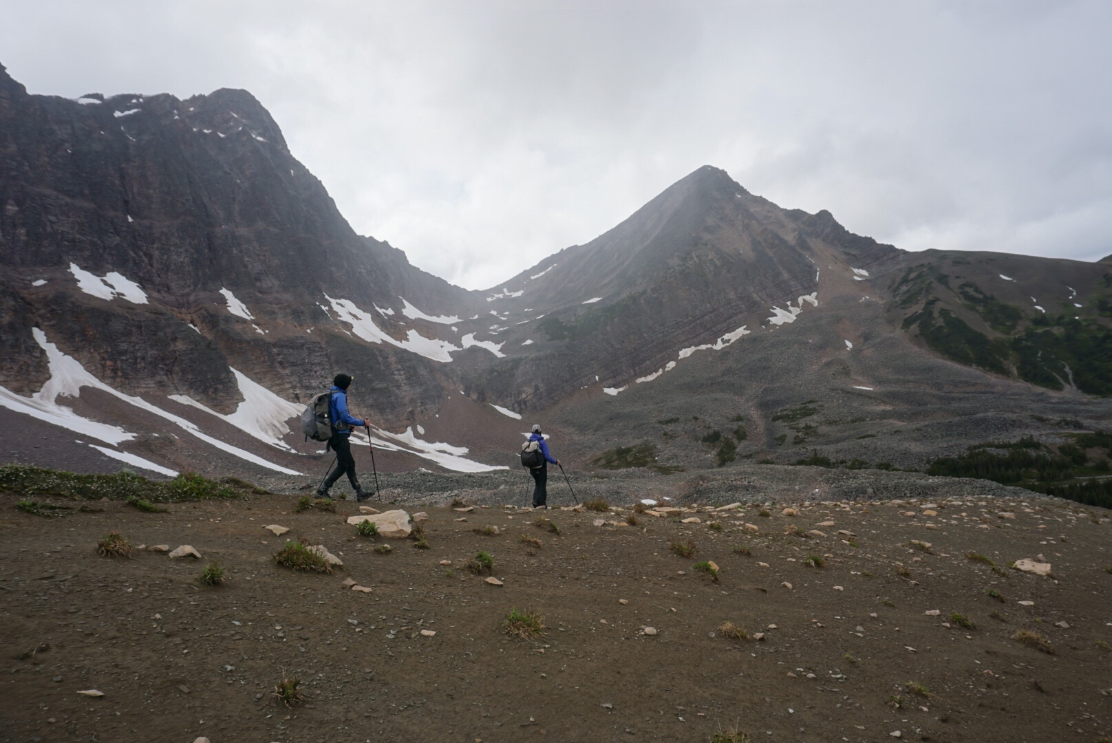
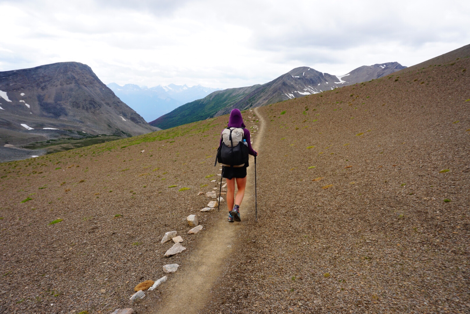
It’s a crisp morning when we wake up at our little perch just below timberline. Yesterday’s climb up Owen Creek was taxing, but it allowed us to get a large portion of the work for the first pass of today’s jaunt behind us.
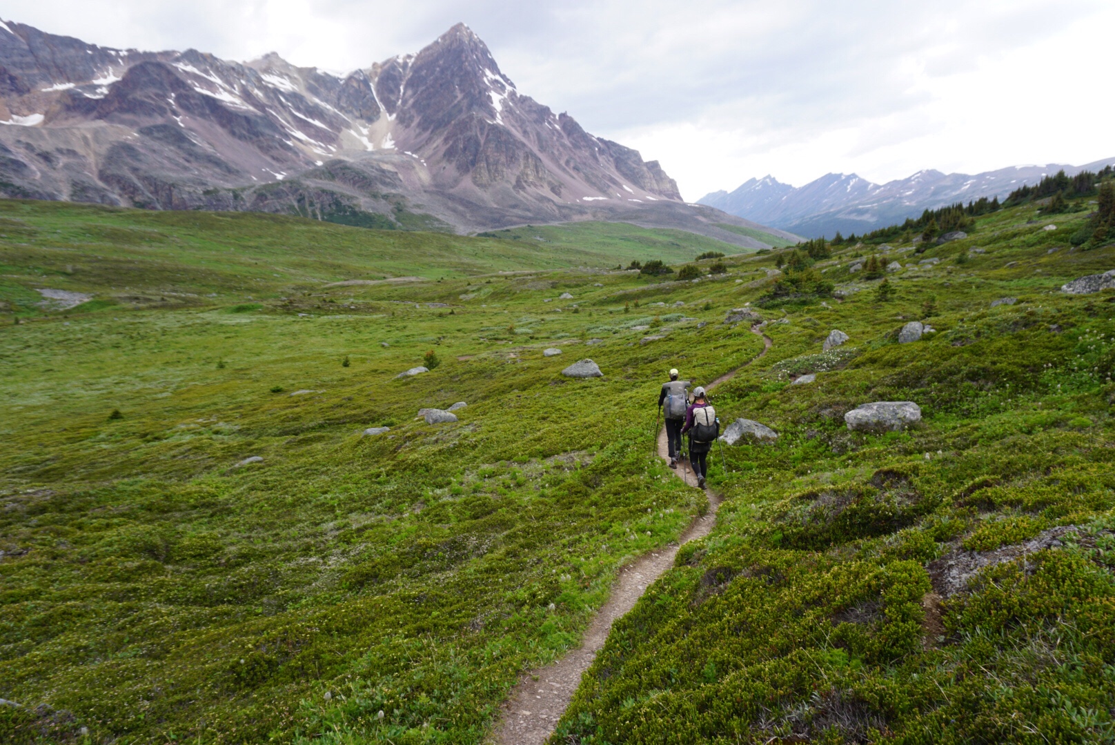
The trail meandered above treeline on a series of grassy steppes, making for easy travel. In the north country the shadows are long and the sun low. Since the start of this trip, we’ve lost more than an hour of daylight, and we begin to notice it. It seems like the mornings are a little colder than they were just a few weeks earlier, and a close examination of the ground cover shows that things are beginning to change from deep green to yellow and orange. Summer isn’t over yet, but the end is coming quickly.
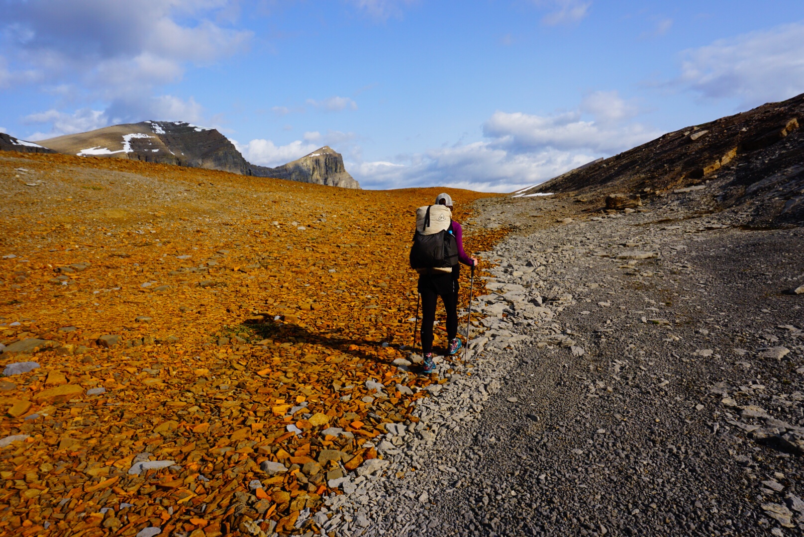
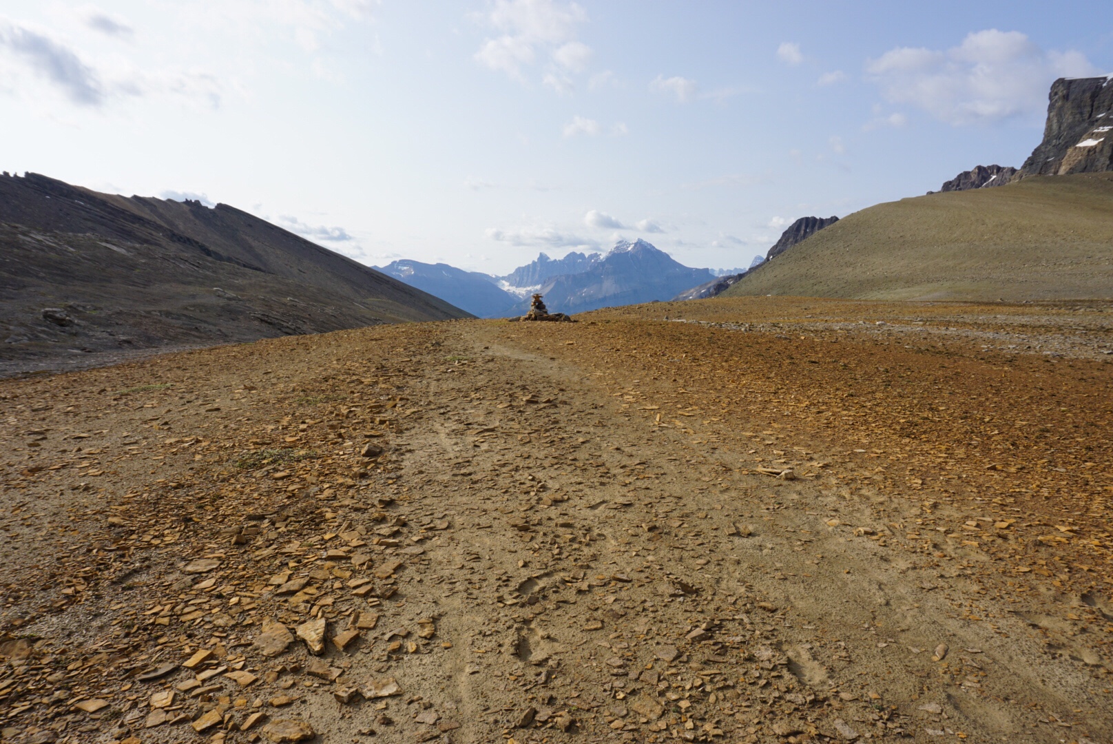
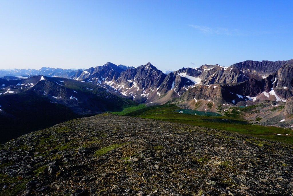
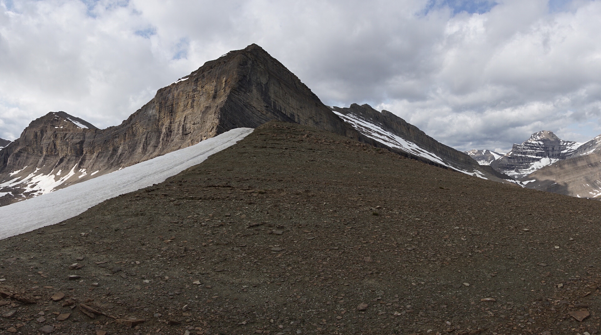
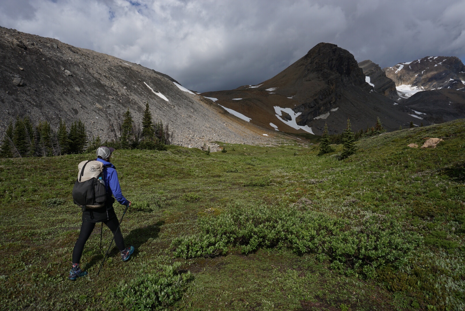
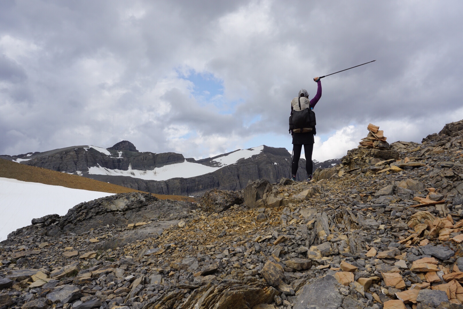
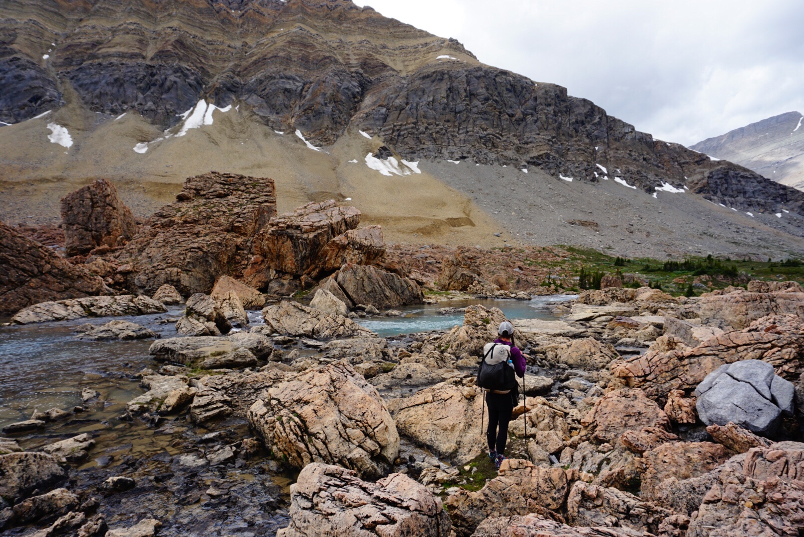
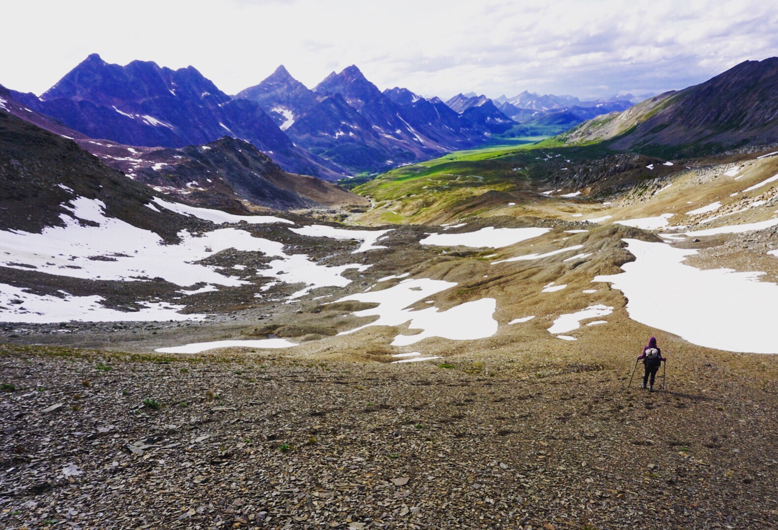
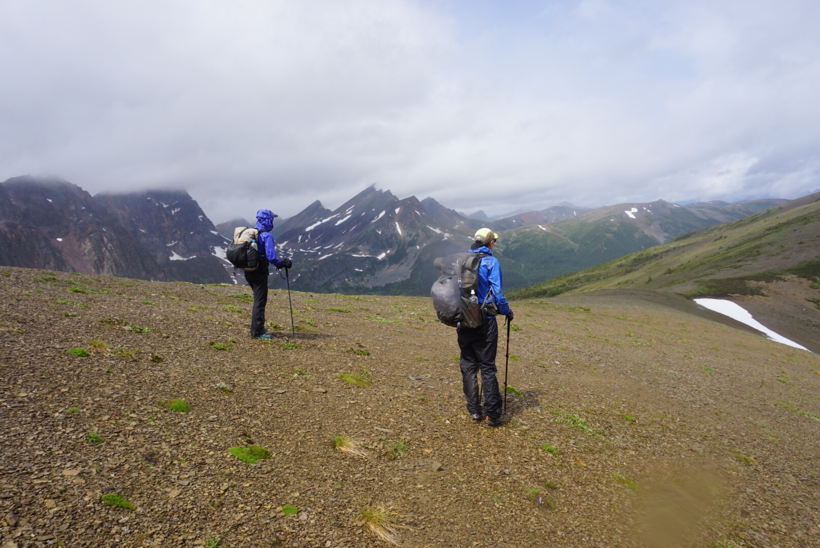
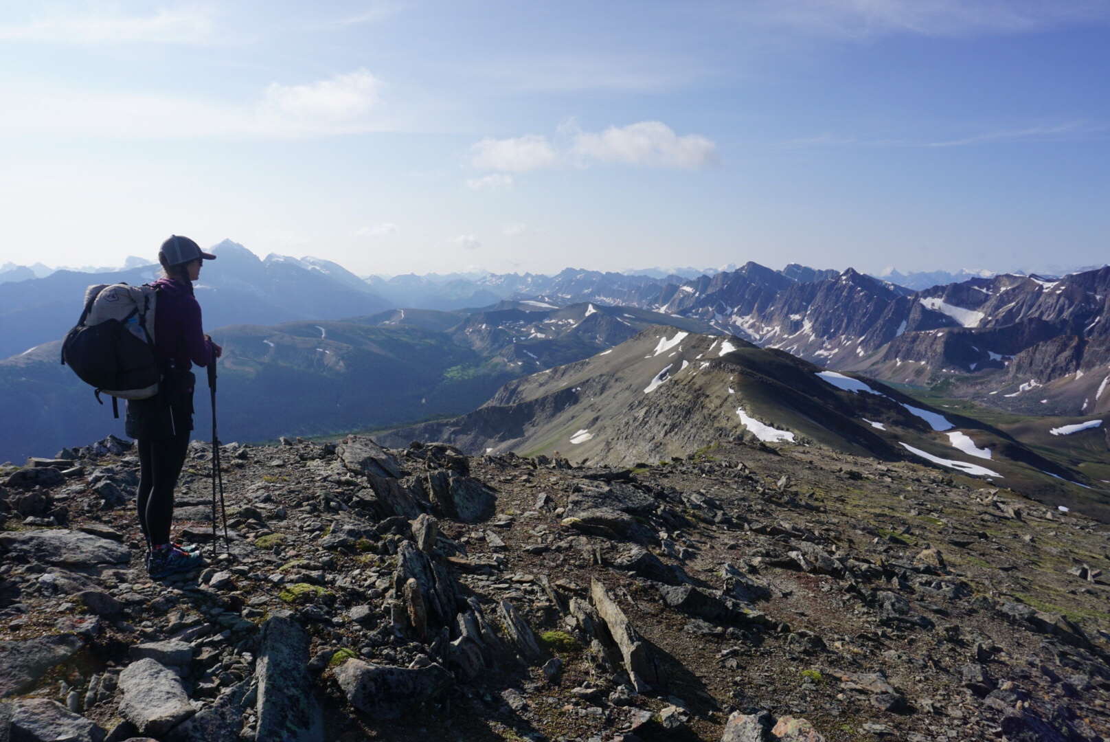
We make our way up the first pass, picking easy lines that are most efficient. Soon we’re at the top of the first pass. There is a unique dividing line running parallel to our crossing. One half of the pass is a gray color, the other an orangish red that remind me of the Elk Mountains back home. It’s a flat top, almost flat enough to land an airplane on for a skilled pilot, and we enjoy the easy walking despite no trail.
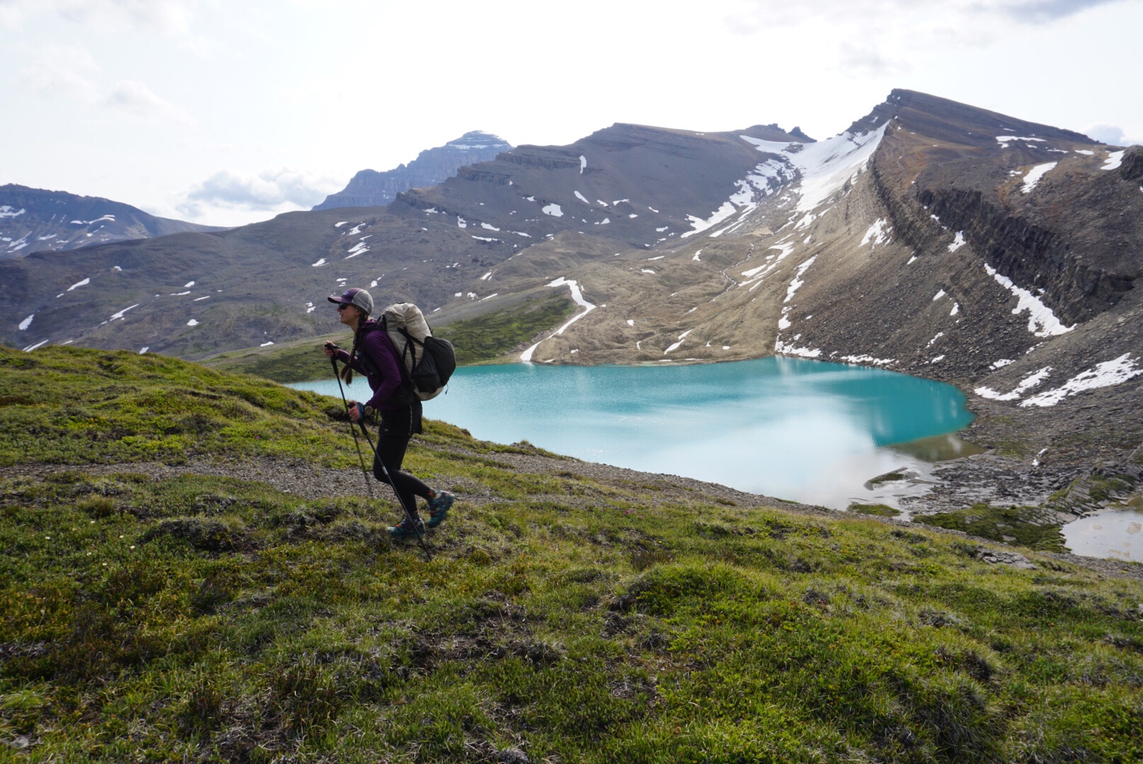
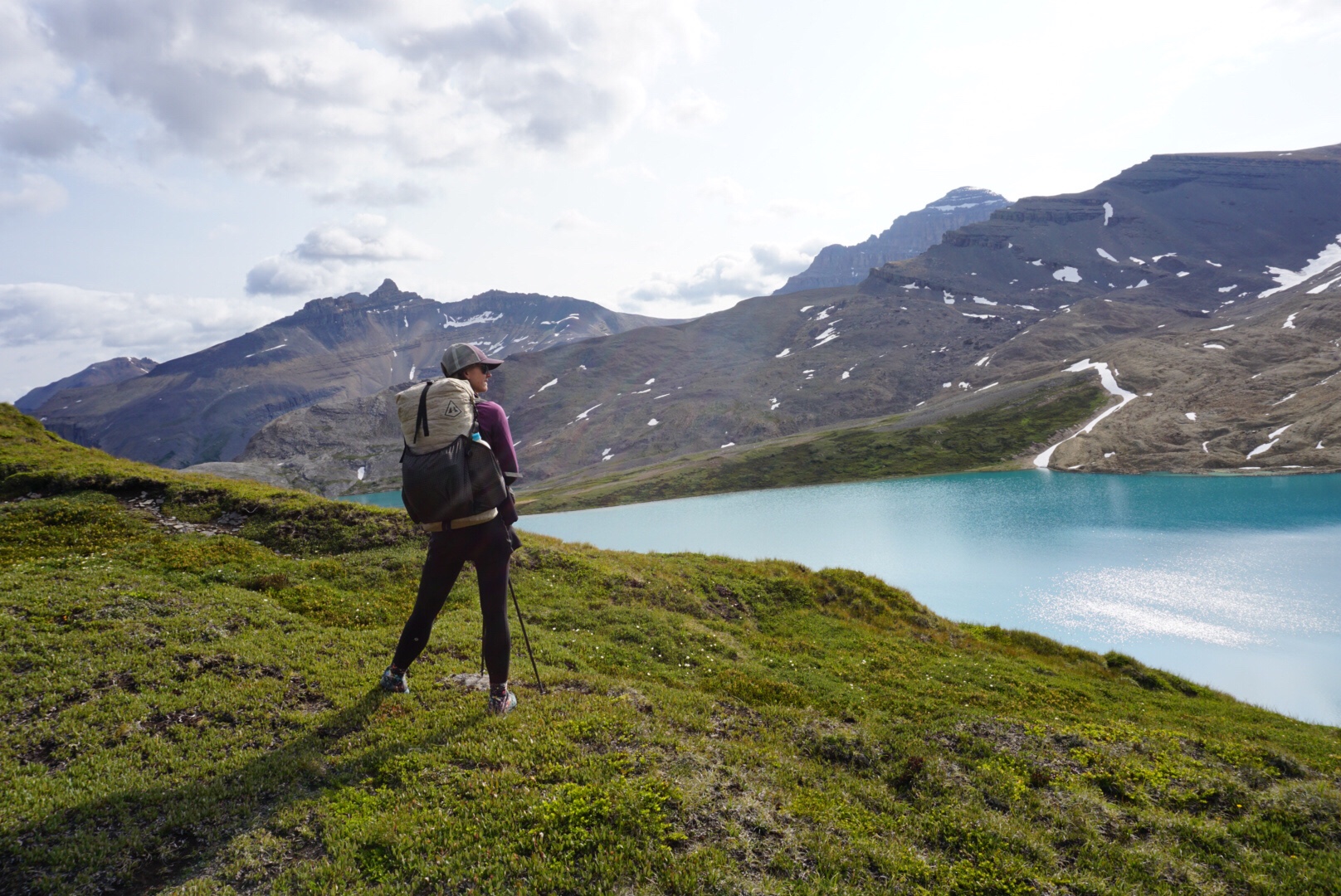
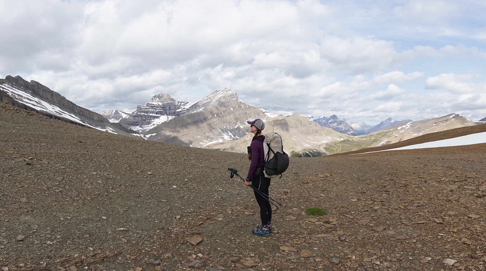
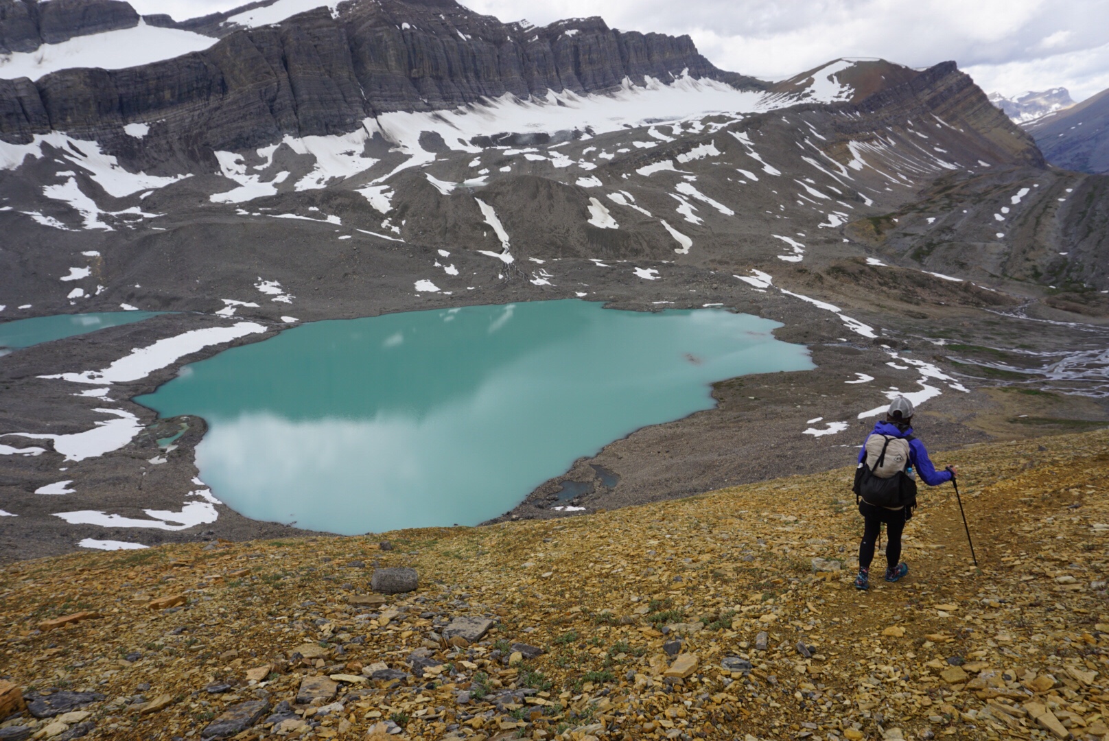
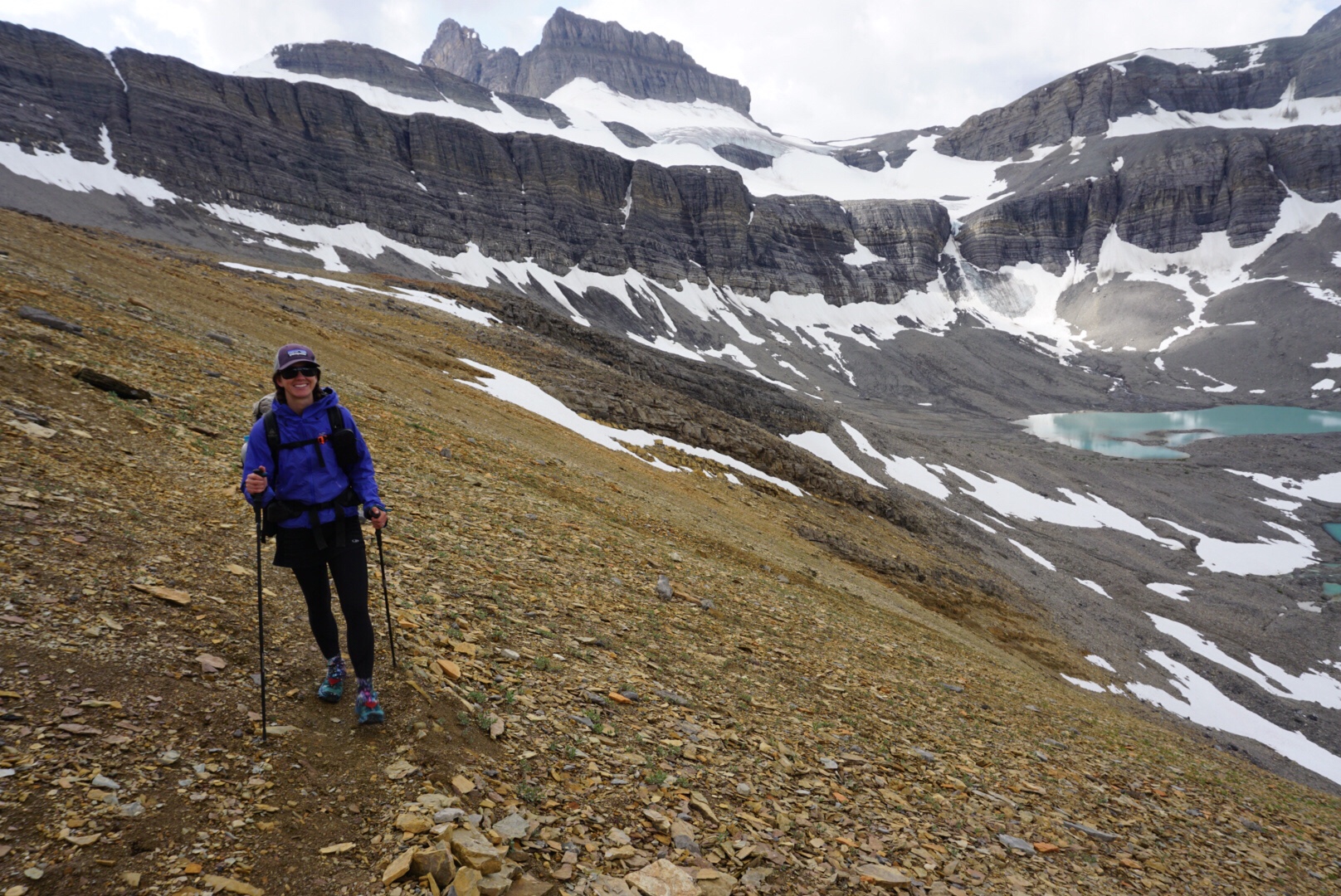
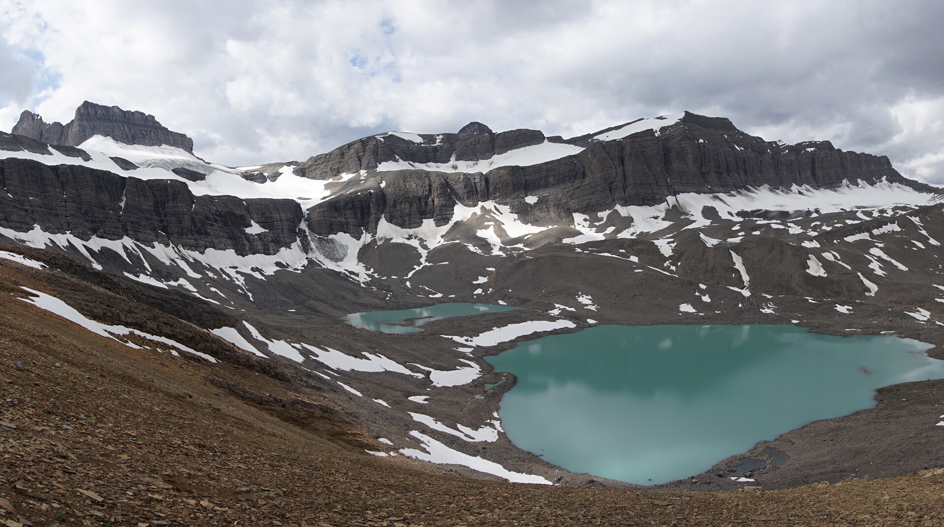
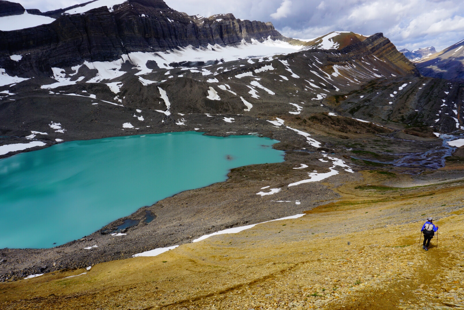
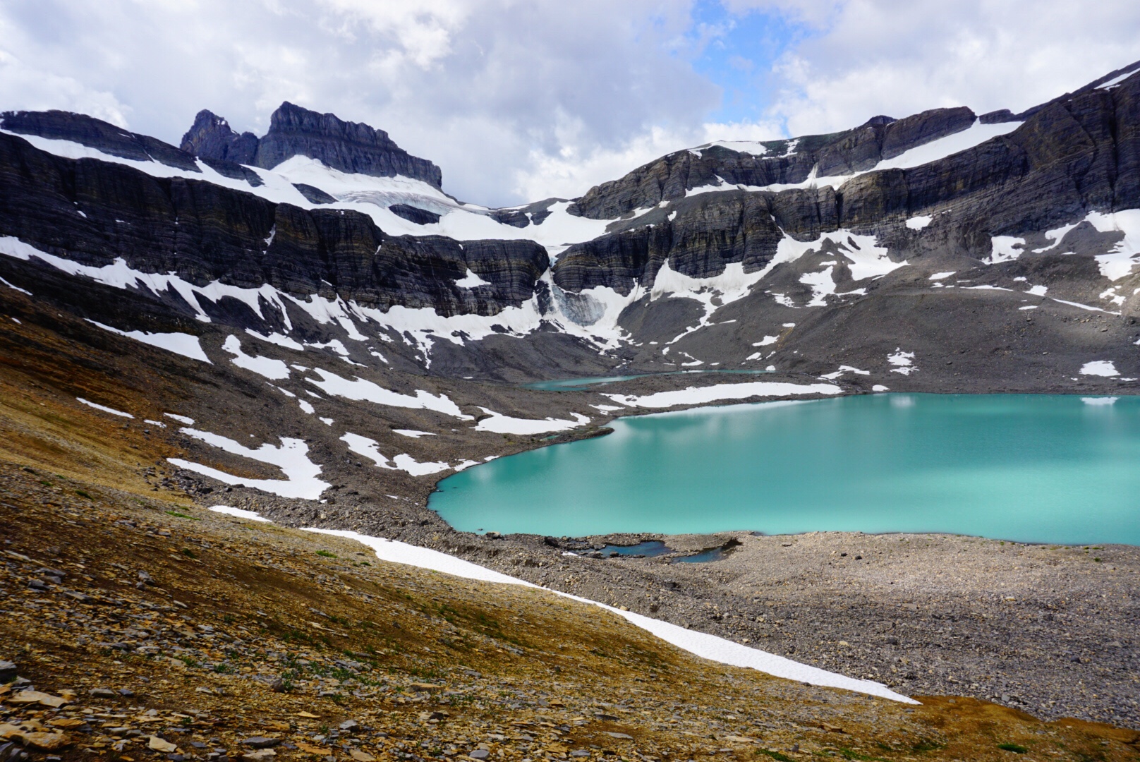
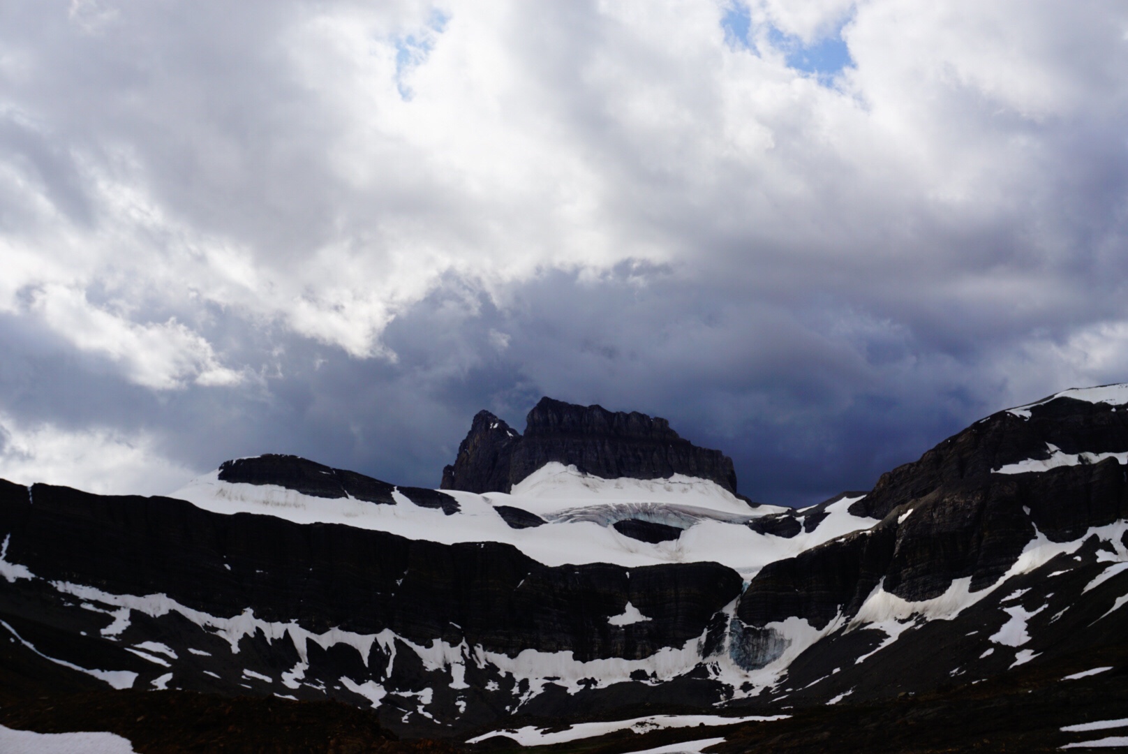
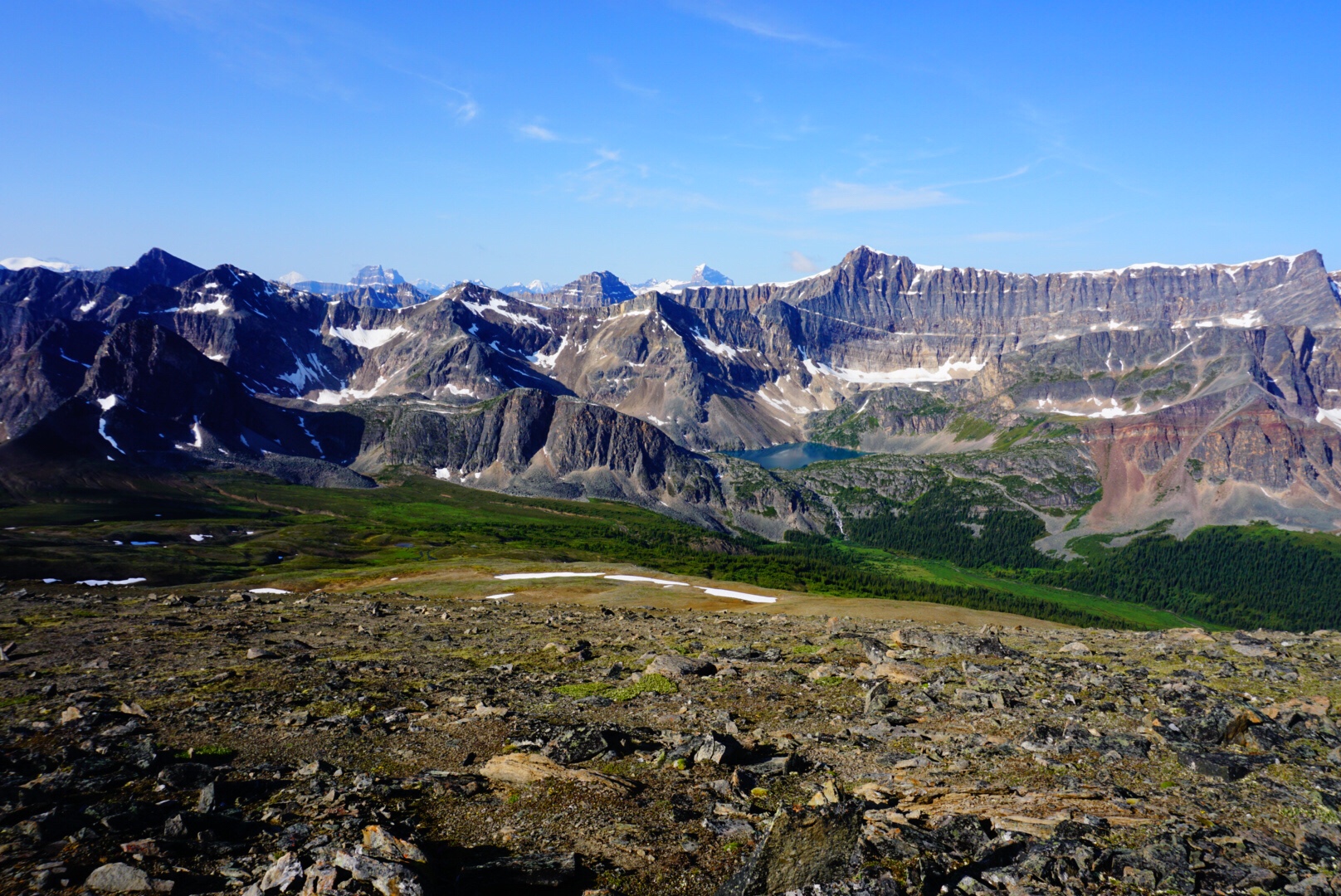
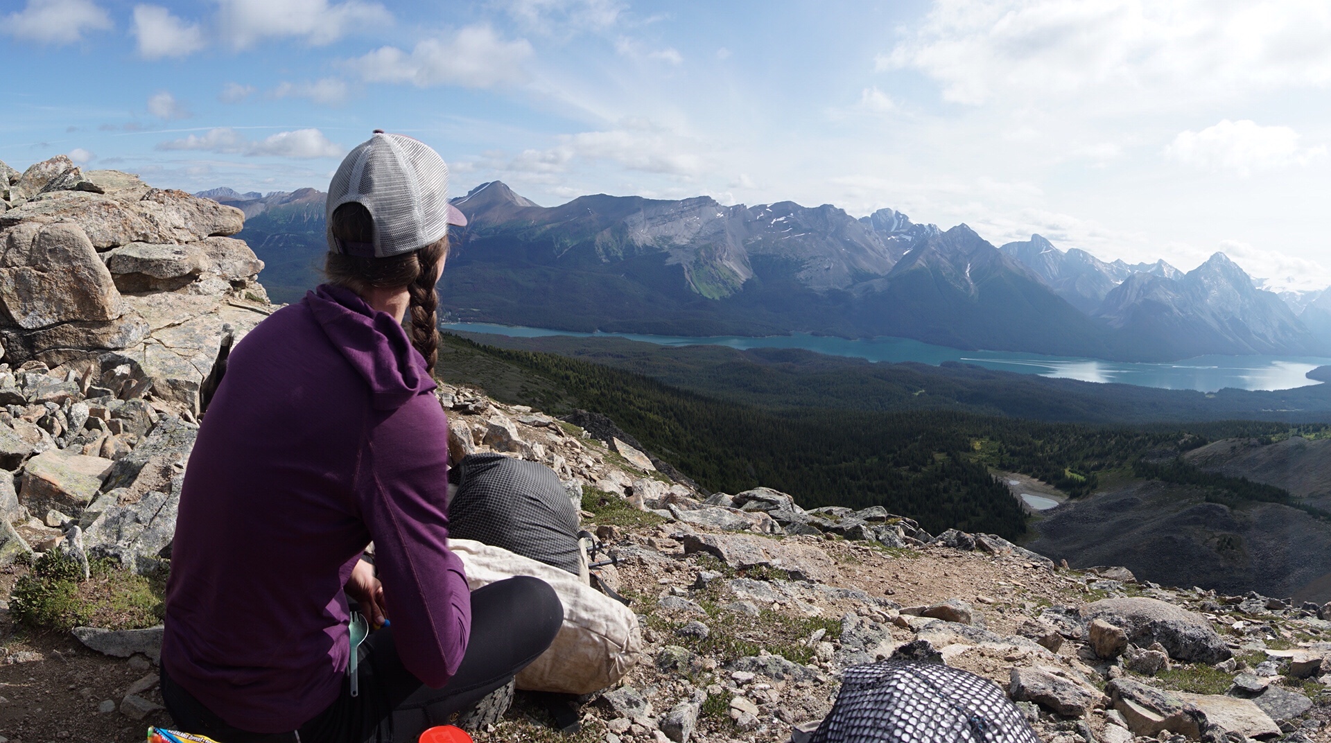
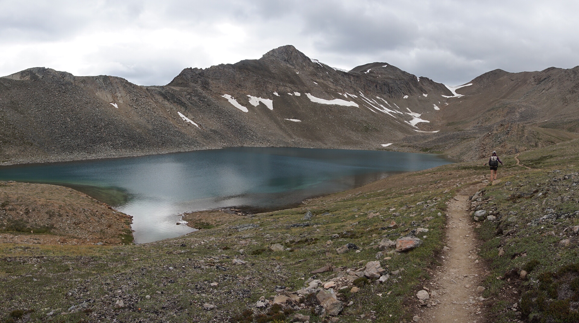
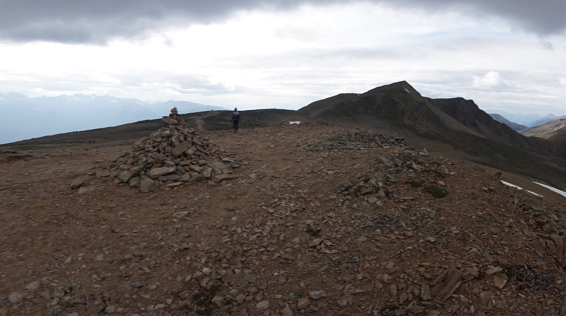
We descend into the Michele Lakes Basin, before climbing a no-name pass that is the highest point on the entire Great Divide Trail. The guidebook informs us that this is a popular area for helicopter hikers, where people pay thousands of dollars to fly in to high alpine areas to hike. There are no helicopter hikers on this day though. Michele Lake’s glacial blue hew glimmers in the morning sun, a stark contrast to the lunar looking rock surrounding the basin.
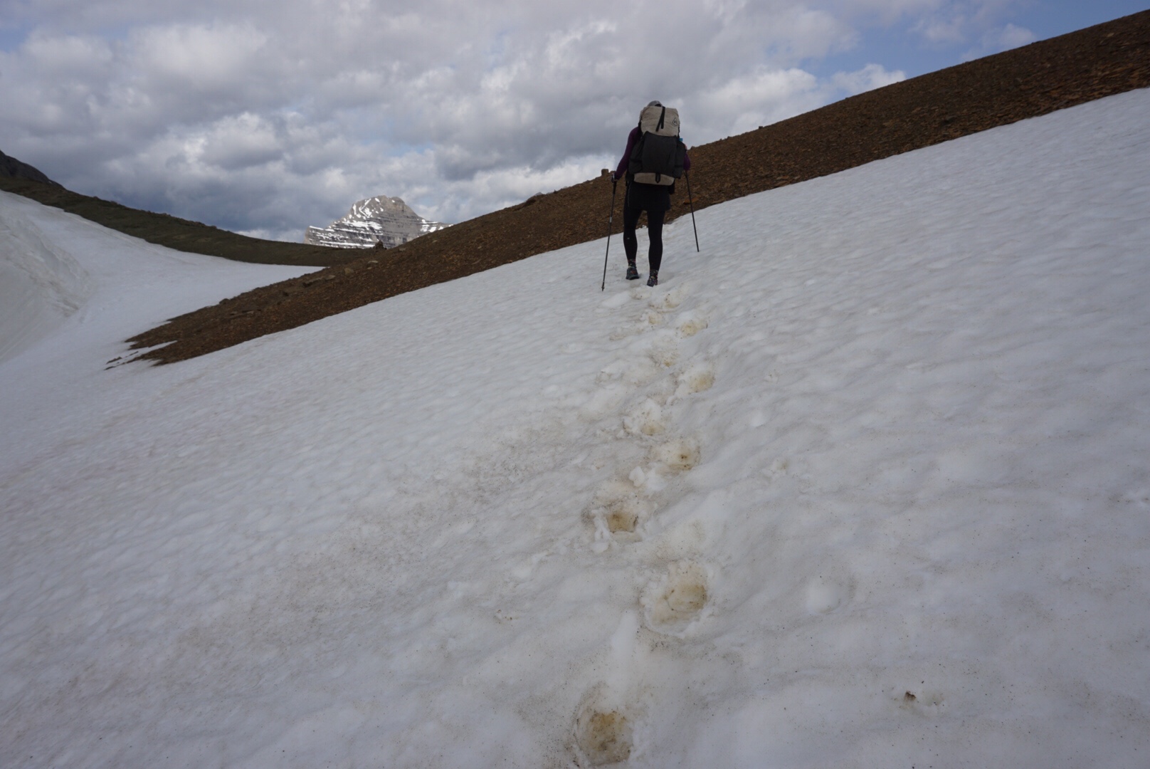
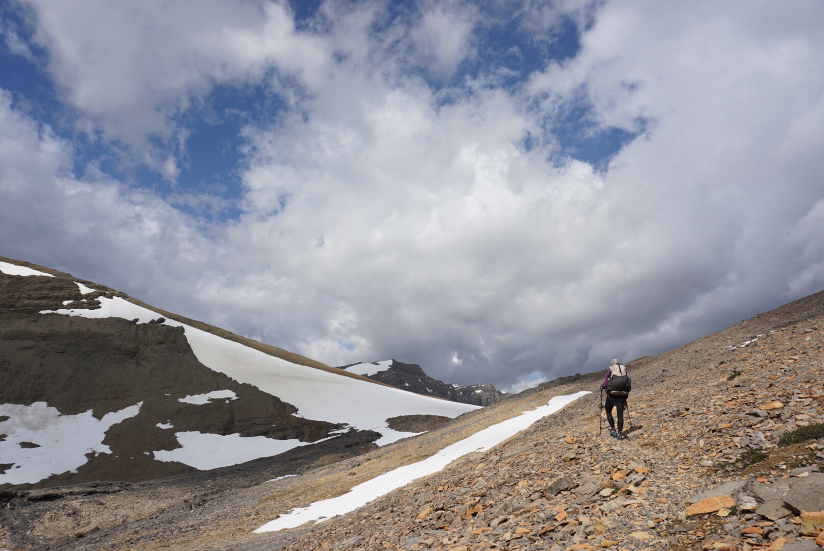
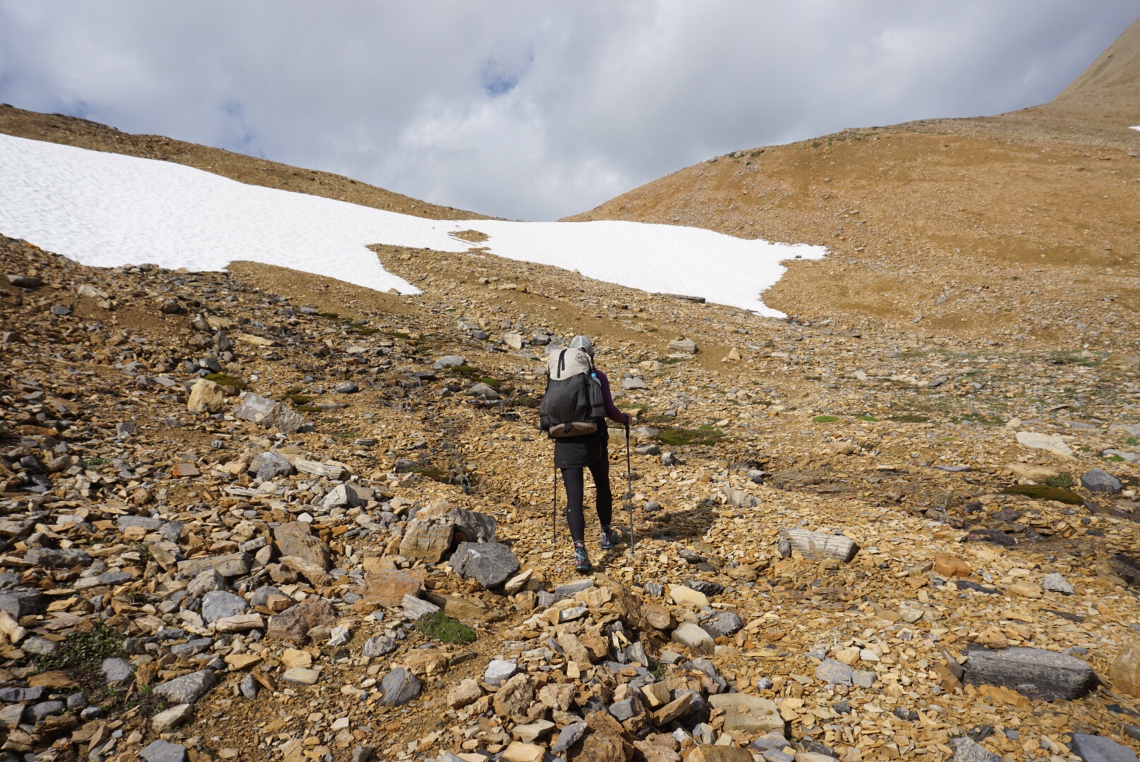
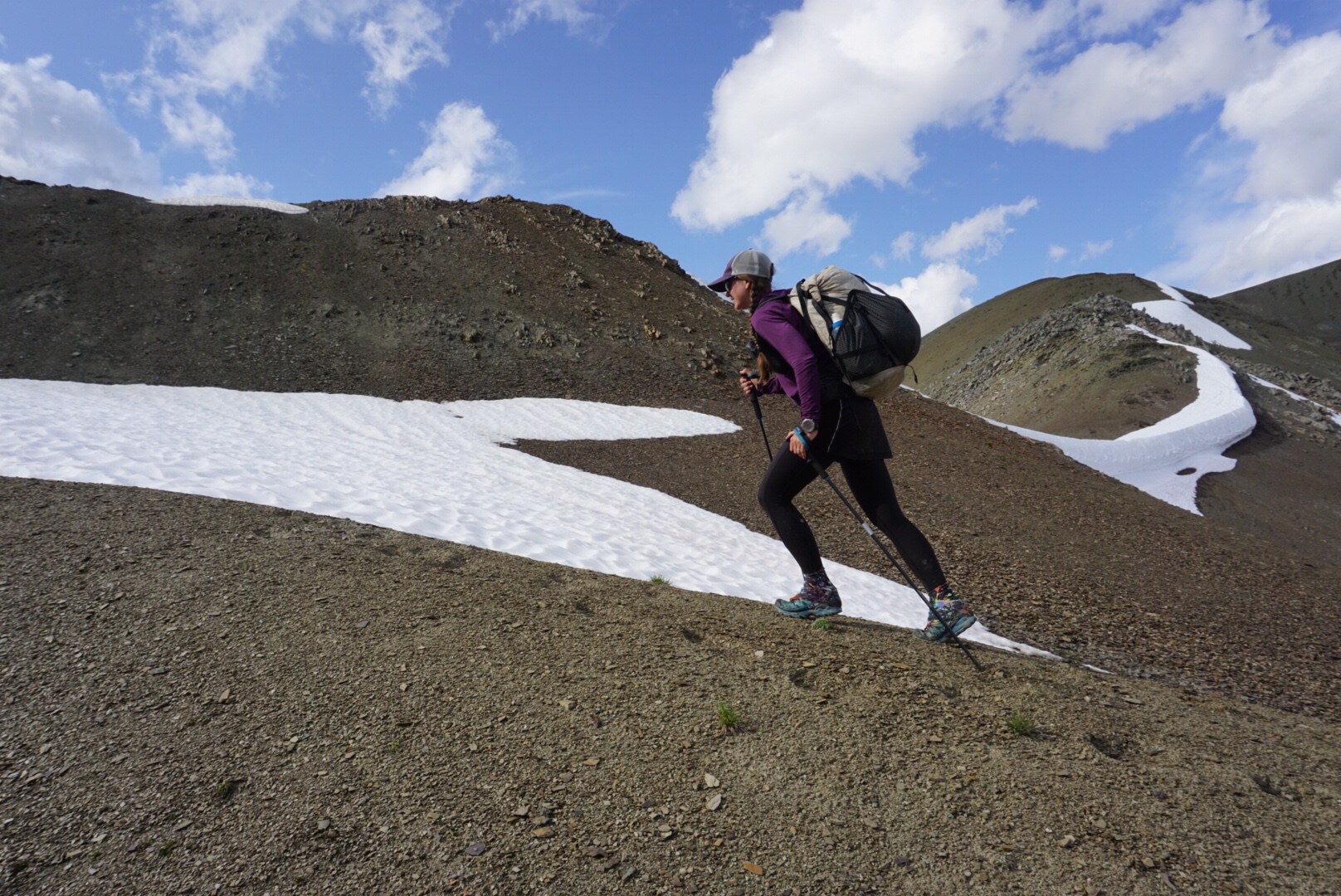
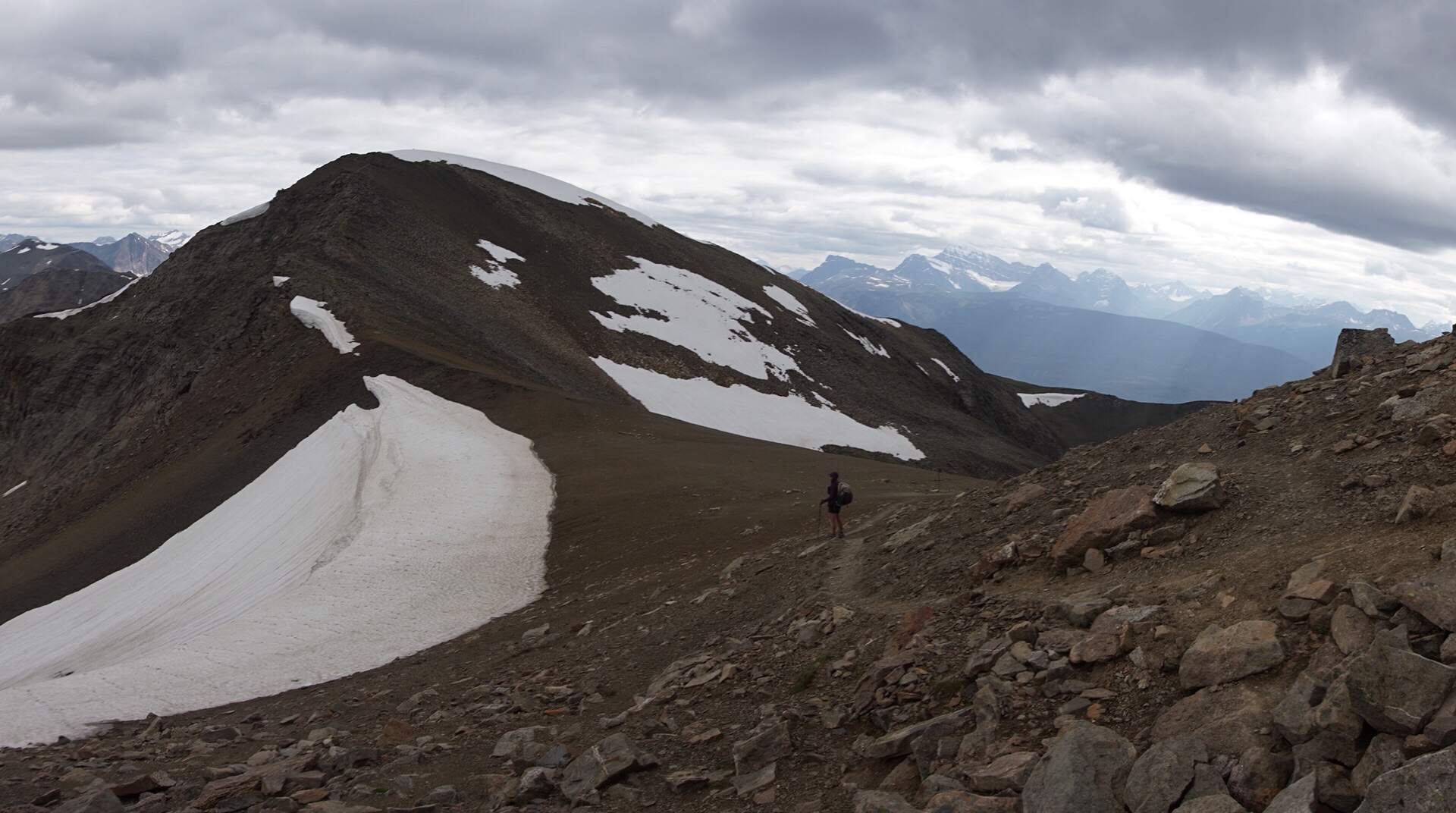
The climb to the highest point is steeper than the first pass, especially the last 200 meters, but soon we gain the top. At 8,466 feet above sea level, this point is actually lower than our home in Colorado, but the effects of latitude are clear. At this altitude in Colorado, pine trees grow, hummingbirds buzz and the living is relatively easy. At this altitude at 52° N, it’s a barren, rock strewn alpine environment with permanent snowfields and glaciers lying a few hundred feet above.
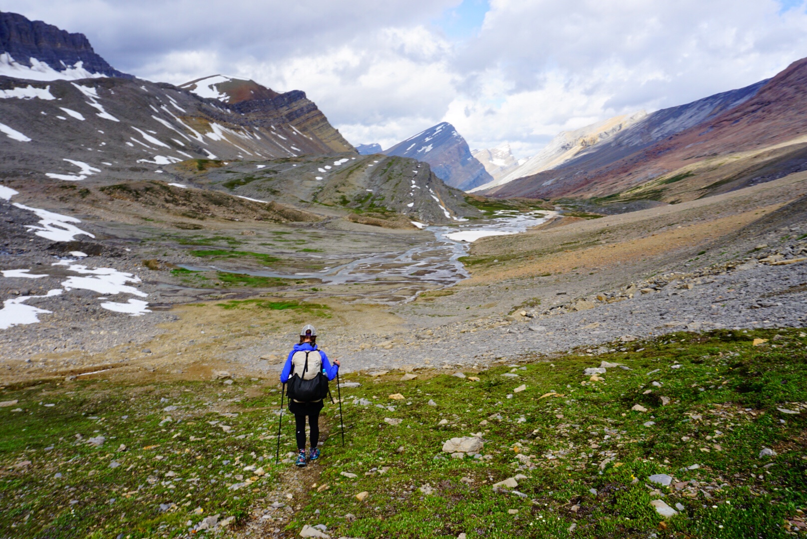
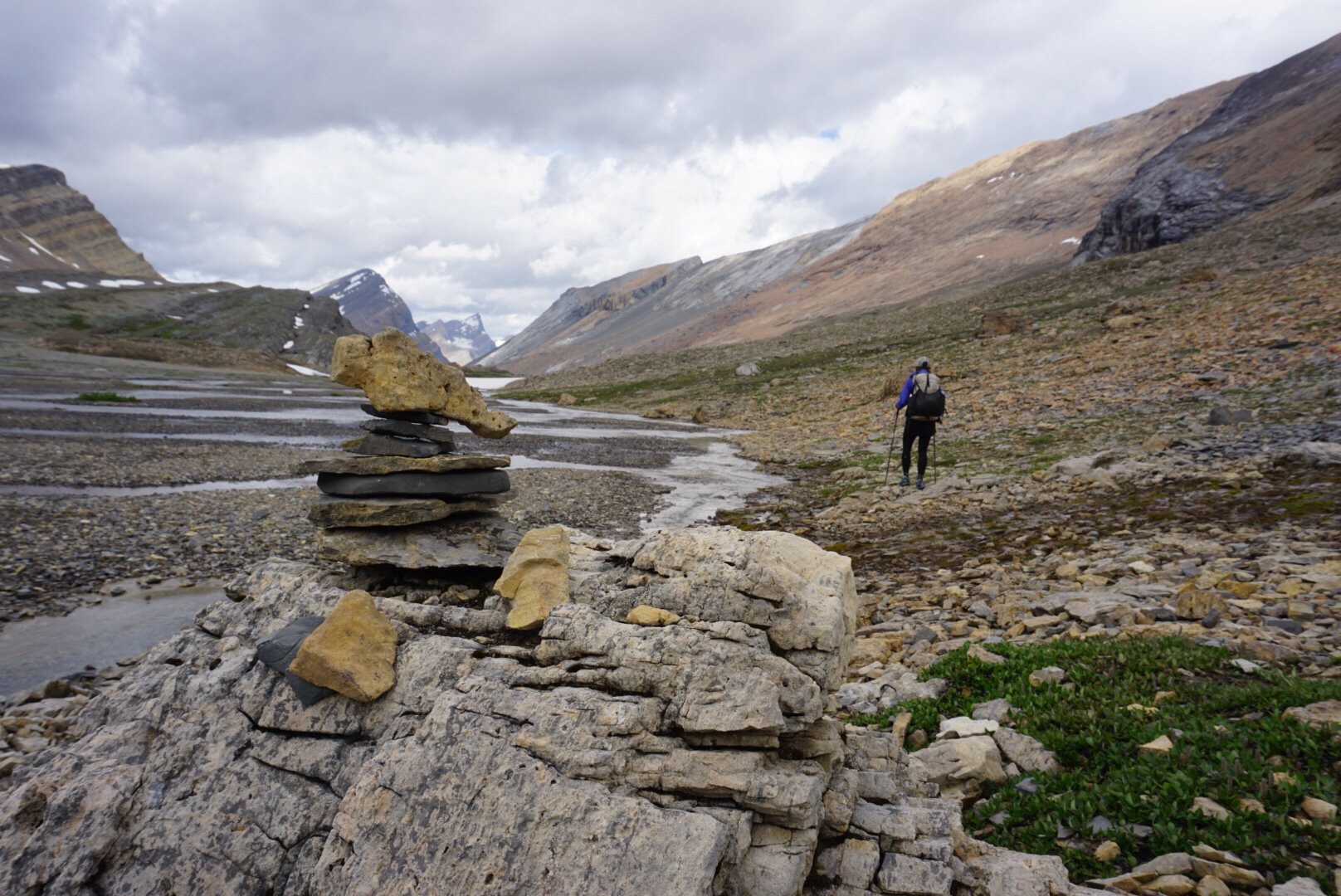
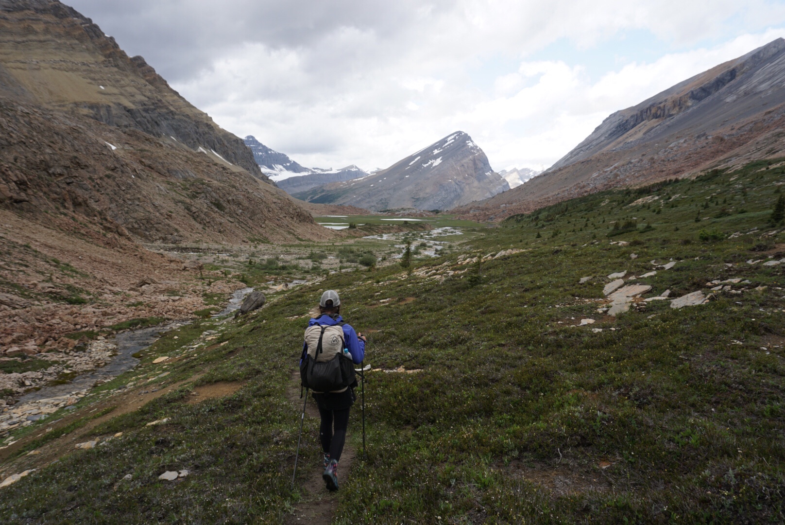
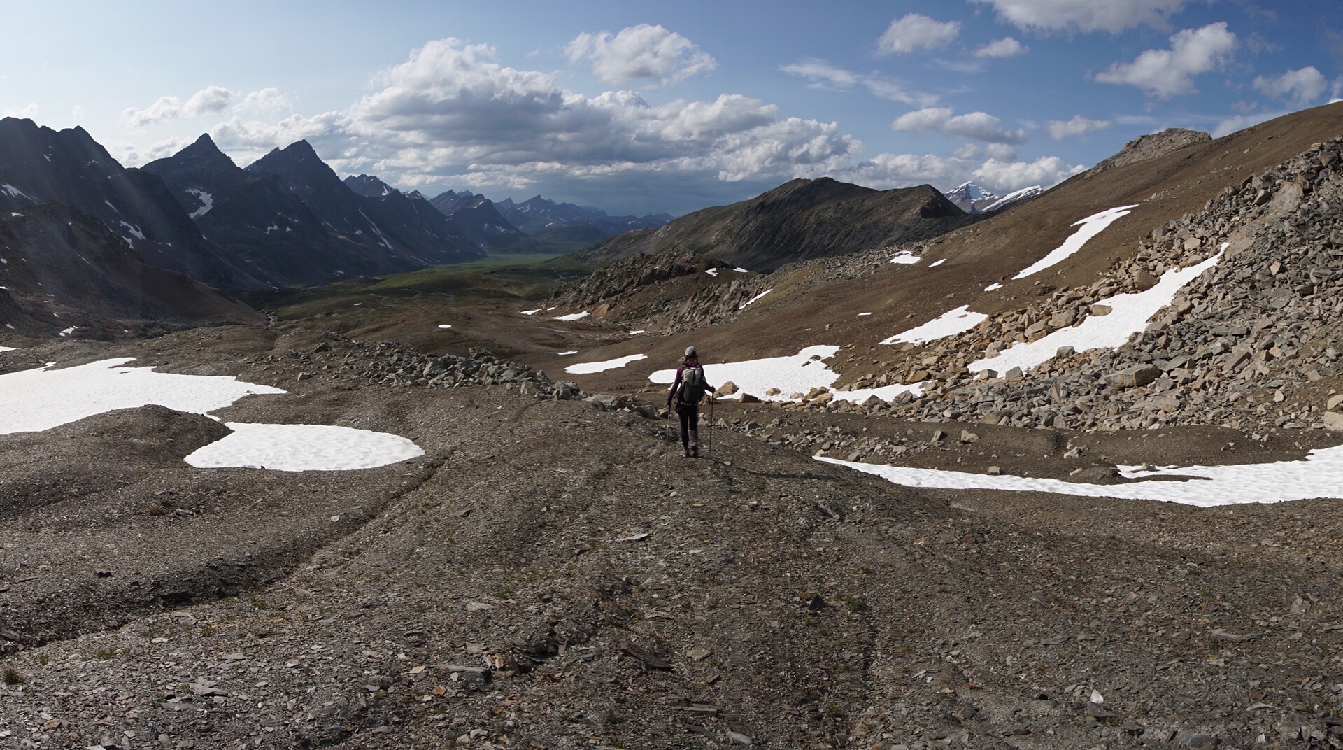
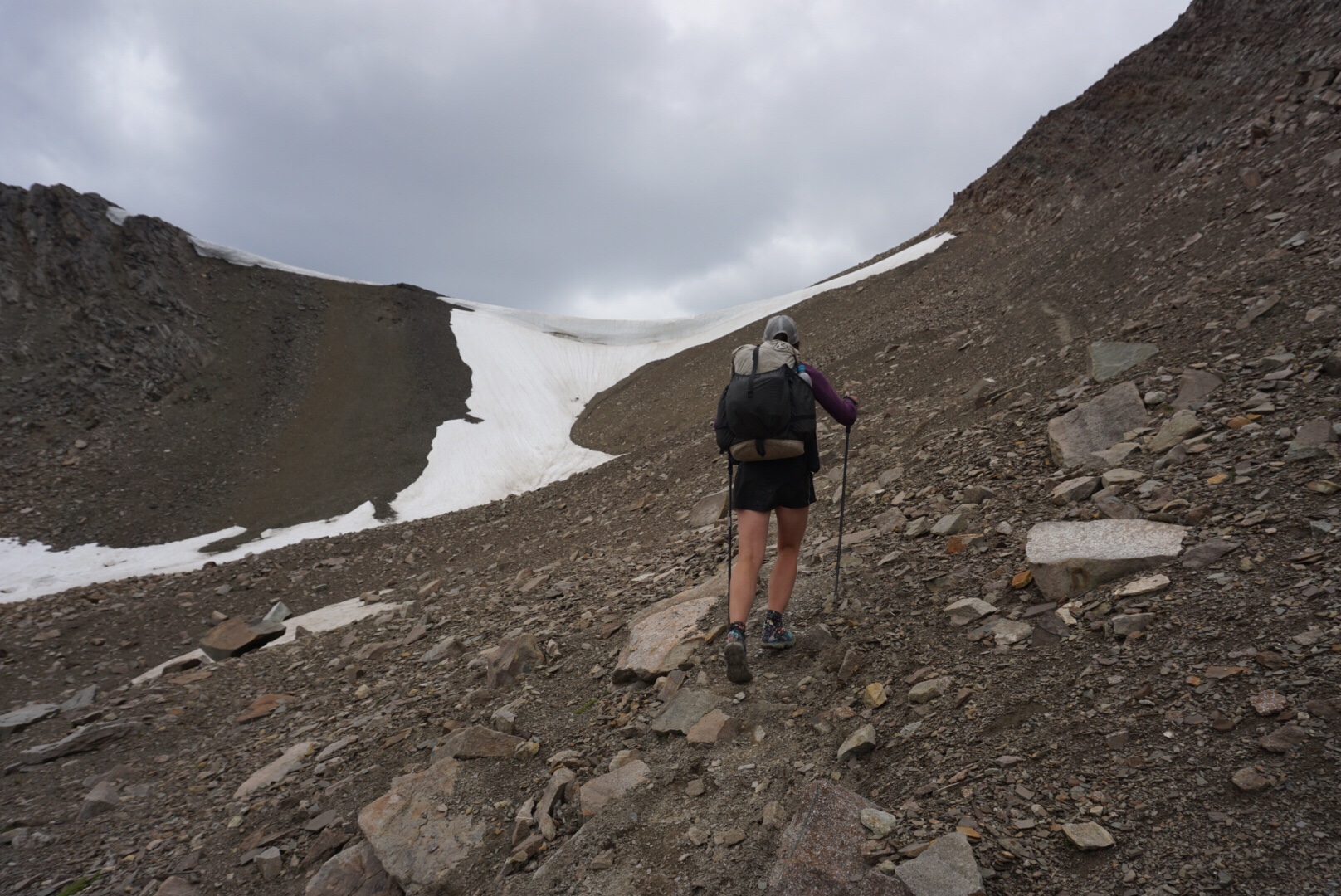
We notice the silhouette of two hikers coming down the ridge line but decide to head down the other side before they arrive. At this point, we are enjoying the solitude. We descend down the other side, try to cross a steep snowfield, and slip and fall. No harm at all, but a bit clumsy, with nothing hurt but pride. After a quick lunch we begin the third major climb of the day, up Pinto Pass. For the first time in awhile, I feel like I find my legs here, and it feels good to go uphill strongly. My body is becoming aligned with the travel out here. The legs are getting stronger, the arms are losing some unnecessary muscle mass, we are becoming one with the environment.
The descent down the other side of Pinto Pass is enormous. A few weeks ago this would have hurt my ankle badly, but today it is no problem. As is usually the case on trail, one ends up walking through most injuries and healing. Walking is the most natural thing humans can do…given enough time and exposure, most ailments heal themselves. We come to Pinto Lake, set up the bug net, and enjoy lunch on her edge. I would have no problem building a cabin in this place, canoeing on the lake, hiking in the mountains, and living out my days in this spot.
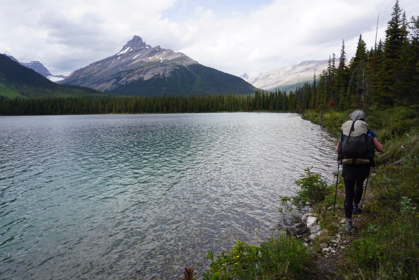
It’s getting late and we have miles to make. The trail meanders around the lake and then begins a long, swampy, buggy trudge along the Cline River. There isn’t so much of a trail here as there is really wet meadows. We all have terrain that isn’t our favorite, and for Elaine, this is it, Nevertheless, she gamefully puts her head down, bug net on, Deet covered, and forges on. The north is beautiful but it isn’t always (or even usually) easy travel up here. There is a reason Alaskans prefer travel in the snow covered winter to the bog covered summer.
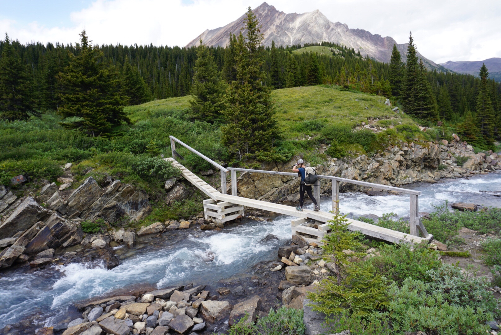
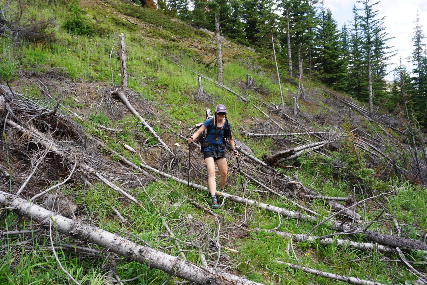
We leave the Cline River and turn north onto a trail adjacent to Cataract Creek. We’d been warned that this was a tricky crossing, but it proves to be no problem. The climb up Cataract is less boggy than the Cline, but it makes up for it with dead fall strewn all across the trail. At one point, just to pass the time, I counted steps before having to hop over a piece of dead fall. The longest I got over a half-hour period was 43 steps!
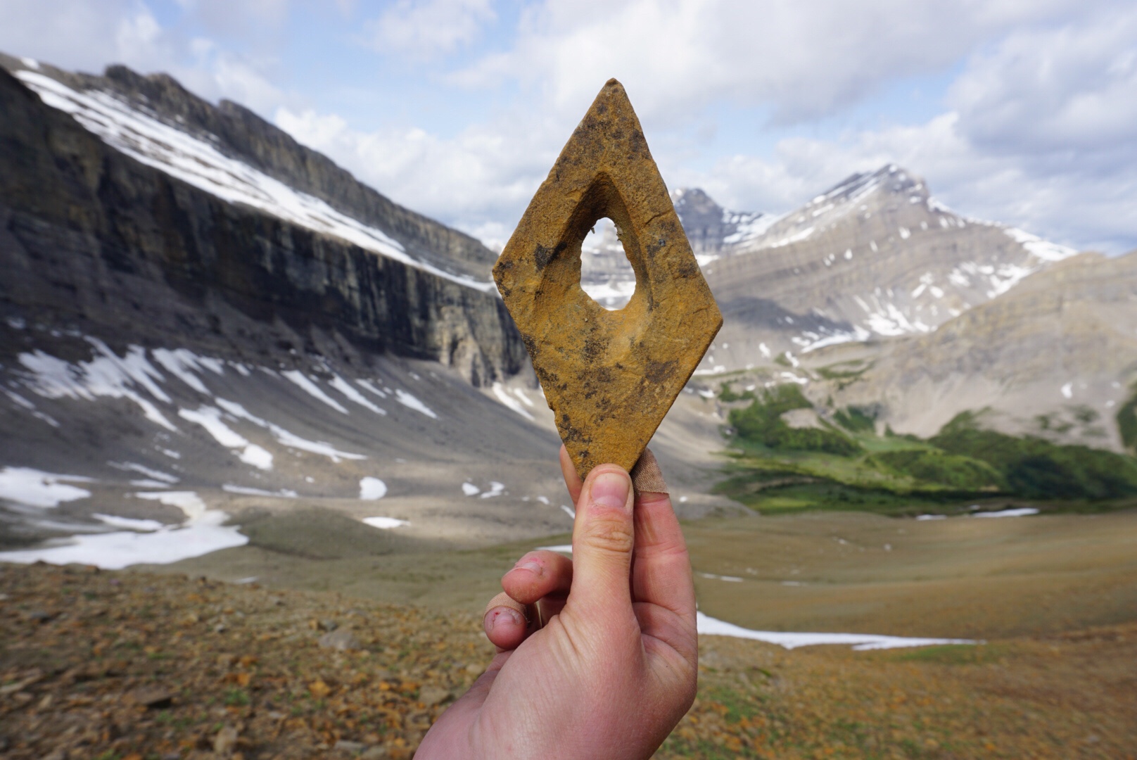
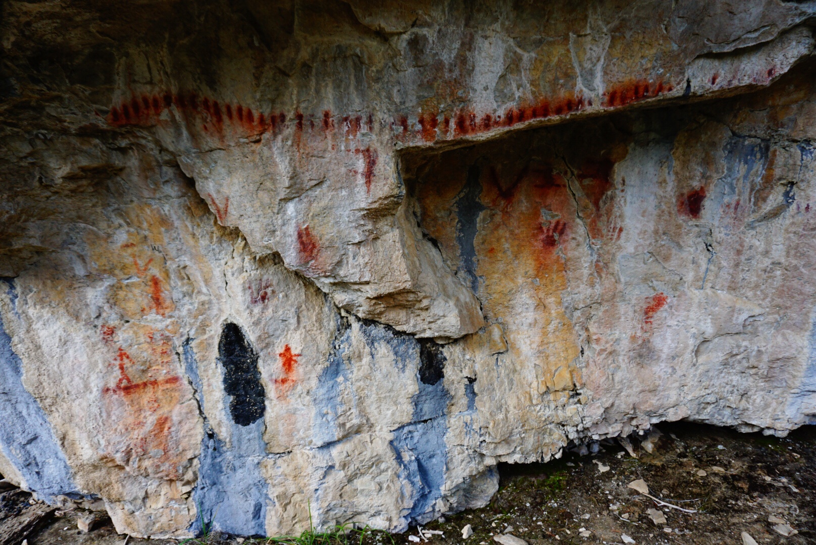
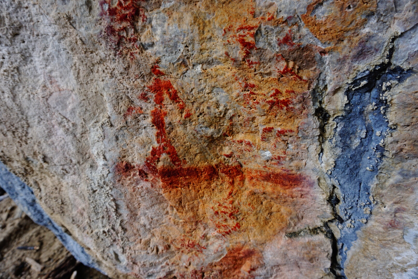
The forest is dense here, but every now and then it breaks out and large spire peaks rise on both sides of the valley. We come to a large rock we’d heard about. On the sides of this rock are reddish pictographs made by indigenous people a long time ago. There is a stick figure of a human, some sort of counting symbol, and what potentially looks like a large animal. We are not the first to pass thru this valley.
We continue and the trail gets more swampy. The mosquitoes are viscous, but worse are the biting flies that insist on circling our heads for hours straight. We decide to set up the bug net, eat an early dinner and hike on, as this is a challenging place to camp and bugs would make the evening ritual of dinner outside less than enjoyable. As we end supper, a light rain begins to fall.
Suddenly, to the left we here a rumble. The rumble turns into a roar, and soon an explosion. A glacier on the mountain across the valley was calving at that very moment, sending tons of ice, snow and rock down a cliff wall hundreds of meters below. These are the most unstable mountains either of us has ever been in, and they are literally falling apart as we walk thru.
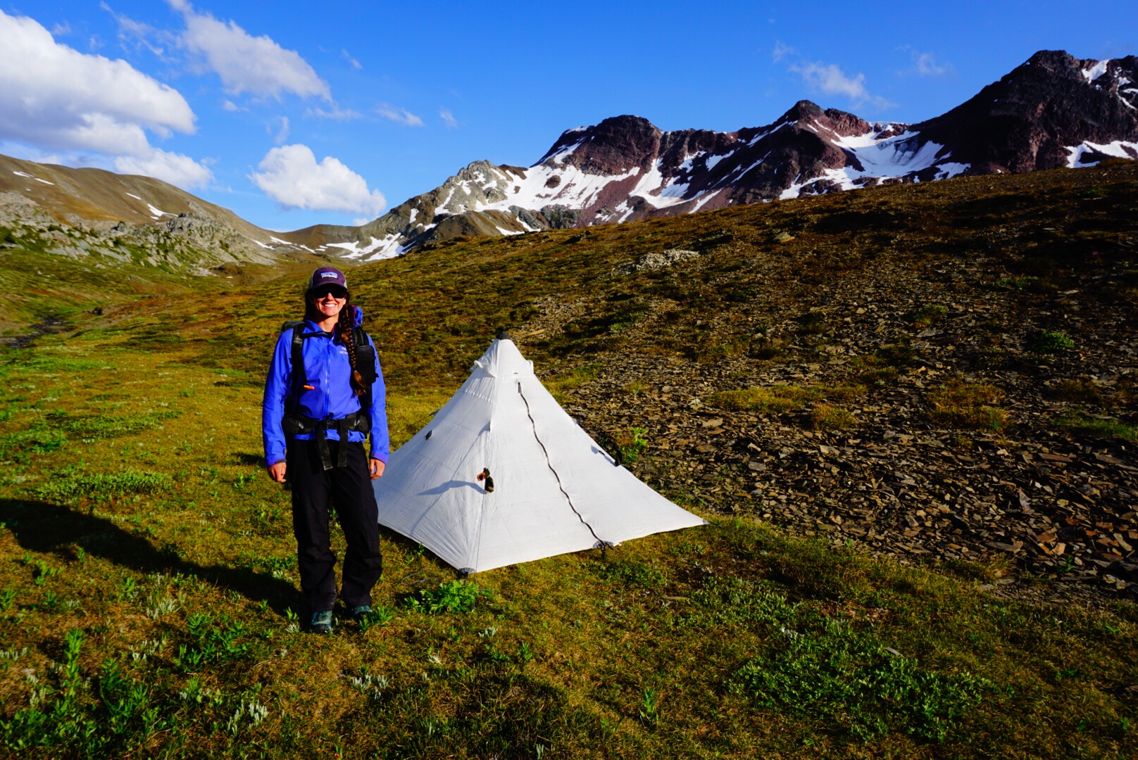
Adrenaline from the explosion settling, we continue on. It’s getting dark and the rain is falling harder. The map note tells of a “meadow” ahead that offers better views. We decide to aim for the meadow as a place to sleep for the night. Upon arrival, we discover the meadow is a swamp, soaked by a spring. It is indeed beautiful, but finding a dry spot here proves challenging, Finally we find a piece of tussock a foot elevated from the swamp, and set our shelter there. Soon we’re asleep, dreaming of swamps, glacial explosions and better travel ahead.
August 1 – 22 miles, 4,600 feet climbing
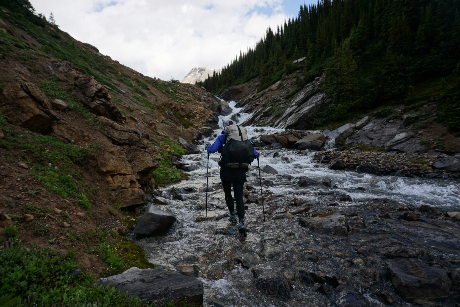
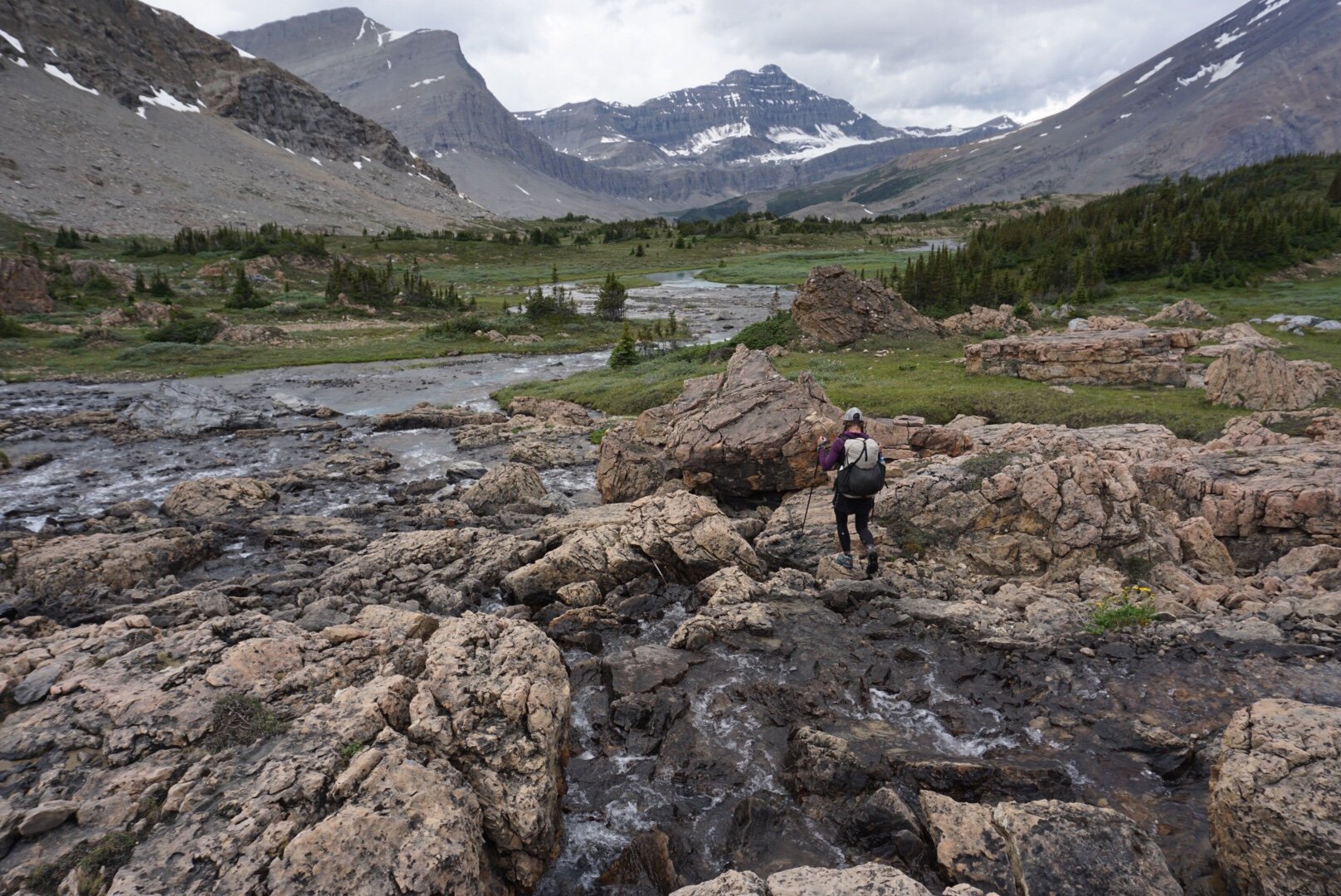
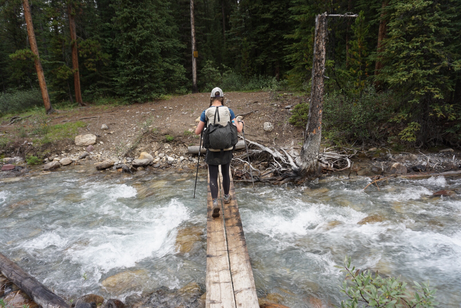
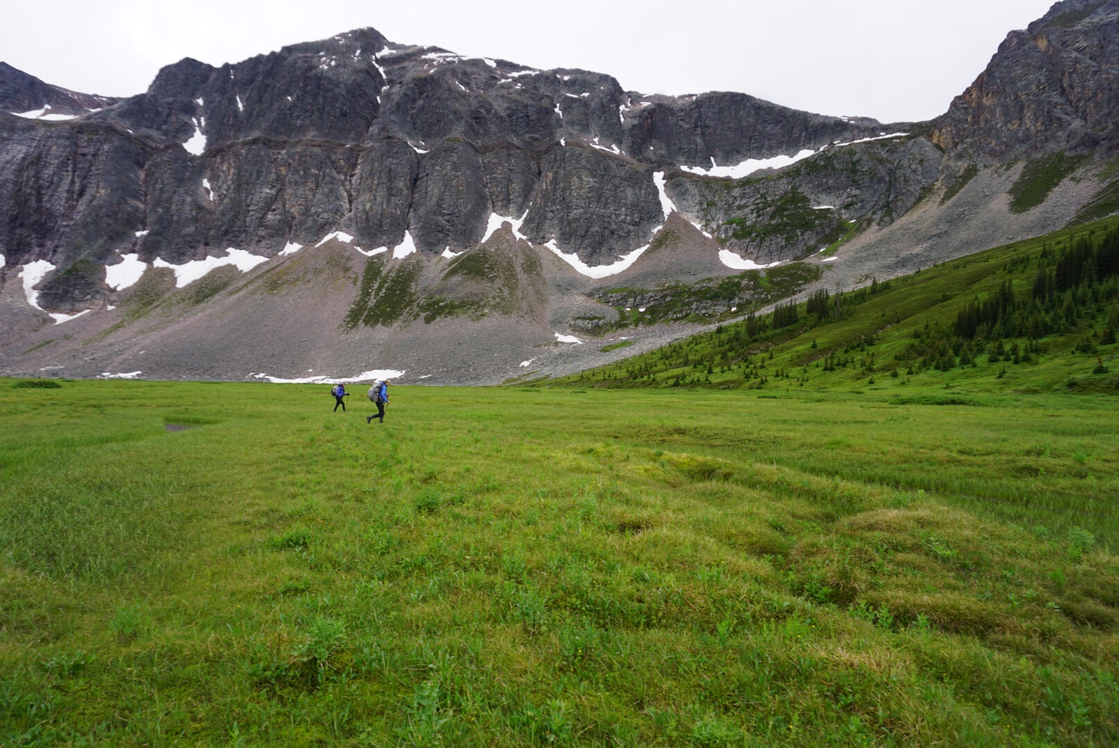
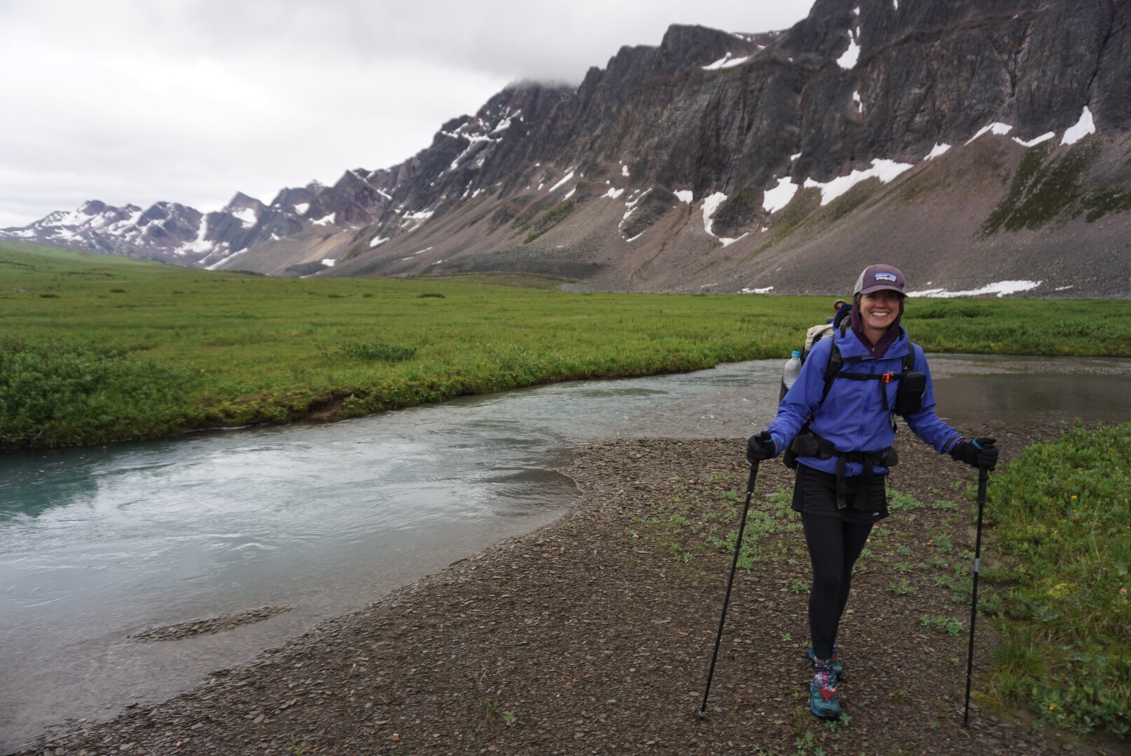
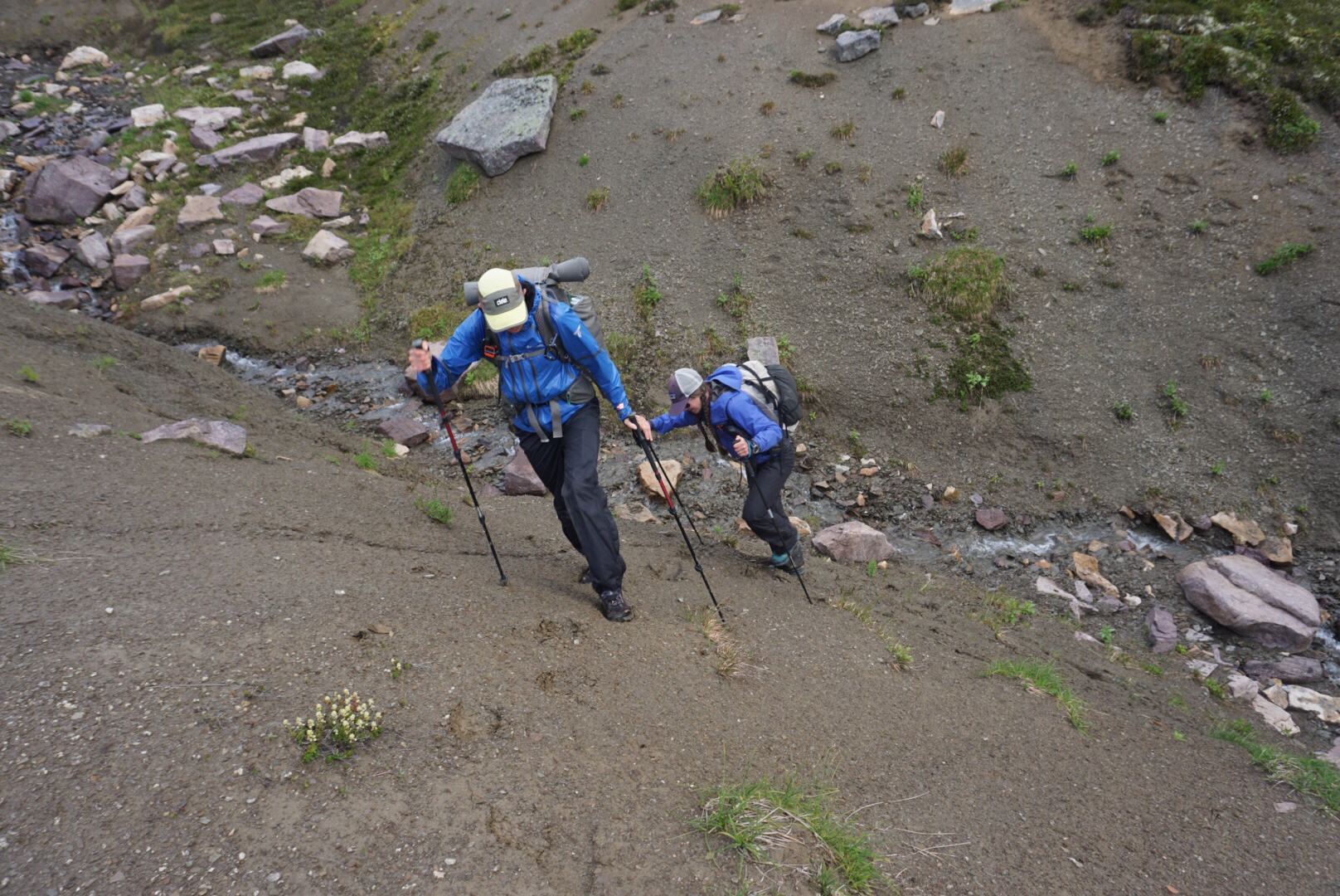
Last night’s rain left everything soaked, and we started the morning with the always-enjoyable “car wash” effect from tight, wet brush. We spent the first hour of the day cold, soaked and searching for mental strength to continue moving forward. The route crossed Cataract Creek multiple times, the waters numbing our feet and making hiking more challenging.
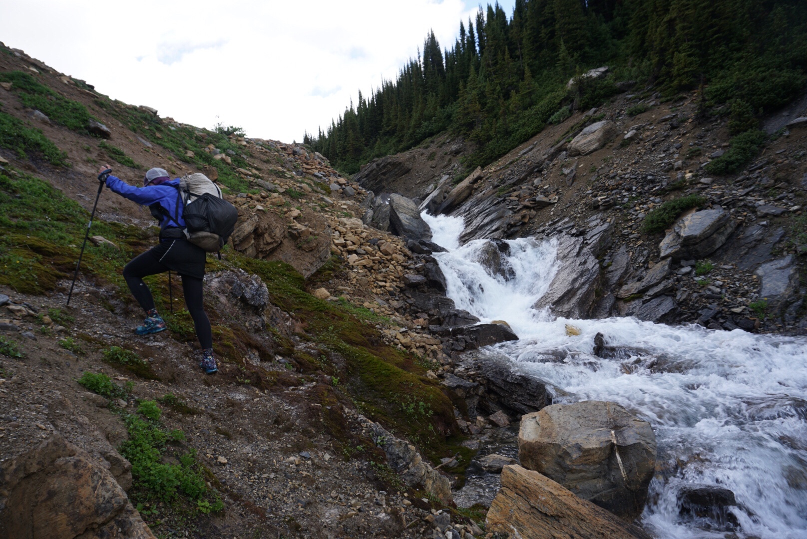
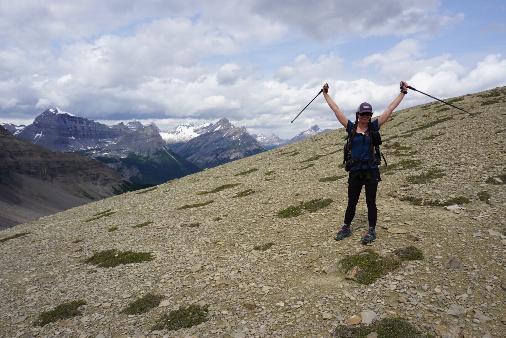
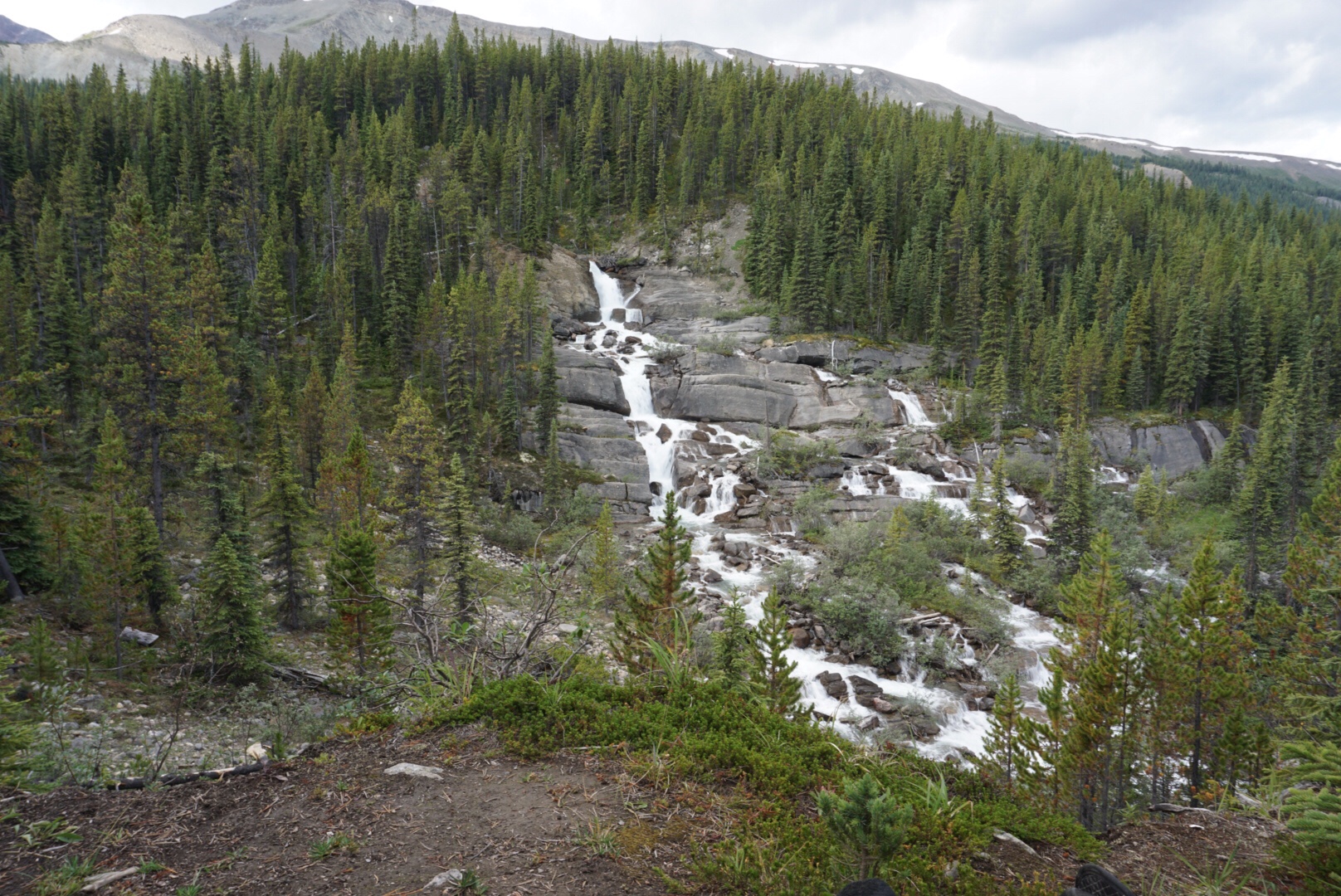
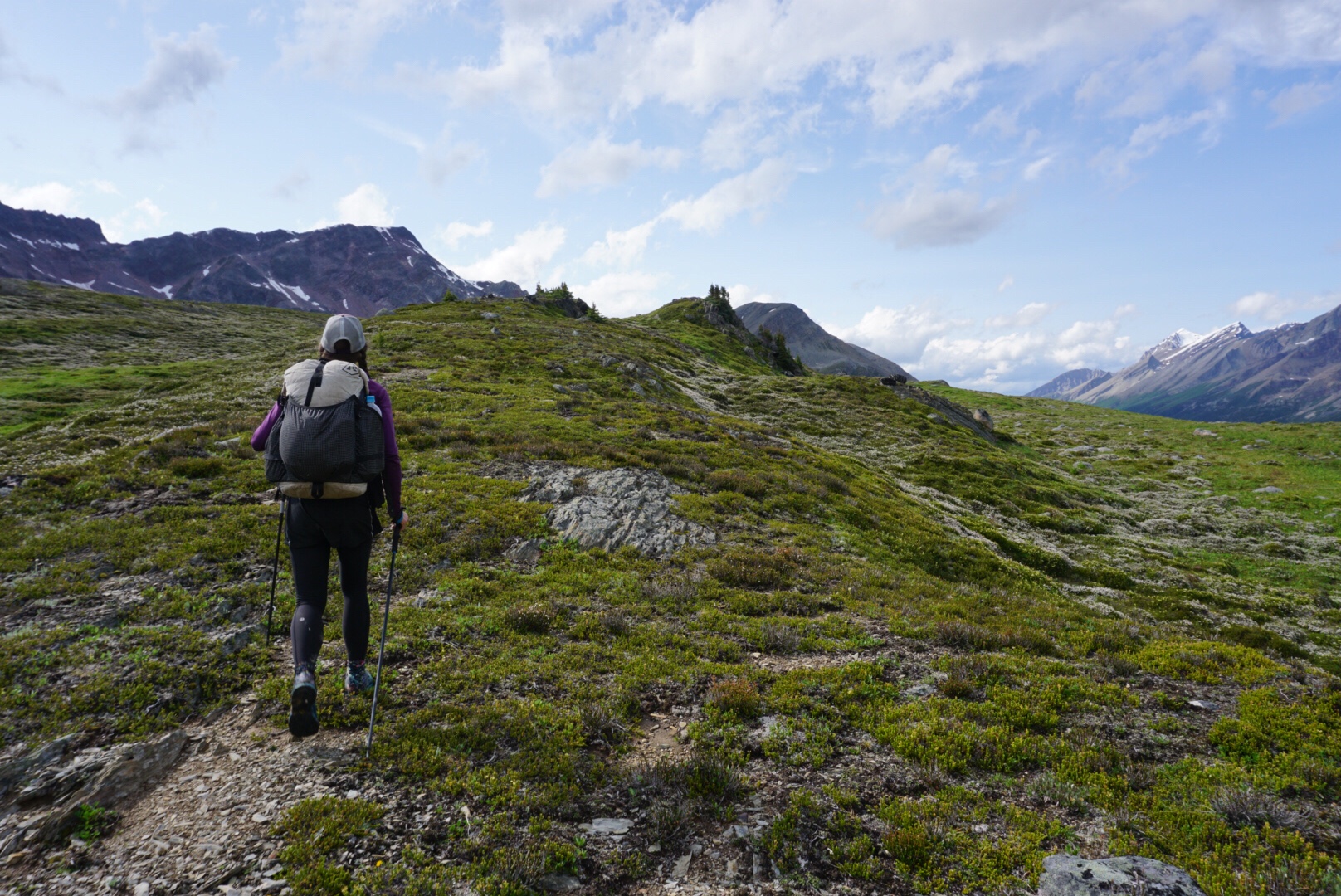
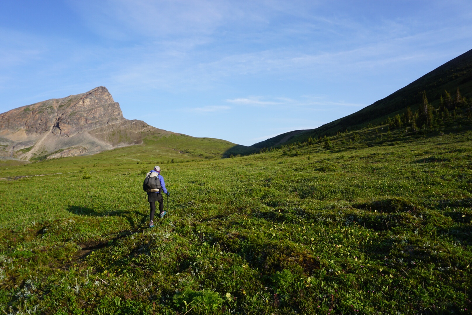
And then, everything turned. The sun began to shine through the clouds and we finally emerged above timberline. The feeling was ecstatic, rising through the deep, dark, bug infested forest into the open, friendly sunshine of the high tundra. As waterfalls cascaded down around us, we walked with new purpose and energy, and even let out primal howls to celebrate our improved fortunes.
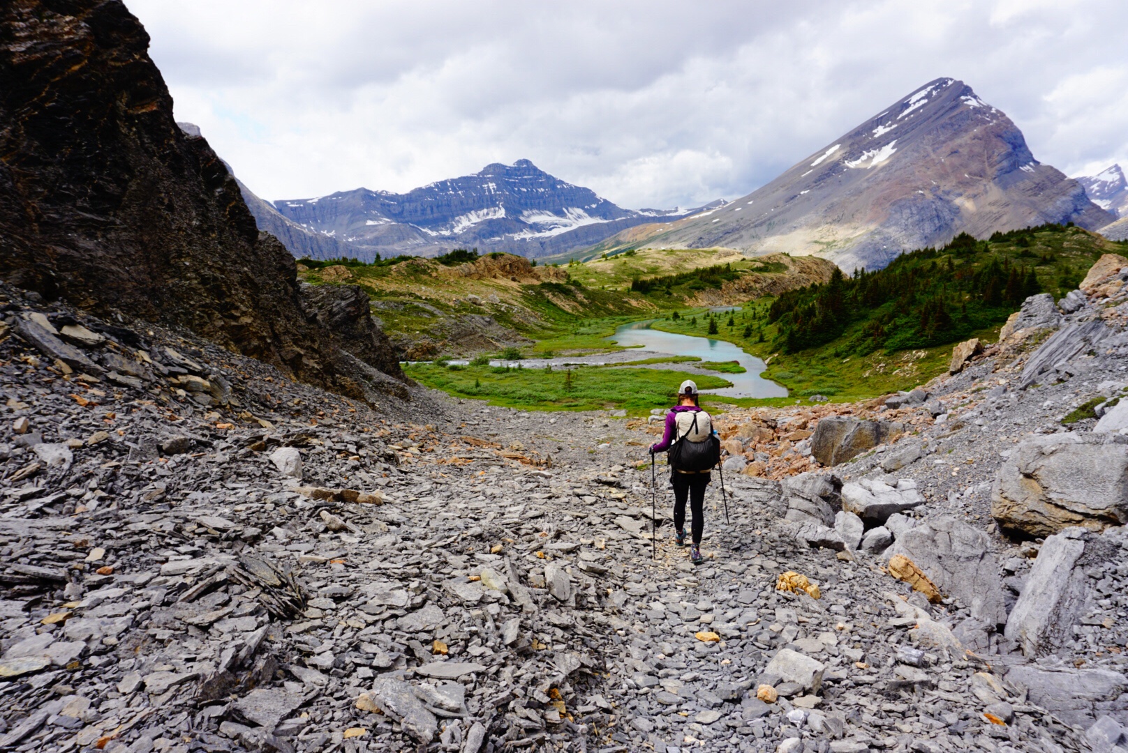
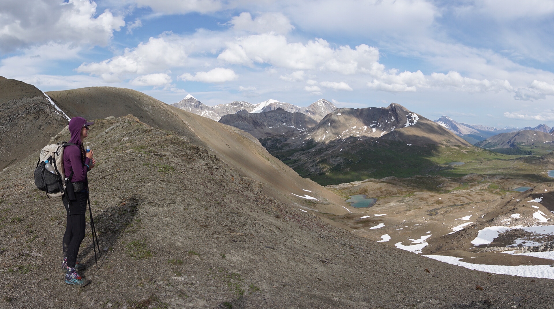
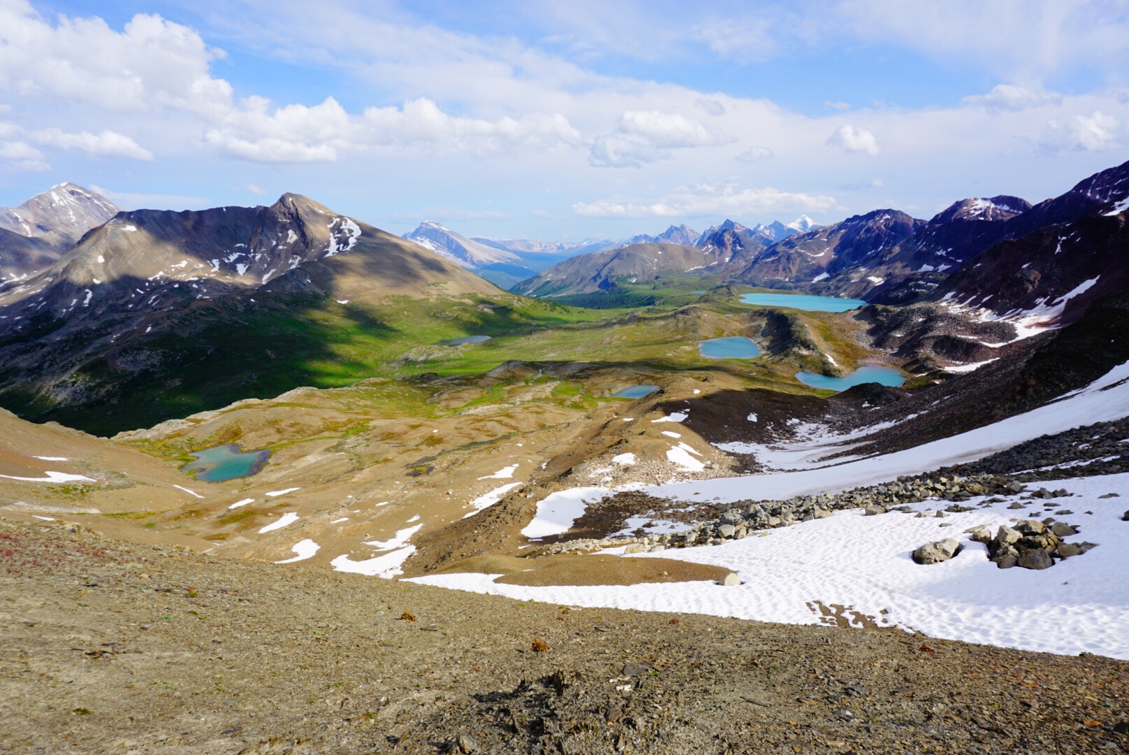
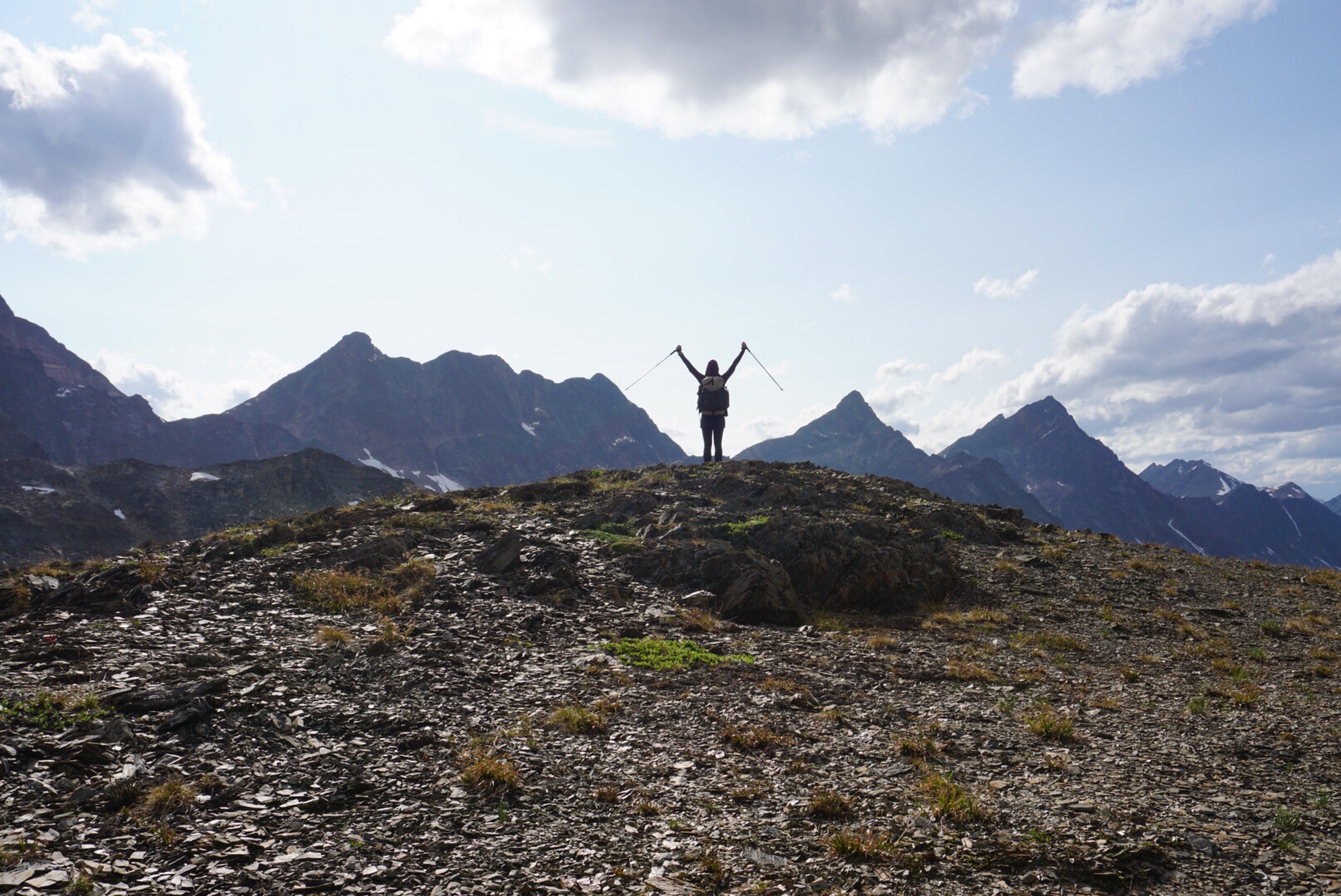
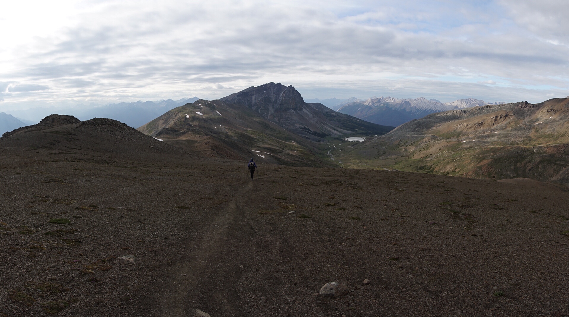
The route rose steeply up the walls of Cataract Pass. We followed the footsteps of mountain goats and before long were at the summit. We came to sign saying “Jasper National Park.” This is a place I’ve wanted to visit my entire life, and to come here this way, walking hundred of miles, emerging out of tough terrain to the top of a remote mountain pass deep in the Canadian Rockies was a bit emotional. It’s one of the finer moments of my entire life.
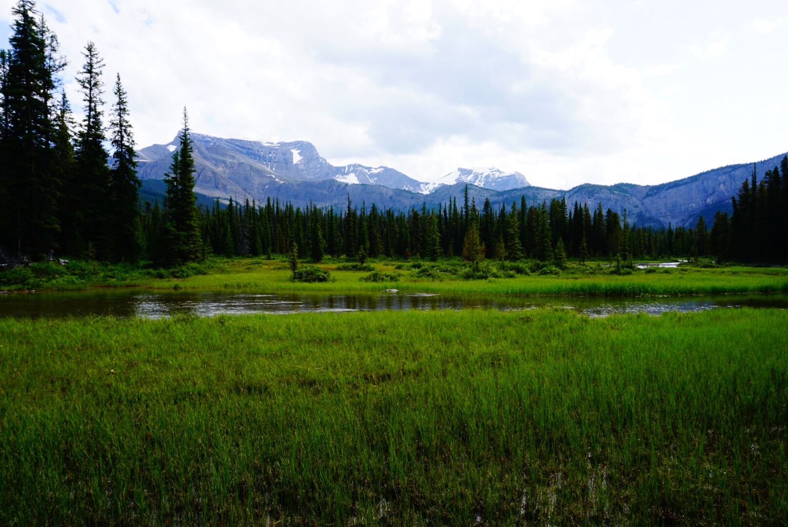
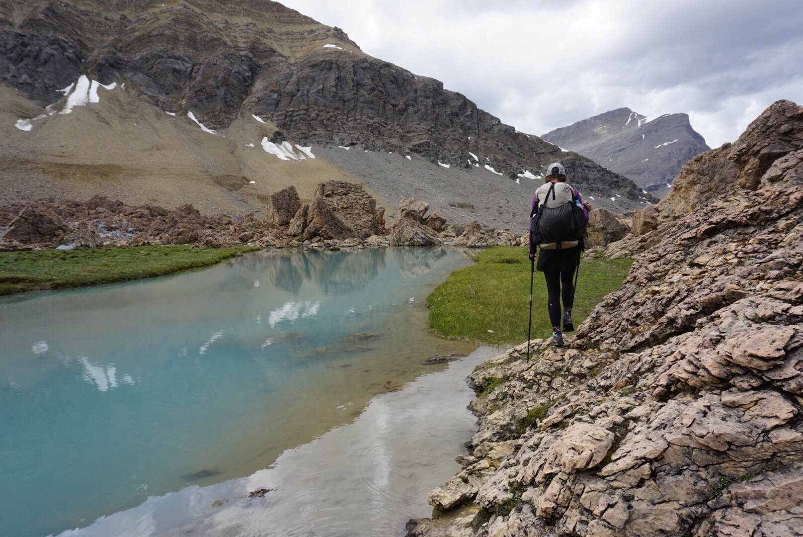
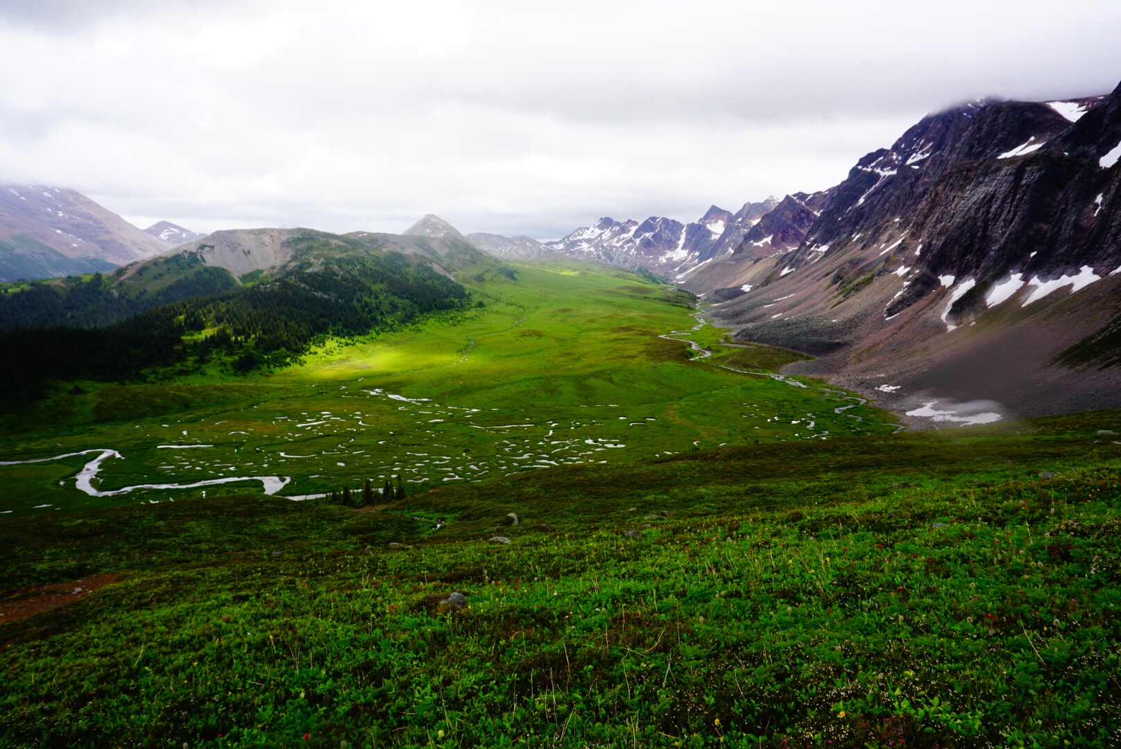
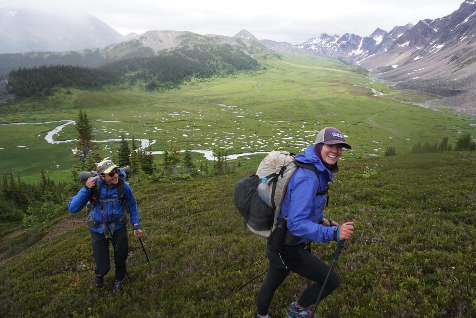
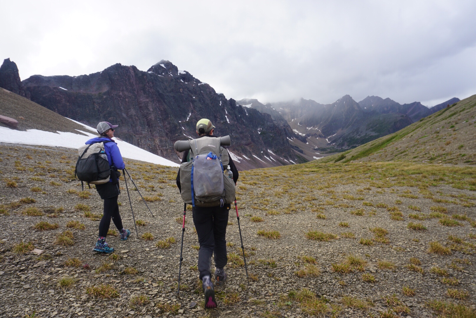
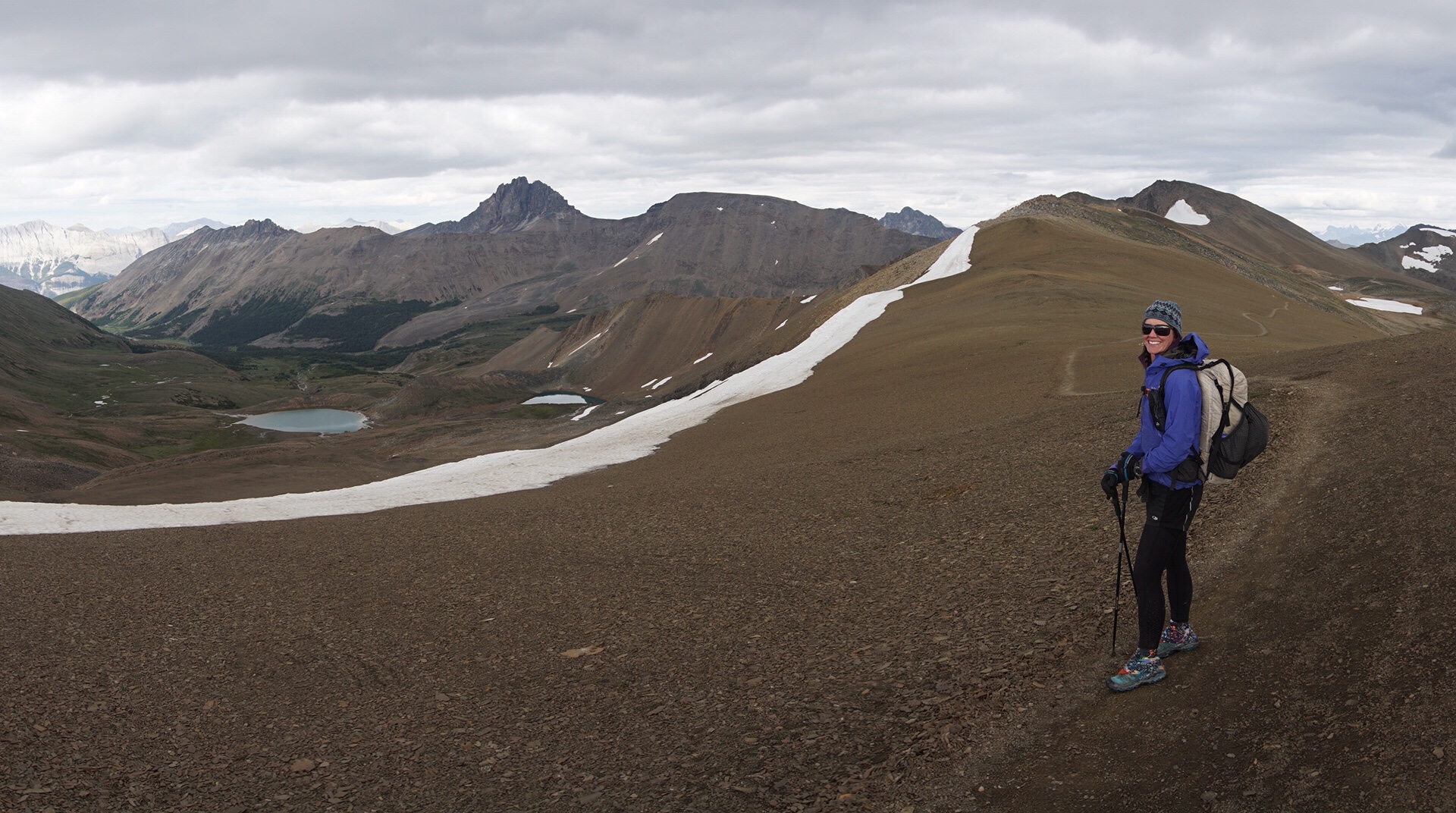
In front of us was pure northern beauty. Massive grey rock walls rose to the sky with hanging glaciers clinging to their upper reaches. Below, bright blue glacial lakes extended to light green meadows with glacial rivers meandering through the center. Clouds raged over the tops of the highest mountain summits, and in the far distance, mountain range after mountain range, as far as the eye could see, extended in every direction.
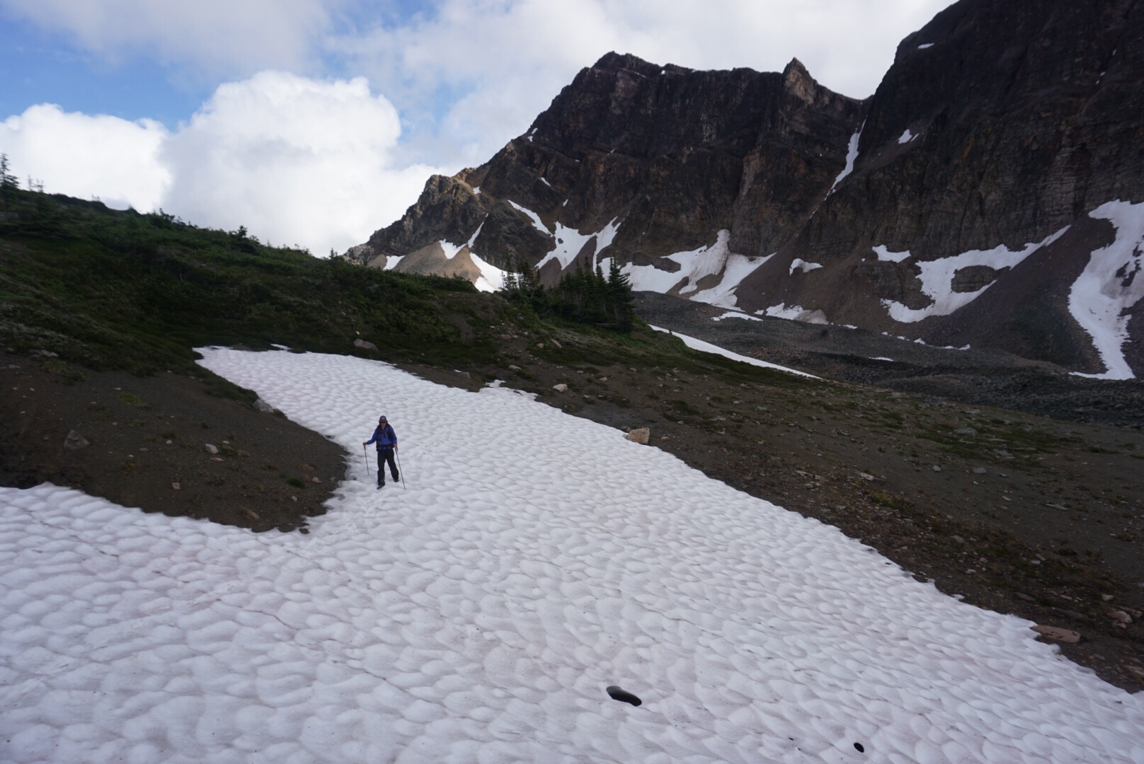
A storm was brewing over the pass, so we dropped down to the valley below before taking a food break to soak in the environment. The trail continued down through a jumbled rock garden that looked like something out of the Lord of the Rings. We scrambled carefully over the massive talus chunks, careful not to miss a step and get hurt.
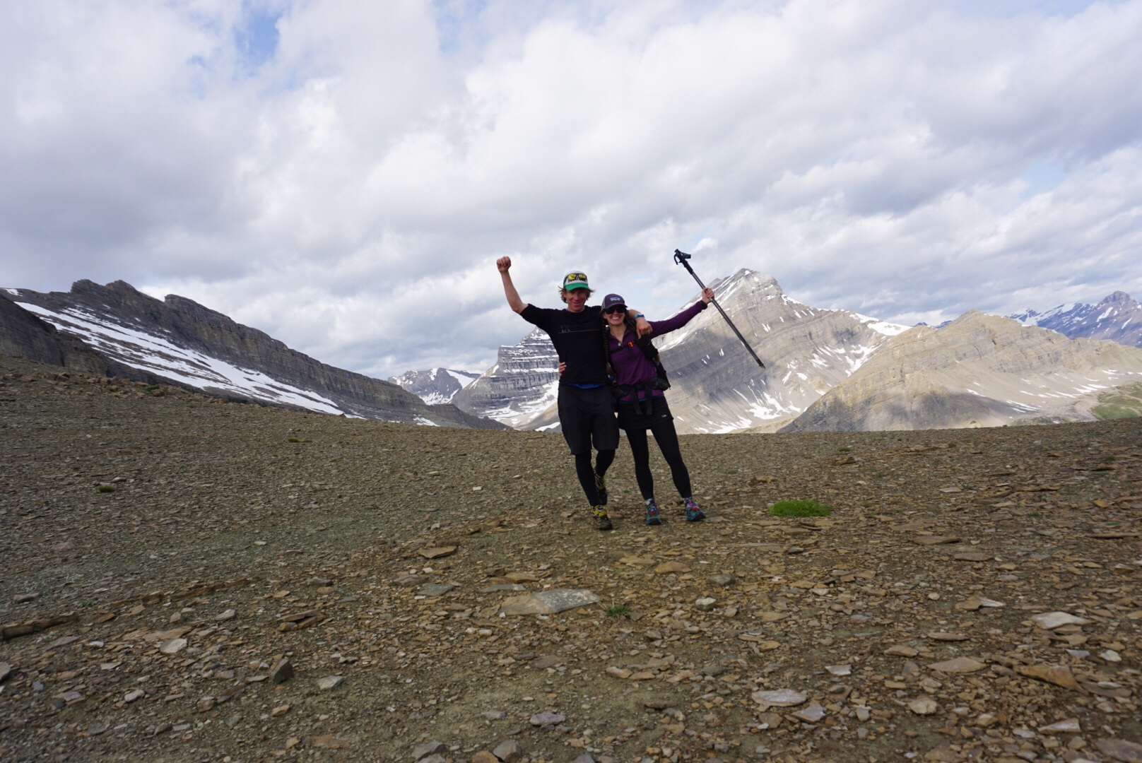
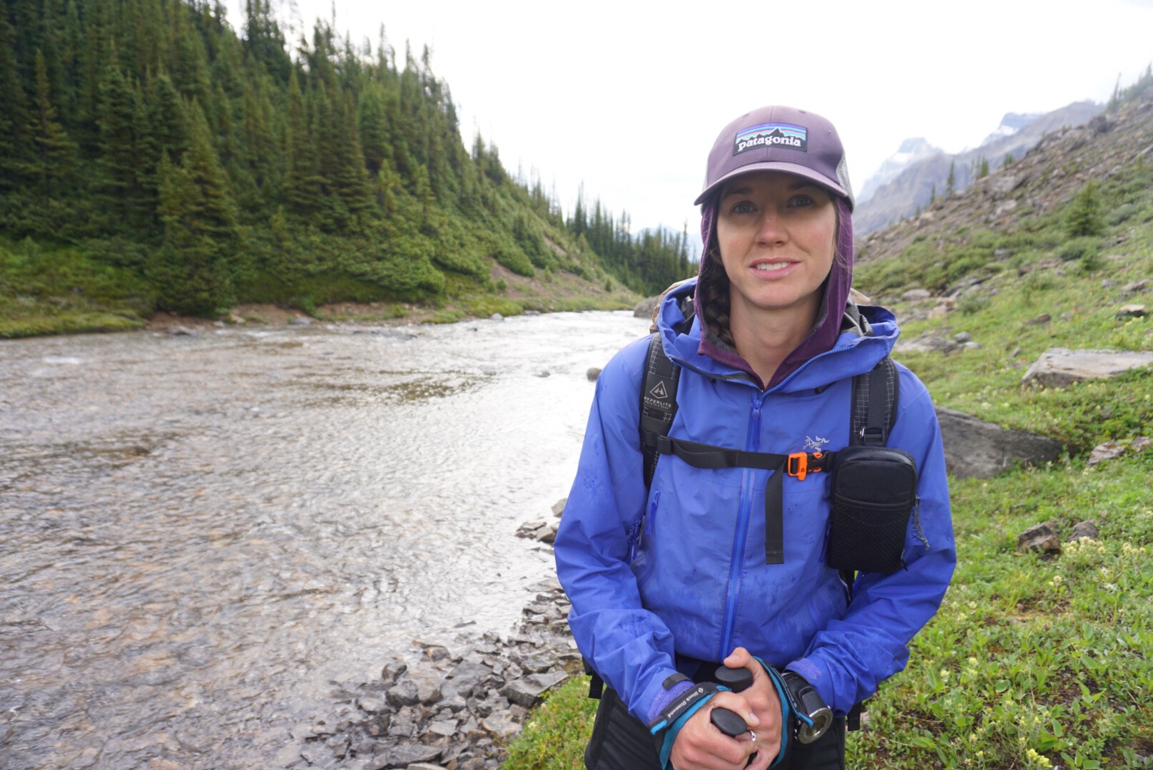
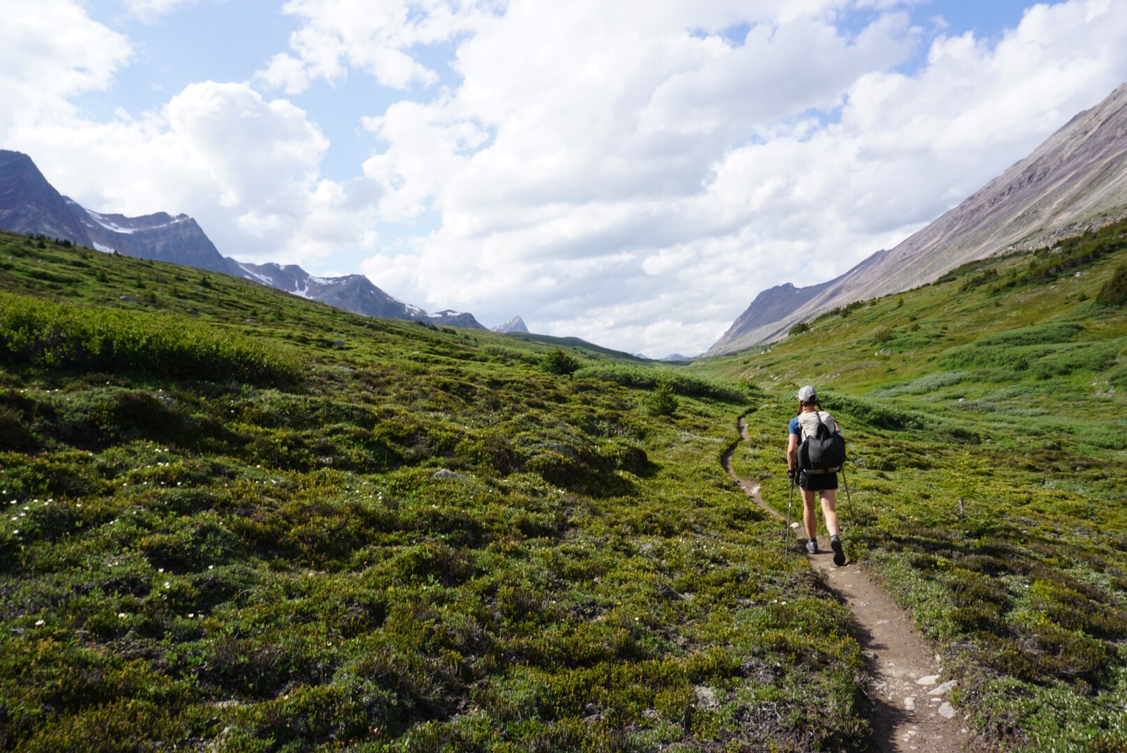
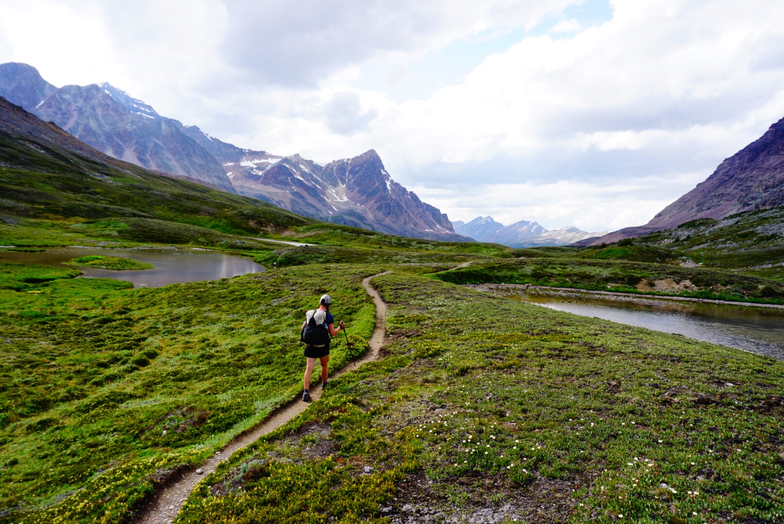
Soon, as often happens in the national parks, the trail became immaculate. With a spring in our step we meandered thru the perfection, down the huge open valleys that reminded me of the Talkeetna Mountains in Alaska. Along the way we met another thru-hiker named Mik, a Canadian from Vancouver with a mellow, intelligent vibe who seems like one of the most competent people out here. We hiked together for awhile, before separating, making a mental note that they might be somebody we’d like to do some hiking with later on.
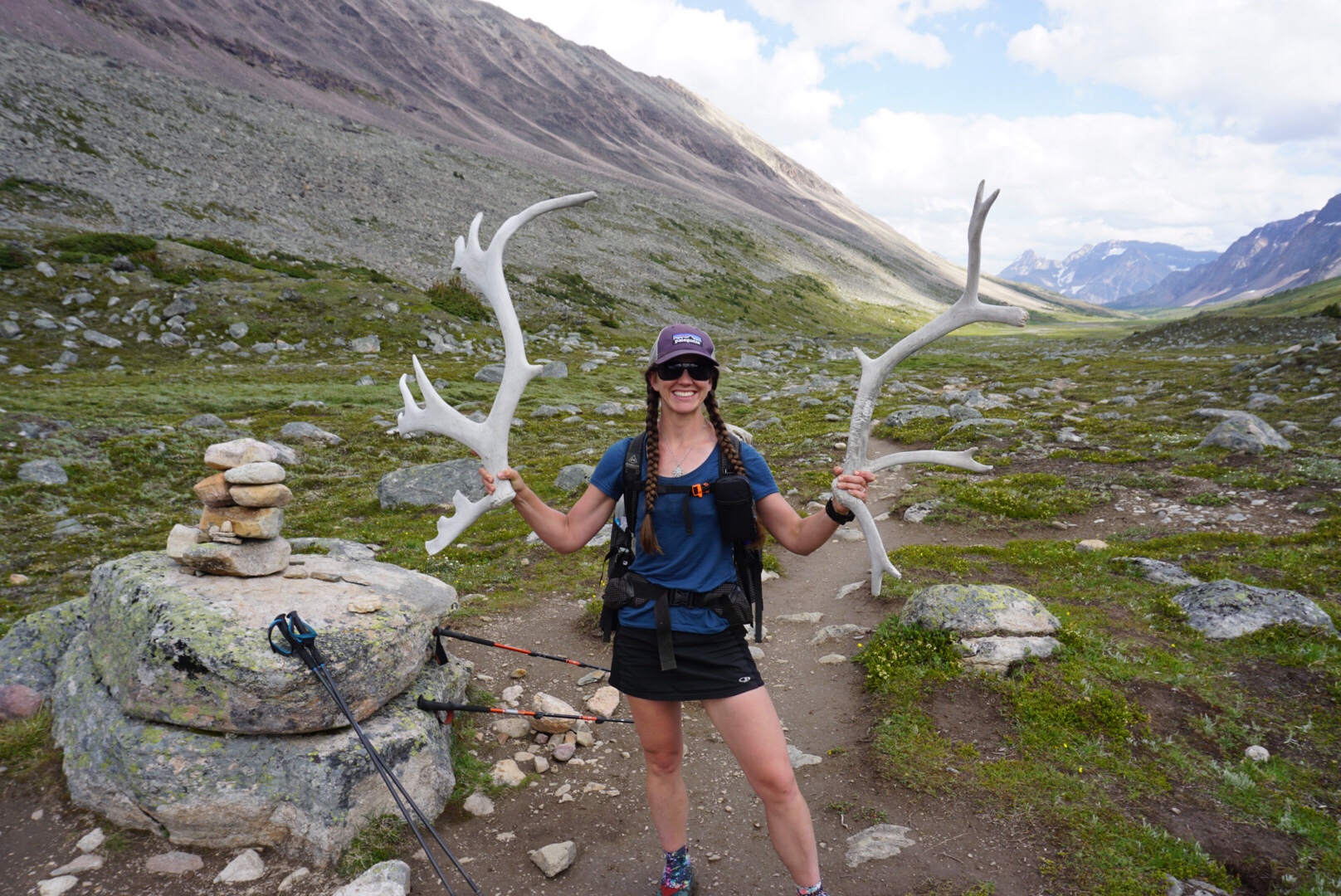
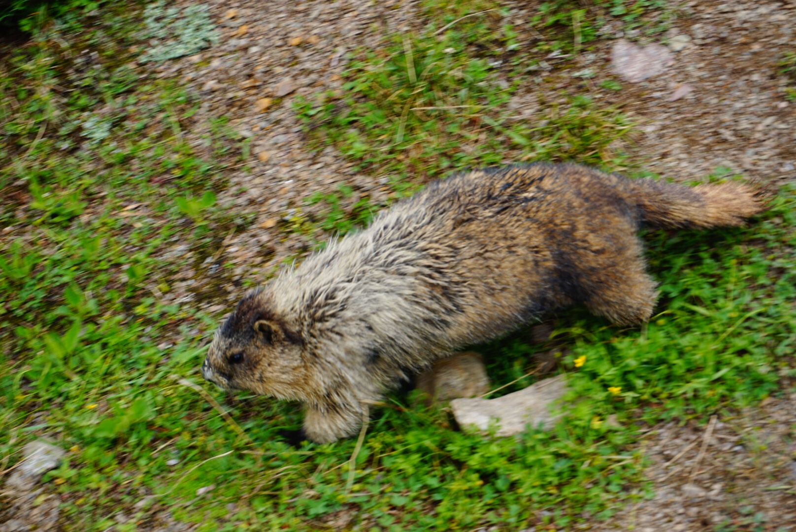
The trail raged through a huge, open treeless tundra valley. We came across numerous caribou antlers, – we’ve now hiked far enough north that caribou live here! The late afternoon light cast a golden hew over the arctic landscape. We passed many marmots, pika and ptarmigan, animals lucky enough to make this their permanent home.
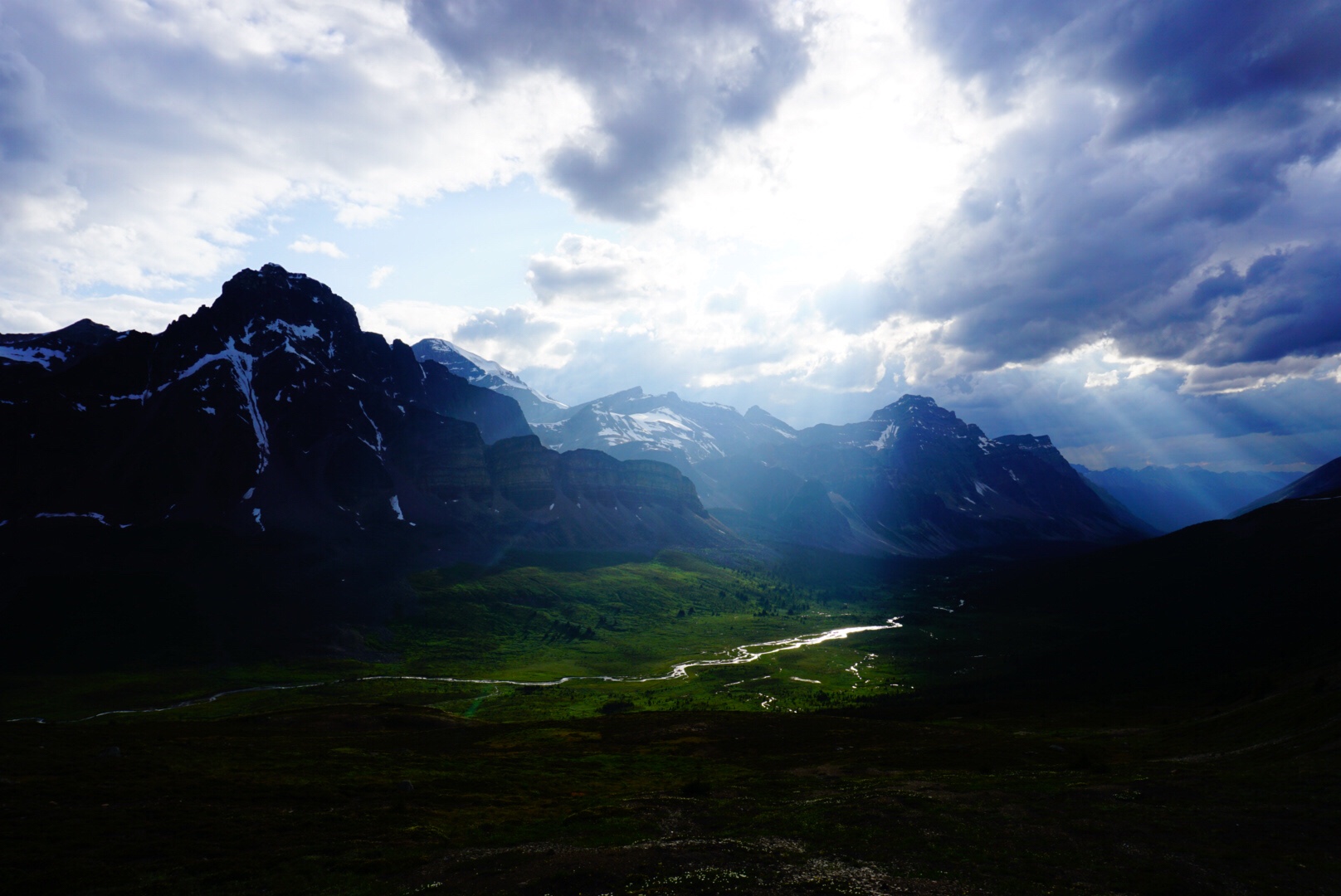
We caught back up to Mik and decided to continue on together for the rest of the day. The trail crested another mountain pass, and from the top the sun, clouds, mountains, and sky decided to put on a light show, casting beams on the valley below.
We began the descent down the other side to the Jonas Cut-Off Campground below. Soon we were in camp, cooking dinner and trading stories about the trail and comparing equipment with our new friend. The Great Divide Trail is the hardest trail I’ve ever been on, and because of that the good moments, the days that have some kind of flow are that much better.
Happy August…I think it’s going to be great month.
August 2 – 17 miles, 3,500 feet climbing
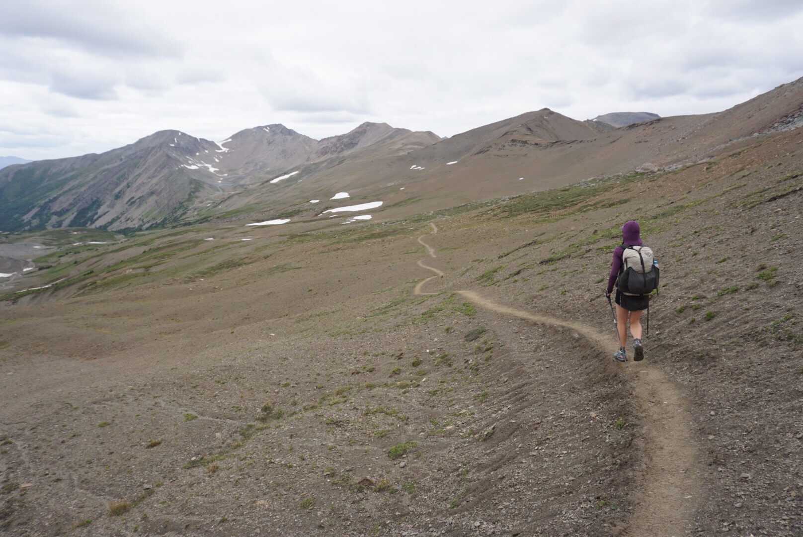
Elaine and I rise early and break camp, saying bye to Mik for now, with hopes of meeting up trail. We experience a new sensation during the first part of this day…boring trail. The GDT has been many things thus far, but boring is not one of them. But as we walked along the perfectly flat, forest strewn trees, we both agreed, we were bored.
Of course, that was the wrong thing to admit to the trail gods, let alone the GDT. Soon we began to climb up Maligne Pass, and things instantly deteriorated. The trail became a muddy, dead fall strewn mess and the mosquitoes and flies decided to launch a full-on attack. A steady rain began to fall and we heard a distant rumble of thunder in the distance. Never, ever admit to the trail that you are bored.
We were coming to a decision point. The official GDT route continued north up and over Maligne Pass and into the Maligne River basin. The problem is Jasper National Park decided to decommission this section of trail in 2012, as it’s home to a rare species of Woodland Caribou. By all accounts, the official trail here is severely overgrown and almost impassable. It’s not a great option.
A new “alternate” has emerged to allow hikers to pass through the park. Dubbed the six-pass alternate, this slightly longer, completely off-trail route bypasses the river valley and takes to the high alpine, crossing six mountain passes along the way. It requires a special permit, as its home to a large caribou herd that summers in the mountains. By all accounts, it’s a fabulous route.
One thing we have learned is that when given the chance between taking a high route or a low route on the GDT, the high one is almost always preferable. Open travel on tundra is much more enjoyable than slogs through buggy, swampy river basins. Of course, high routes present their own challenges. They involve much more climbing, and if the weather is bad, they can be deadly because of lightning.
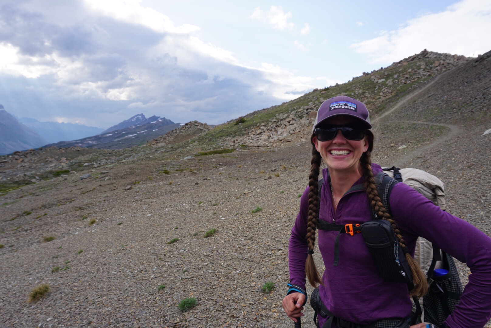
Utilizing the InReach, I messaged my sister who is something of a weather buff, asking for a good forecast. She got back to me soon: while rain was predicted, lightning was not. We can hike in rain and snow all day, but lightning is the big X-factor. Armed with this promising forecast, we made a decision to do the six-pass alternate.
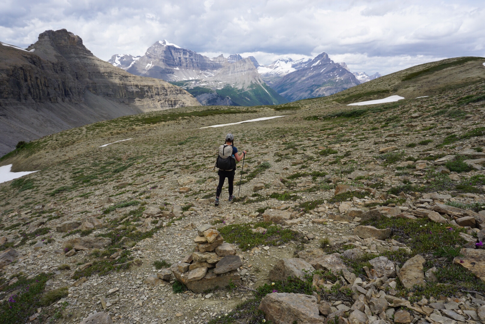
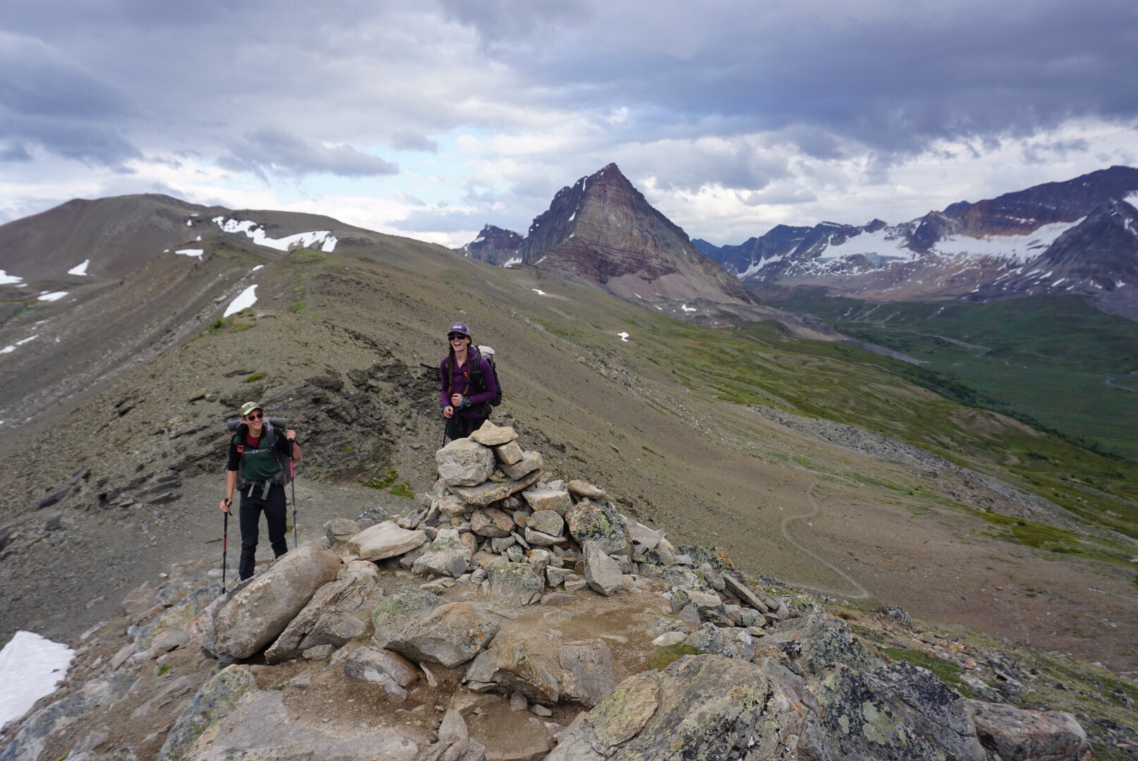
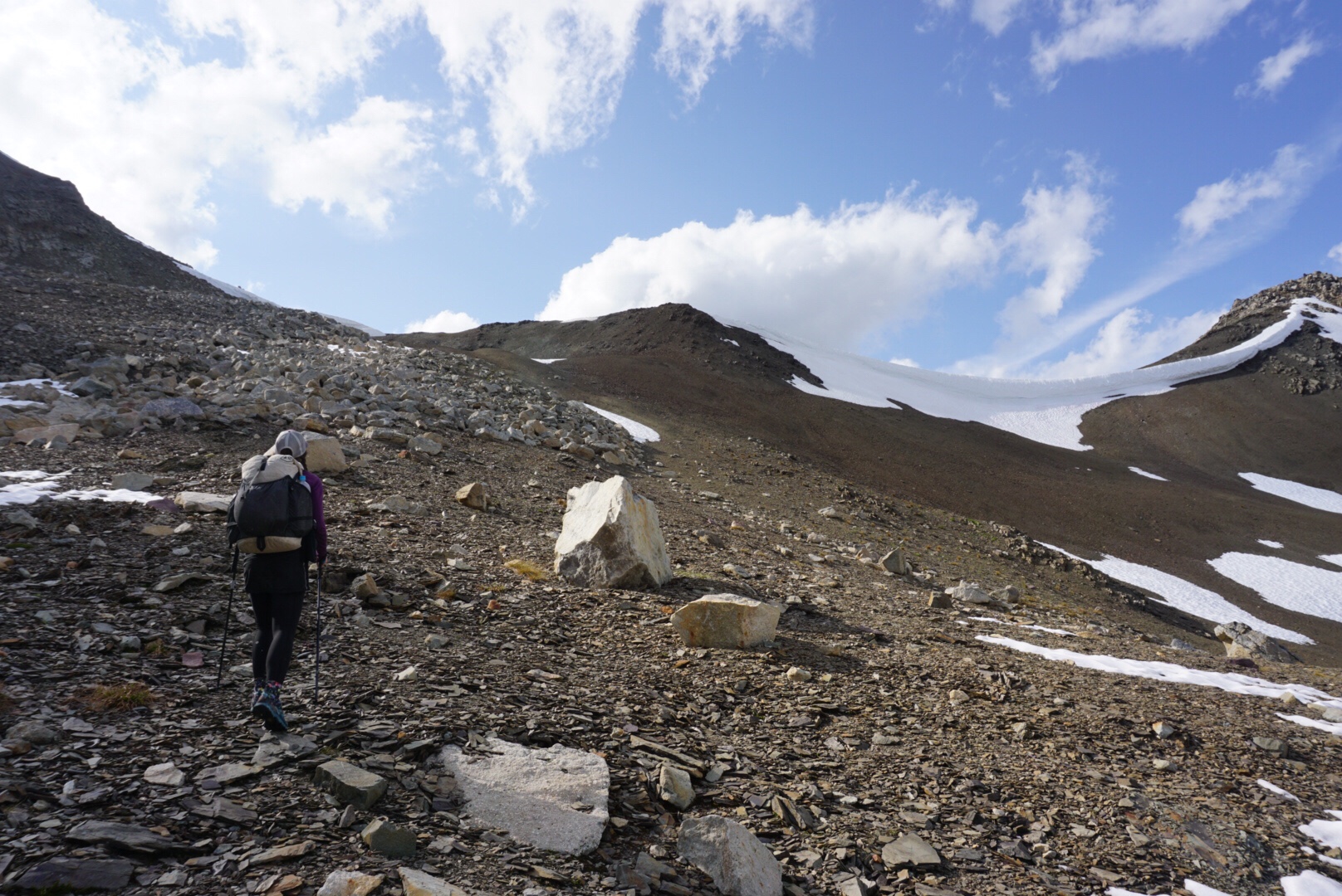
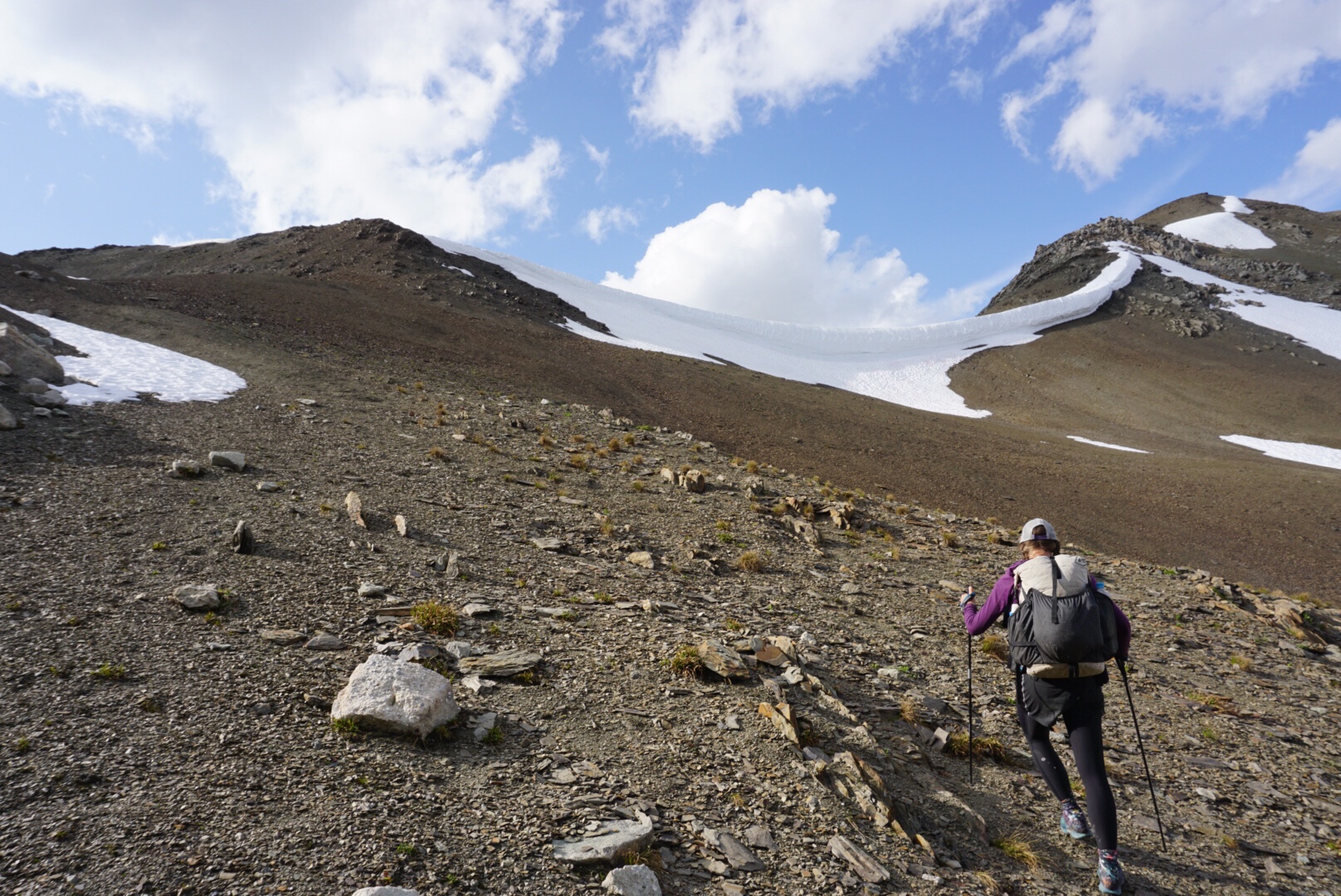
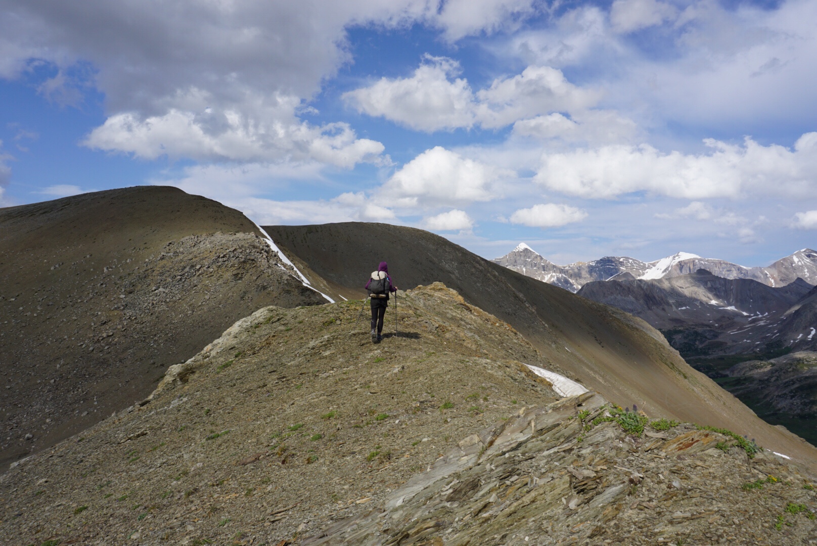
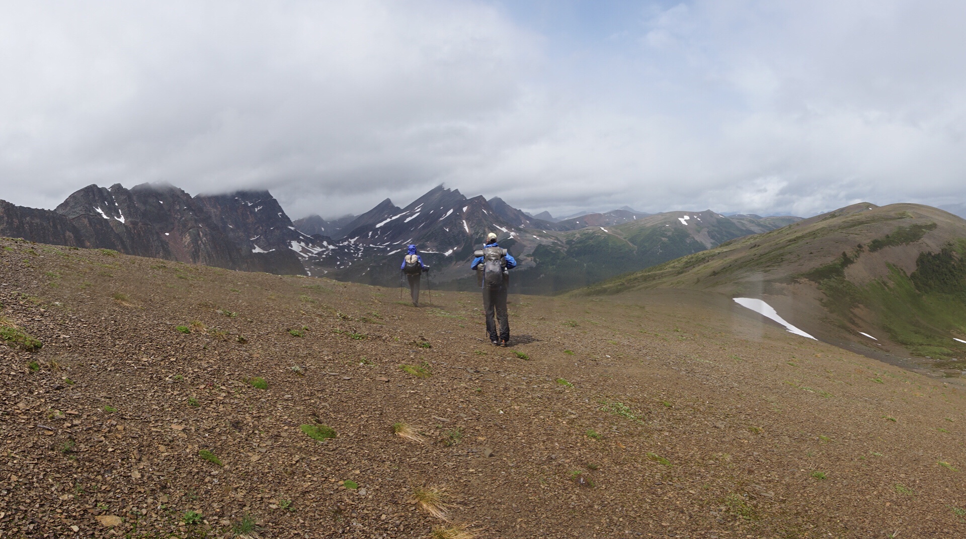
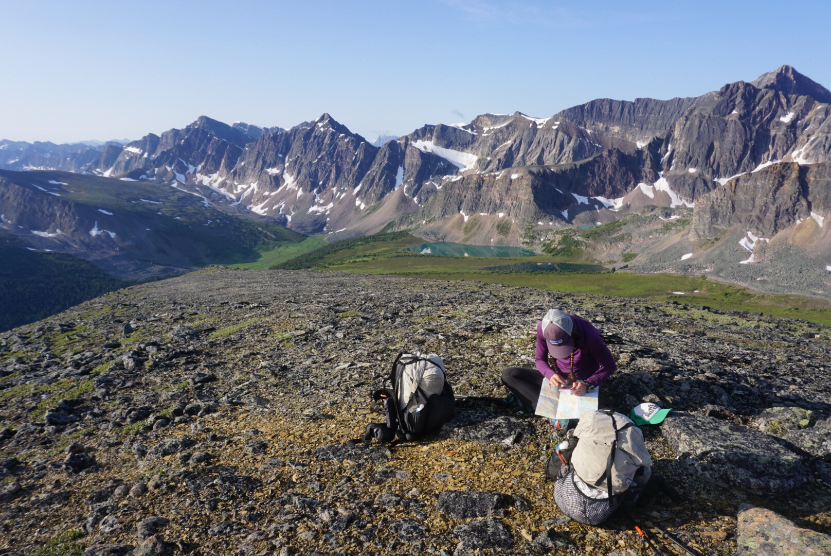
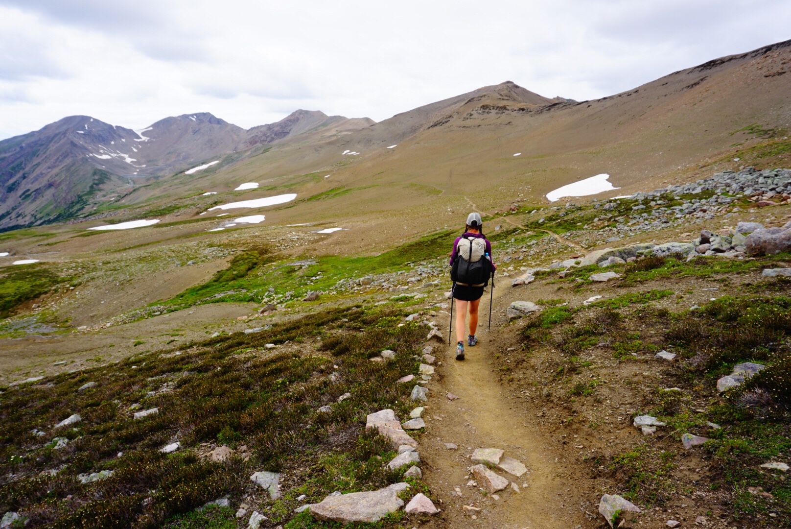
Near the top of the pass, we angled west off the main route to the first pass. We were immediately travelling off trail, following the land, reading vegetation and picking the line of smooth attack. I love this type of travel, where decisions are based on the world in front of you, not some predetermined trail. It is, in a sense, the next level of travel for Elaine and I in our outdoor adventures, far from set trails in distant and truly wild places.
The route benched up a number of rises and we were soon well above Maligne Pass, looking at the route ahead. The pass itself had a massive cornice above it, so that wasn’t the way to go. We decided to tackle it to the left of the cornice, a route that would require a bit more climbing, but that should be much safer. The last part of the pass was quite steep, but it was short, and soon we we reached the top.
In front of us was a wonderland of mountain peaks and green valleys that looked like a fantasy world. This crossing was significant in another geographical way. It marked the point where we crossed into the Arctic Ocean drainage basin. From this point forward, all water encountered will flow north, eventually destined for Great Slave Lake, the Mackenzie River, the Beaufort Sea and the Arctic Ocean at 69° north latitude.
When I think back to the last two years and the beginning of this adventure that began deep in the New Mexico desert, it’s almost overwhelming. I remember the day before we departed, standing on a dusty field outside Lordsburg, New Mexico, under a raging sunset, Elaine throwing her fist in the air, and feeling an excitement that life as we were meant to live it was just beginning. And now, here we are, 3,500 miles later, having crossed endless mountain ranges, deserts and rivers, at the entrance to the ARCTIC.
In truth, I wasted a lot of my younger years riding bikes around in circles and trying to manage insecurities by proving myself in an arena that meant nothing. Crossing a mountain pass into an Arctic Ocean river basin after seven months of walking kind of makes riding a bicycle around a contrived loop in hopes of winning a medal look like child’s play. But, as they say, better late than never. There is a lot of adventure out there still and I aim to squeeze every ounce of it out for as long as I can. And this region, the arctic, will be the setting for a lot of this adventure. It speaks to both of us, and it feels like a place that matches our desires and dreams.
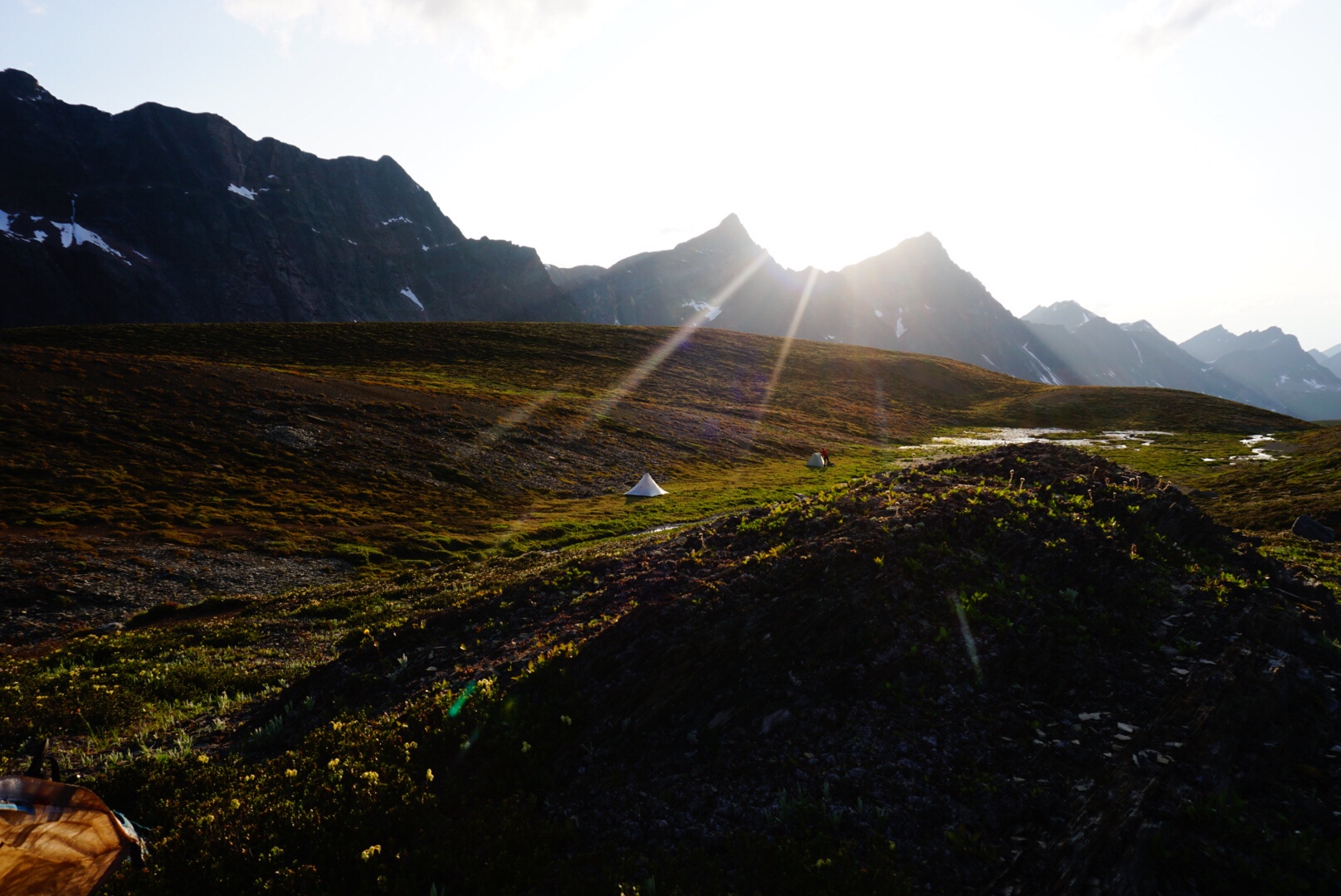
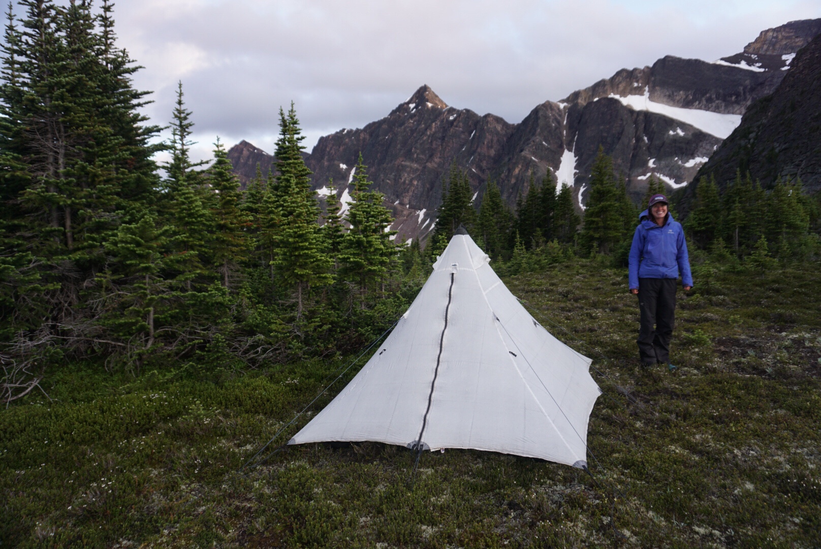
It was about 7 pm when we began down the other side into Terra Incognita. The light was dancing with the mountains, creating magical silhouettes and long shadows. Honestly, we could have camped way up high, but given that there was some cloud build-up, we opted to drop slightly lower and set-up shelter there.
It was a perfect spot, flat, protected and with views that extended to dream world. We cooked on the warm tundra, while the marmots and pika chirped, skin warmed by the evening sun, and sipped tea as we enjoyed the silent, beautiful spot.
Looking up valley, we saw a single human descending from the pass quickly. Elaine, who has amazing eyesight, quickly identified the person as Mik. We gave a howl and yell and soon Mik was in camp, sharing the same energy and ecstatic feeling that we were feeling. We cooked dinner and slept in the wilderness, the way human beings have been doing it for all of time before we lost our way.
August 3 – 12 miles, 4,100 feet climbing
A hard rain beats against our shelter as day emerges. Today’s plan calls for crossing four more passes. Time to stiffen the lip, because this will not be an easy day.
The day merged into an endless – yet fabulous – series of climbs and descents over mountain passes, through storms and across some of the most wild mountain terrain I’ve ever experienced. The day felt more like a migration than a hike, the three of us pulling our weary bodies over rocks, streams and tundra like migrating caribou, into the land where the gods danced. My notes about the day are vague, because in essence it all melded into one:
1st pass…long approach across valley, quite steep.
2nd pass…down valley, then up over a double pass, up saddle then traverse. Cold rain, chilly snack break.
3rd pass…A talus-filled , side-hill trouble child. Rain off and on every two minutes. Ankle didn’t really like this one so much,
4th pass…Steep, straightforward, much better than 3rd. Followed gullies right to the top. Ended day with navigation through trees and scree to camp at double lake. Mosquitoes brutal.
What stood out about the day was our new friend Mik. As I mentioned earlier, Mik is from Vancouver and is highly competent in the outdoors. Mik shares our belief that the competitive nature of thru hiking is silly, and has a calm, positive demeanour that is a joy to be around.
Mik is also transgender. Truth is, I’ve never known a transgender person before. That’s not exactly true, as I have some friends on social media who are transgender, who post often about things like pronouns and work place discrimination. But honestly, for me, it was a distant concept that I’d never been exposed to.
Mik, whose name is short for Mikolash, is writing a blog called Gayly Forward that is being posted by the Canadian equivalent of REI, a company called MEC. Rather than explain what it’s about, I’ll let you simply read it.
Hiking with Mik has been a great experience for Elaine and I. Mik was very open to answering our questions no matter how inane. For those curious, Mik’s pronoun is “they,” and it’s simple…instead of saying he or she, just say they. Not that complex really. Even more interesting was a series of conversations about good books, climate change, the differences between Canadians and Americans and every topic under the sun. If you told me before this hike that in the very wildest part of the walk we’d be learning about transgender lifestyle I probably wouldn’t have believed it, and I’m grateful for it.
We were tired at the end of this day. There was a lot of steep climbing and we must have changed in and out of our rain layers 20 times over the course of the day. It was a cold evening, and would likely freeze overnight. Our plans diverged from here – Elaine and I would be up early to finish the last pass and make some progress towards Jasper on the Skyline Trail, while Mik would be taking a more relaxed approach, leave later in the day, and hike the entire Skyline Trail in one day the day after.
Before the day ended we did learn about something called “Mass Drop,” a new concept where individuals are creating outdoor gear through crowd funding that is pushing gear beyond what the big companies are feeding the general public. Every region has its own gear culture, and the GDT is no exception. The trail “legend” up here is a guy named Dan Dursten who has hiked the route multiple times and has built a tent designed for the wet and harsh climate the GDT presents. It’s fun to be on the cutting edge of the new wave of outdoor gear that is designed and developed from actual trail experience and savvy in a small batch format.
August 4 – 25 miles, 6,100 feet climbing
We left our camp near the two lakes in the fields of heather and began a steep climb up the last pass. It froze last night, the first freeze of the season, and despite the steep climb I left my long layers on till the very top.Tomorrow is Lammas day – halfway between the summer solstice and the fall equinox, and in the Celtic culture the beginning of the harvest season and the end of summer. Given the overnight freeze, it seems absolutely appropriate.
Determination plays a big role when the body is exhausted, and we made a point of not stopping once on the entire steep climb – a body in motion stays in motion. At the top the sun finally hit us, so we shed layers and watched as the fog rose over the Maligne River to the east. To the south, we could see the entire 6-pass alternate, jutting and angling across these wild mountains.

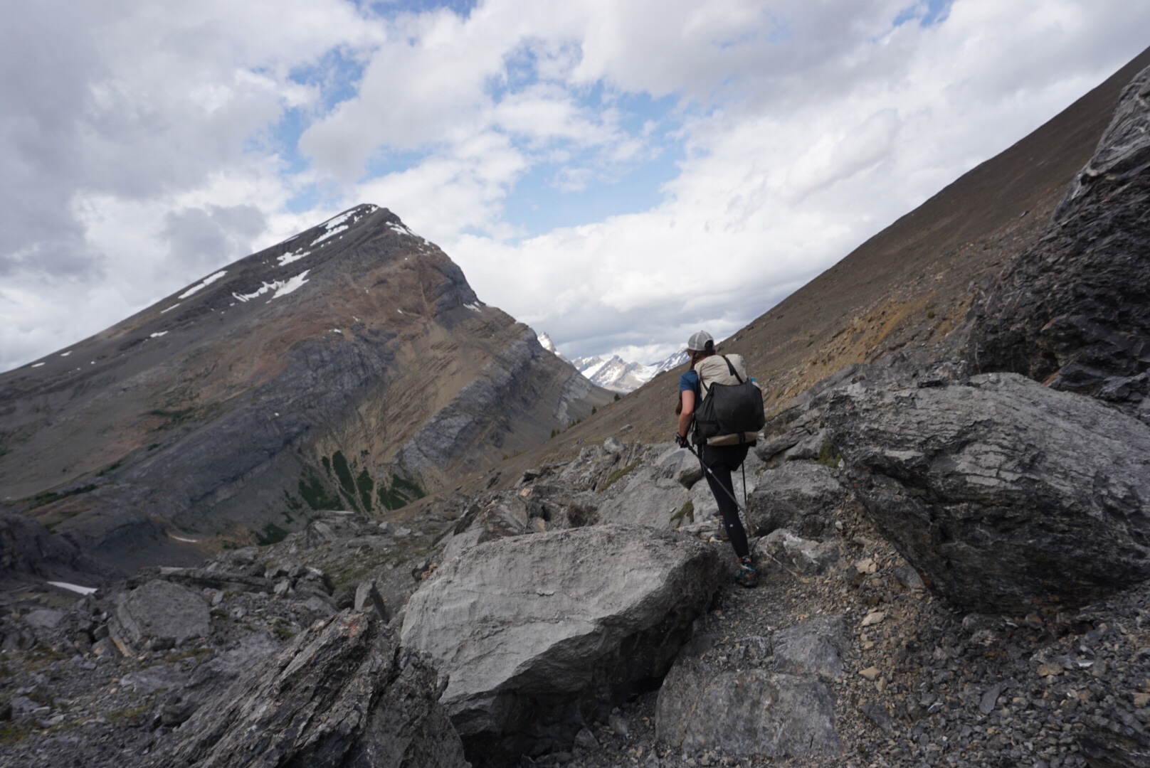
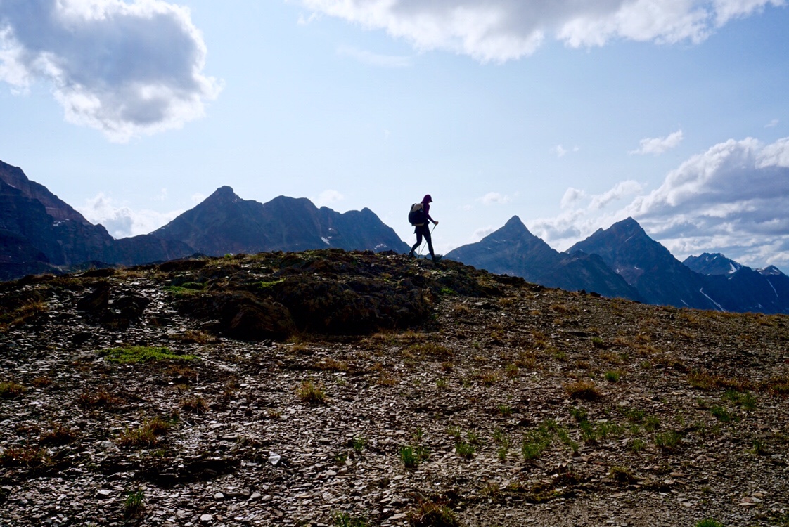
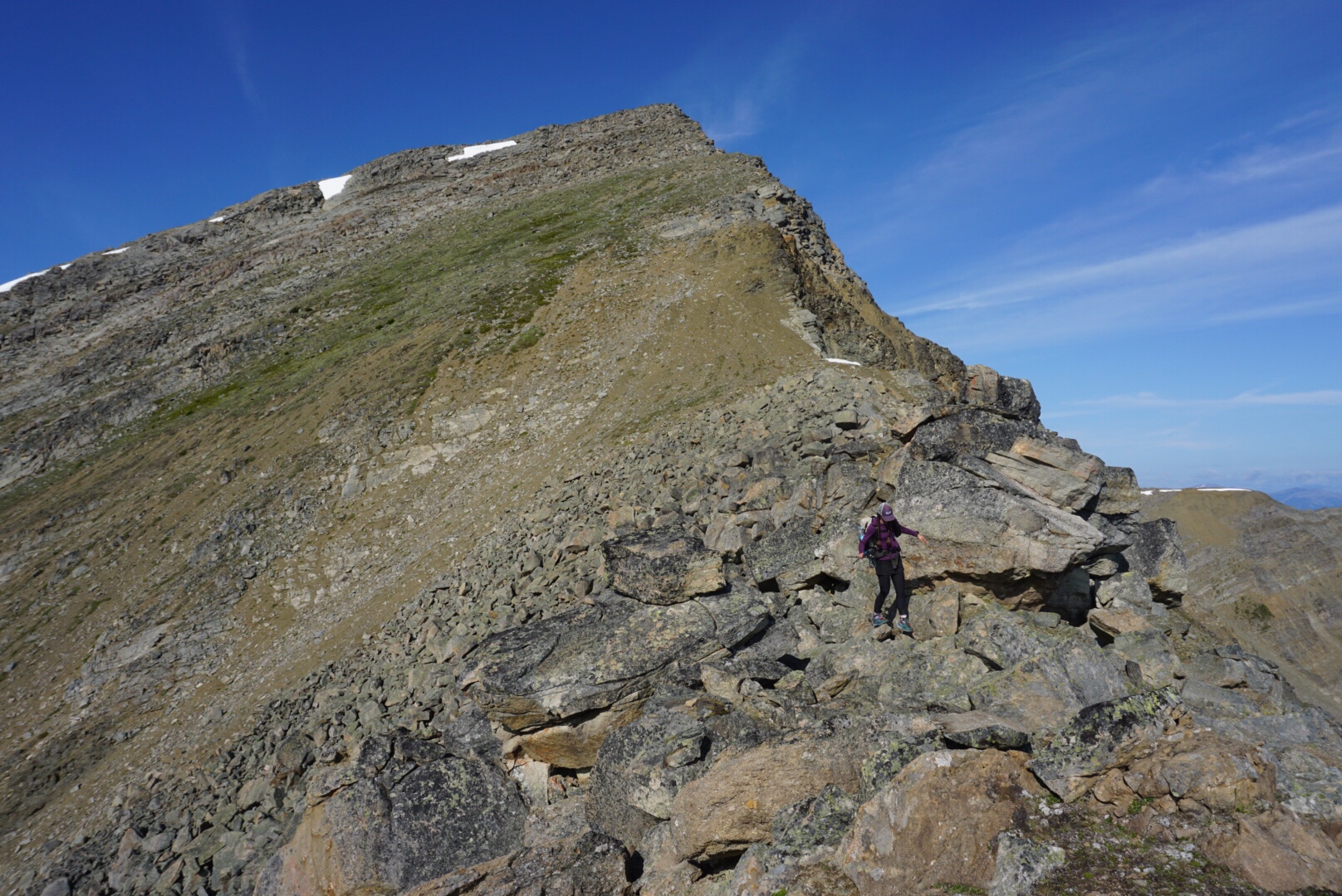
The 6th pass isn’t really a pass at all, but a long ridgeline that ends at the top of a peak. Walking along the very top of the ridgeline was a bit airy, but a preferred option as the going was steep on the sides. After a few false summits, we finally crested the main peak. It was hazy, but we could still make out the faint outline of Mount Robson to the north, the highest peak in the Canadian Rocky Mountains and the end of the “official” GDT.
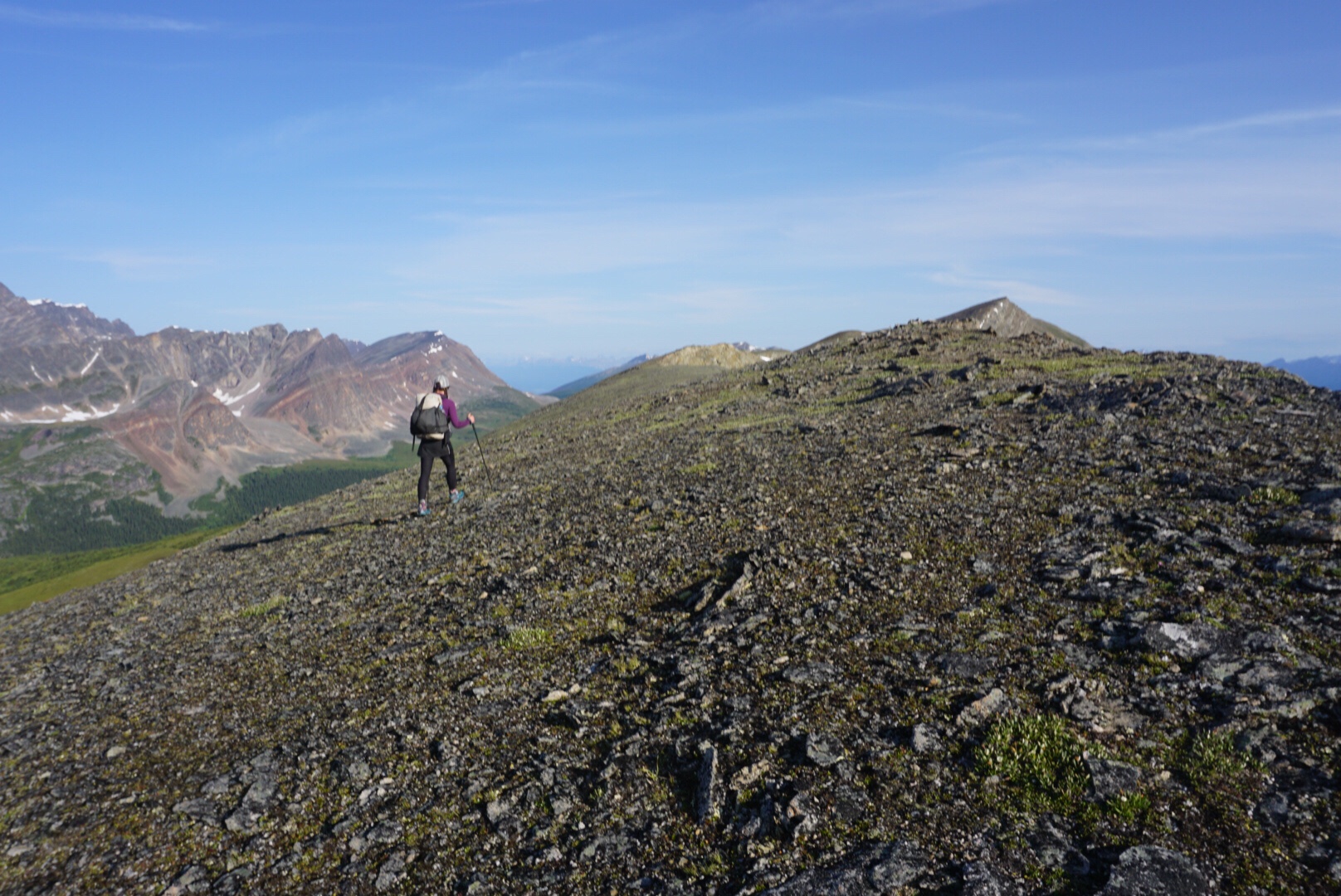
The drop off the other side of the peak was hair raising, a class IV drop that stretched my nerves a bit further than they’ve been stretched for some time. But, as they say, it’s good to scare yourself from time-to-time to let you know you’re still alive and have a heartbeat. We continued along a lower ridgeline, passing marmots along the way, before finally cresting a last hill that brought us to real trail and the end of the 6-pass alternate.
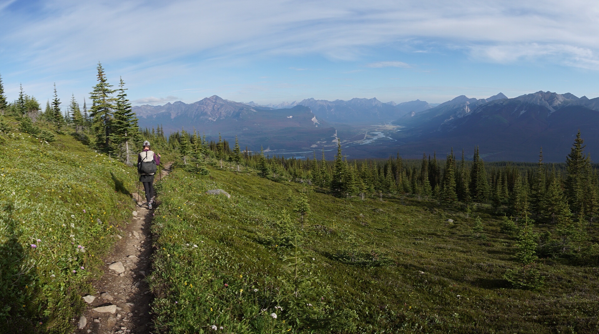
After a snack break, we continued down the hill, passing hikers heading up the other way on day hikes. Since we had plenty of food left, we opted to skip the cafeteria at Maligne Canyon and head directly onto the Skyline Trail. What a change! It felt like we were suddenly dropped onto the Colorado Trail or Pacific Crest Trail. The tread was smooth, the grade was perfect, and we were soon traversing along at a comfortable 3 mph with relative ease.
After the mostly-sufferfest of the past nine days, the civilized trail was a welcome respite. We meandered along, chatting with other hikers. For a lot of this hike I think both Elaine and I have wondered what it wrong with us, as it’s rare where we’ve felt good. It turns out nothing is wrong with us, the GDT is just that hard. It was nice to feel like strong hikers again.
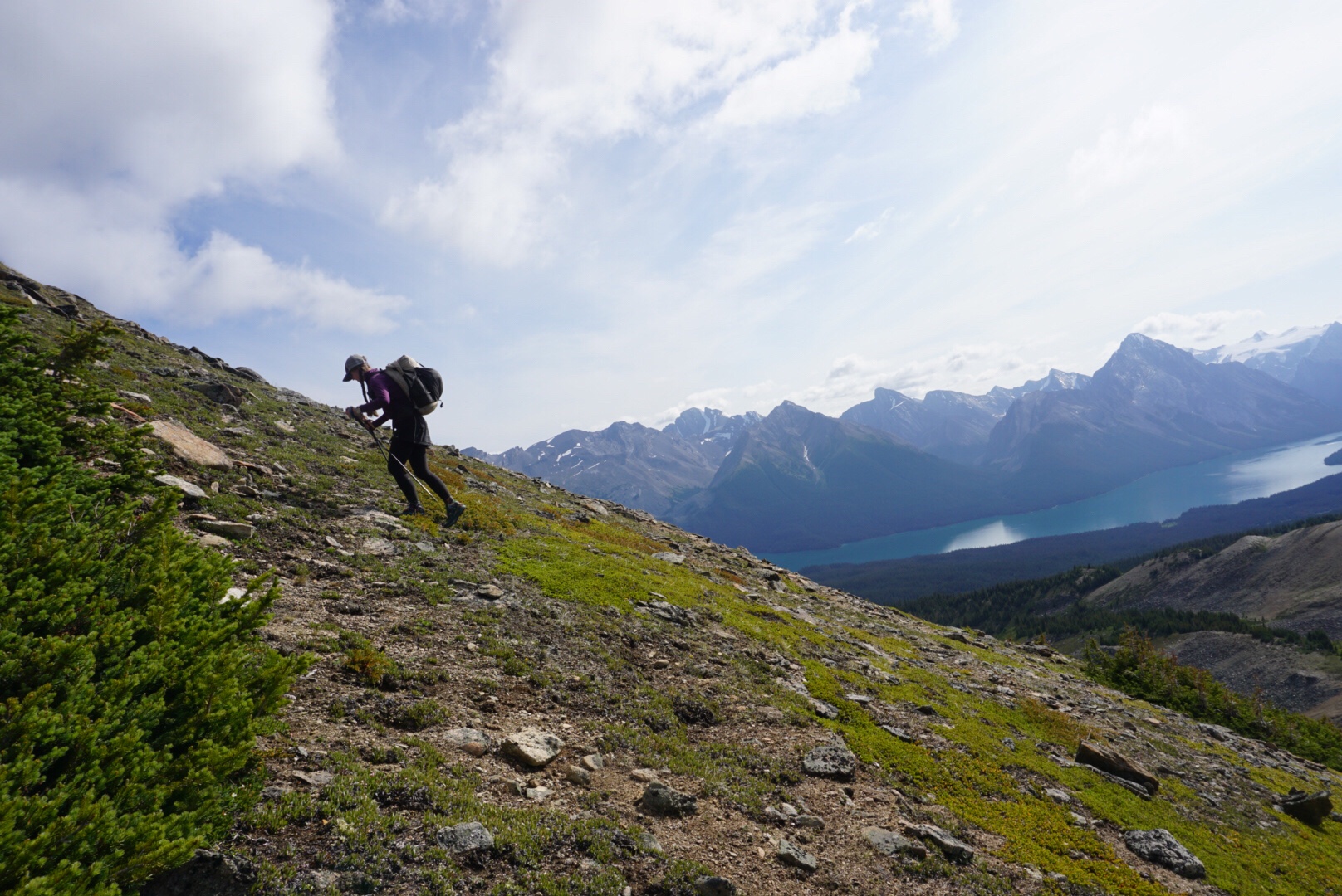
The Skyline Trail climbed out of the trees and into some of the most magnificent tundra we’ve enjoyed yet. Huge expanses of open mountain unfolded before us and it wasn’t long before we made it to a mountain pass known as “The Notch.” The Notch is a dramatic ascent that crosses a tiny gap in the ridgeline before continuing north to Jasper. It was a steep climb, but Elaine and I enjoyed the wildness of it. The day hikers had all gone home, and as a cold wind blew in from the north, we summited the pass and continued along an impossibly beautiful stretch of trail right on the ridge of a mountain top.
Dark was coming soon, so it was with some relief that the trail began to drop and we pitched our tent at a park service campground. The campground was the only low-light of the day, a mud-bog, mosquito-infested hole in the forest. It’s strange, but the campsites we find in the wild are much better than the park service options. Established campground surfaces are too firm, too close to water (camping near water is cold and creates dew) and a bit disgusting. Give me a mountain side heather field with an eastern aspect to catch the morning sun any day over that. It’s a good life though, when park service campgrounds are the low point of the day!
August 5-7
Down, down, down we go, on a fire road to Jasper. The hikers heading up the other way look miserable. By god, what is in those heavy packs they carry? Why is there human feces with toilet paper on the side of the road? As we get closer to civilization, we quickly realize that civilization is rarely the best option.
Finally we reach the bottom and a highway. We take a series of confusing trails into town, pass thru a golf course, and get warned a thousand times that there is a grizzly bear eating garbage. Mounties walk by with loaded shot guns…the whole thing seems ridiculous.
We cross the Athabasca River, where hordes of rafters prepare for a day on the frozen river. We enter Jasper, eat food, find places to sleep, make fun of kitschy stuff in tourists shops and rest our bodies, ready to get back into the woods and out of the madness.

Leave a comment